MyTopo
Royal City Washington US Topo Map
Couldn't load pickup availability
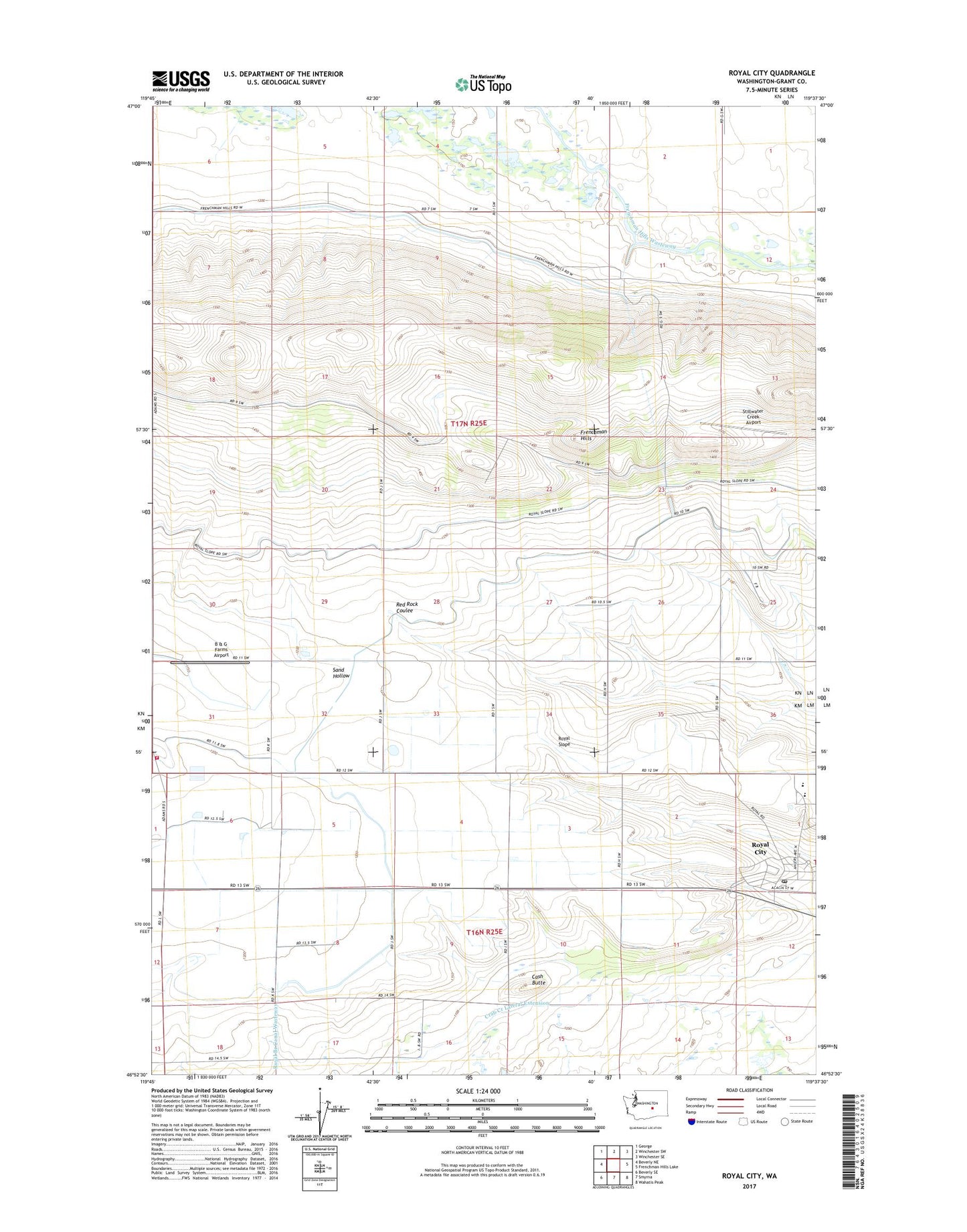
2023 topographic map quadrangle Royal City in the state of Washington. Scale: 1:24000. Based on the newly updated USGS 7.5' US Topo map series, this map is in the following counties: Grant. The map contains contour data, water features, and other items you are used to seeing on USGS maps, but also has updated roads and other features. This is the next generation of topographic maps. Printed on high-quality waterproof paper with UV fade-resistant inks.
Quads adjacent to this one:
West: Beverly NE
Northwest: George
North: Winchester SW
Northeast: Winchester SE
East: Frenchman Hills Lake
Southeast: Wahatis Peak
South: Smyrna
Southwest: Beverly SE
This map covers the same area as the classic USGS quad with code o46119h6.
Contains the following named places: B & G Farms Airport, Cash Butte, Grant County Fire District 10 Station 2, Low Gap Pumping Station, Red Rock Elementary School, Royal Branch Canal, Royal City, Royal City Post Office, Royal High School, Royal Middle School, Royal Slope, Stillwater Creek Airport, Watermaster Headquarters, ZIP Code: 99357