
MyTopo
Calispell Peak Washington US Topo Map
Couldn't load pickup availability
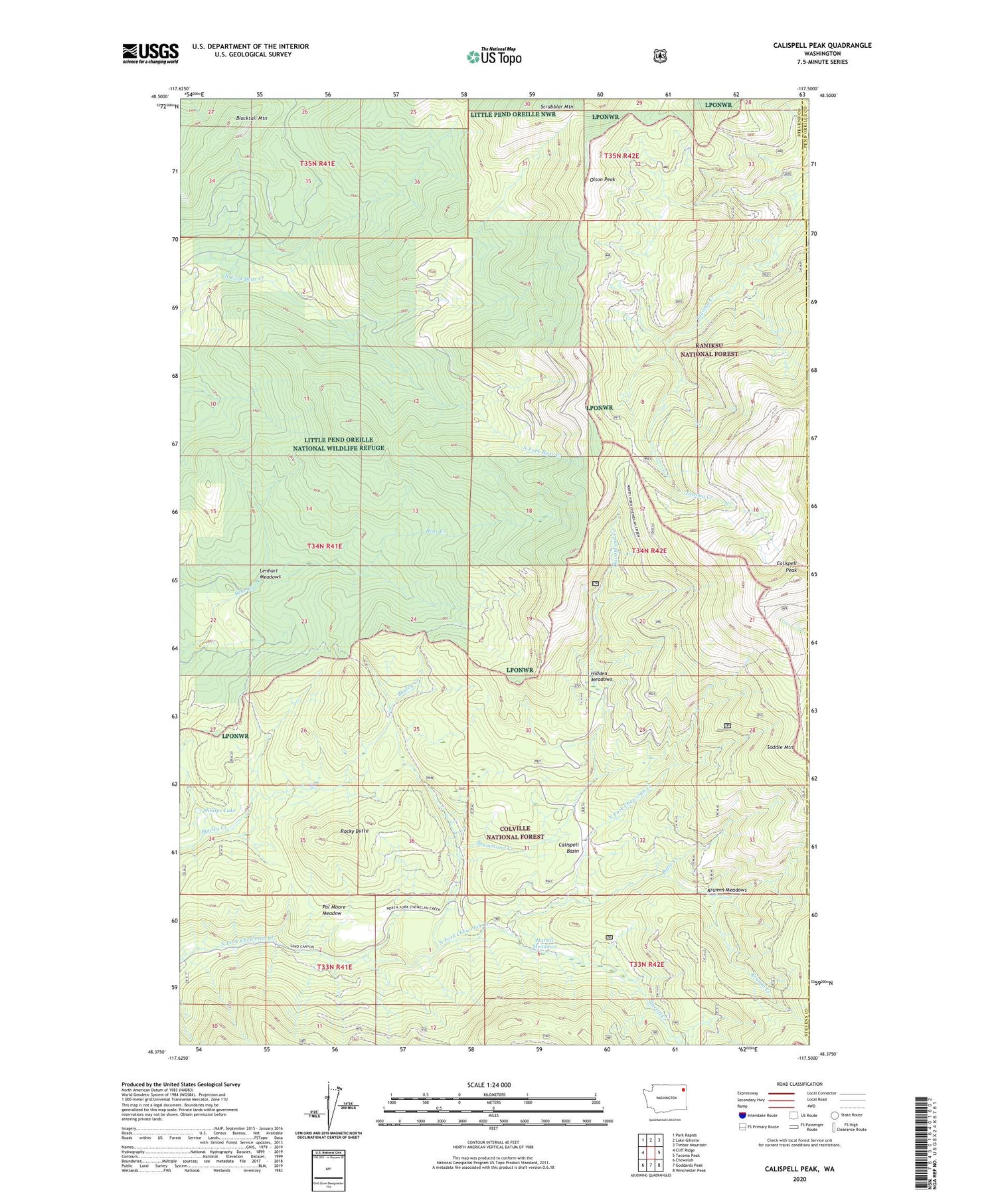
2020 topographic map quadrangle Calispell Peak in the state of Washington. Scale: 1:24000. Based on the newly updated USGS 7.5' US Topo map series, this map is in the following counties: Stevens, Pend Oreille. The map contains contour data, water features, and other items you are used to seeing on USGS maps, but also has updated roads and other features. This is the next generation of topographic maps. Printed on high-quality waterproof paper with UV fade-resistant inks.
Quads adjacent to this one:
West: Cliff Ridge
Northwest: Park Rapids
North: Lake Gillette
Northeast: Timber Mountain
East: Tacoma Peak
Southeast: Winchester Peak
South: Goddards Peak
Southwest: Chewelah
Contains the following named places: Blacktail Mountain, Butte Creek, Calispell Basin, Calispell Peak, Drummond Creek, Hartill Creek, Hartill Meadows, Hidden Meadows, Krumm Creek, Krumm Meadows, Lenhart Meadows, Merikay Mine, Olson Peak, Pal Moore Meadow, Phillips Lake, Rocky Butte, Saddle Mountain, Scrabbler Mountain


