MyTopo
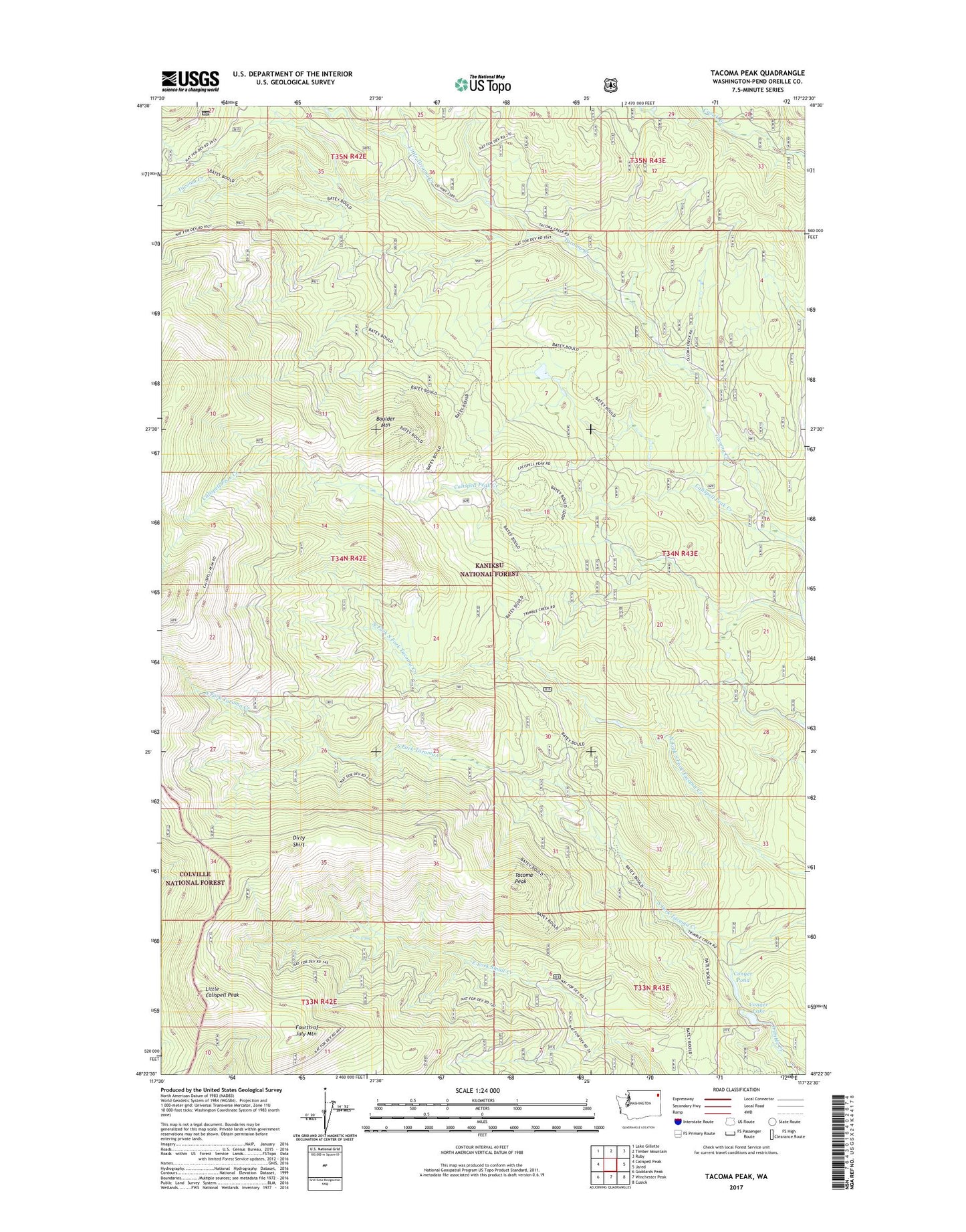
Tacoma Peak Washington US Topo Map
Couldn't load pickup availability
Also explore the Tacoma Peak Forest Service Topo of this same quad for updated USFS data
2023 topographic map quadrangle Tacoma Peak in the state of Washington. Scale: 1:24000. Based on the newly updated USGS 7.5' US Topo map series, this map is in the following counties: Pend Oreille. The map contains contour data, water features, and other items you are used to seeing on USGS maps, but also has updated roads and other features. This is the next generation of topographic maps. Printed on high-quality waterproof paper with UV fade-resistant inks.
Quads adjacent to this one:
West: Calispell Peak
Northwest: Lake Gillette
North: Timber Mountain
Northeast: Ruby
East: Jared
Southeast: Cusick
South: Winchester Peak
Southwest: Goddards Peak
This map covers the same area as the classic USGS quad with code o48117d4.
Contains the following named places: Boulder Mountain, Calispell Peak Creek, Conger Lake, Conger Lake Dam, Conger Pond, Conger Pond Dam, Dirty Shirt, Fourth of July Mountain, Little Calispell Peak, Little Tacoma Creek, Tacoma Peak