MyTopo
Cape Flattery Washington US Topo Map
Couldn't load pickup availability
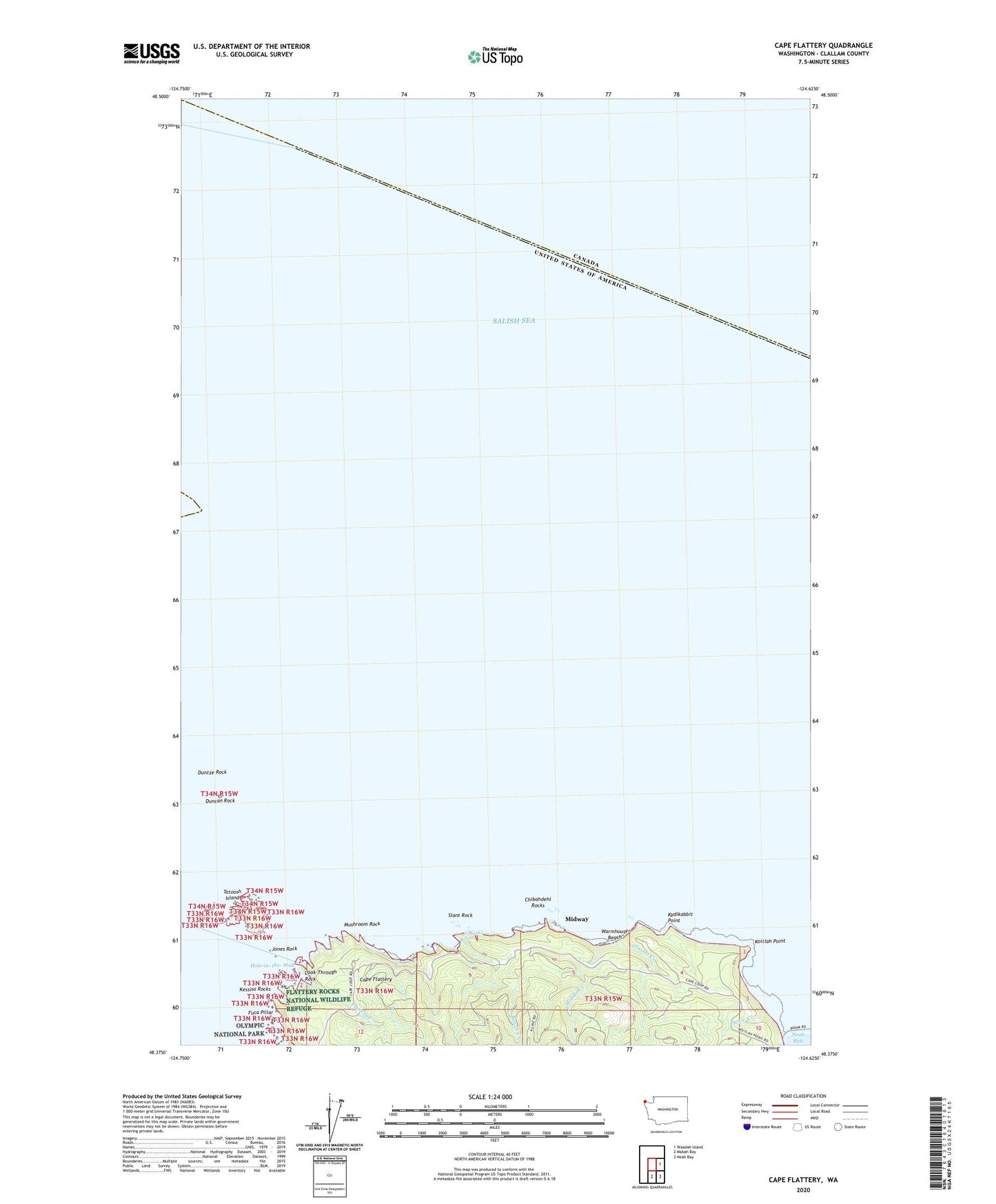
2020 topographic map quadrangle Cape Flattery in the state of Washington. Scale: 1:24000. Based on the newly updated USGS 7.5' US Topo map series, this map is in the following counties: Clallam. The map contains contour data, water features, and other items you are used to seeing on USGS maps, but also has updated roads and other features. This is the next generation of topographic maps. Printed on high-quality waterproof paper with UV fade-resistant inks.
Quads adjacent to this one:
East: Waadah Island
Southeast: Neah Bay
South: Makah Bay
Contains the following named places: Beach Creek, Cape Flattery, Cape Flattery Lighthouse, Chibahdehl Rocks, Classet, Classet Creek, Duncan Rock, Duntze Rock, Flattery Creek, Fuca Pillar, Hole-in-the-Wall, Jones Rock, Kessiso Rocks, Koitlah Point, Kydikabbit Point, Look-Through Rock, Middle Creek, Midway, Mushroom Rock, Sah-da-ped-thl, Scow Creek, Slant Rock, Tatoosh Island, Titacoclos Falls, Warmhouse Beach