MyTopo
Neah Bay Washington US Topo Map
Couldn't load pickup availability
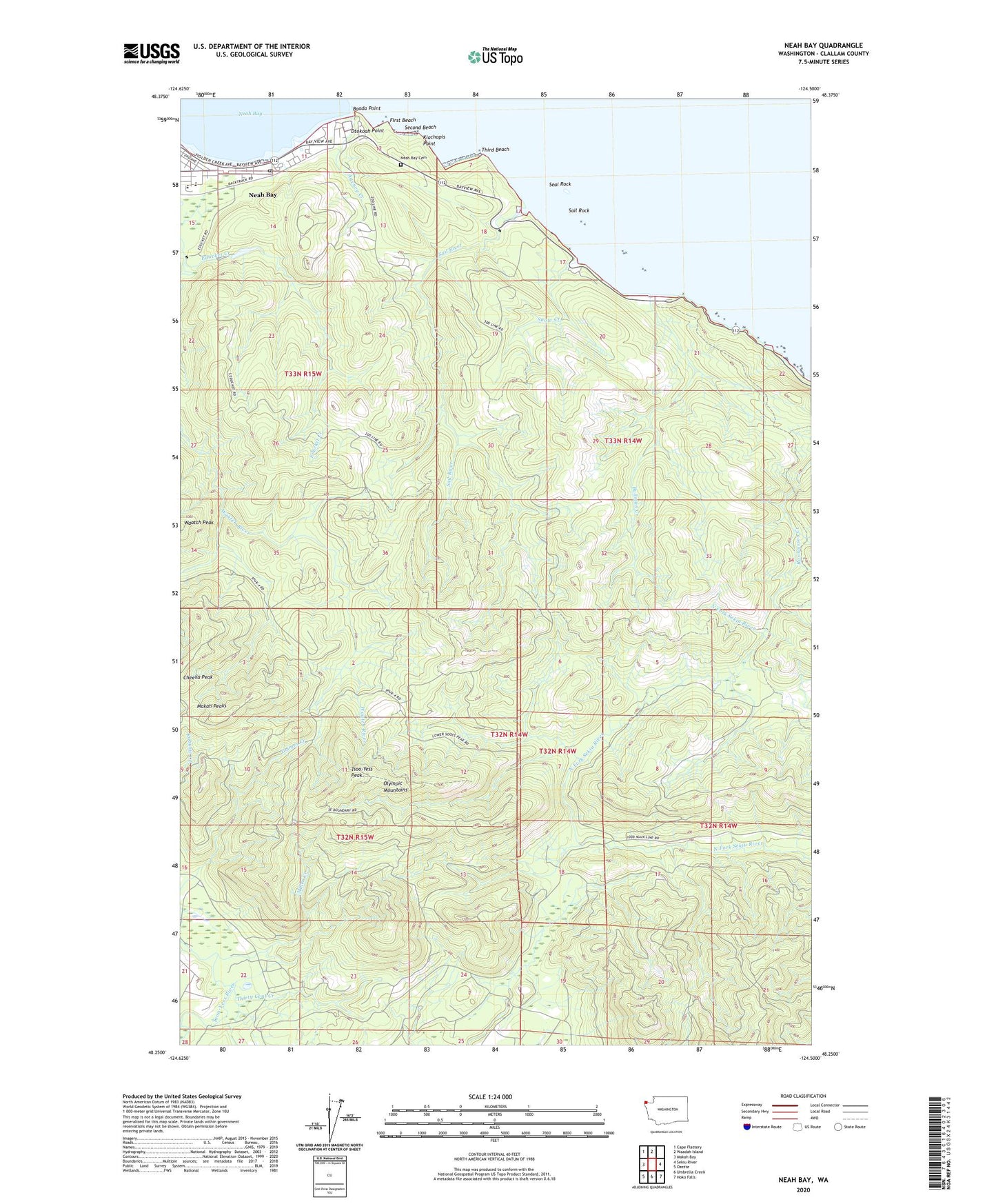
2023 topographic map quadrangle Neah Bay in the state of Washington. Scale: 1:24000. Based on the newly updated USGS 7.5' US Topo map series, this map is in the following counties: Clallam. The map contains contour data, water features, and other items you are used to seeing on USGS maps, but also has updated roads and other features. This is the next generation of topographic maps. Printed on high-quality waterproof paper with UV fade-resistant inks.
Quads adjacent to this one:
West: Makah Bay
Northwest: Cape Flattery
North: Waadah Island
East: Sekiu River
Southeast: Hoko Falls
South: Umbrella Creek
Southwest: Ozette
This map covers the same area as the classic USGS quad with code o48124c5.
Contains the following named places: Agency Creek, Apostolic Faith Church, Baada Point, Bullman Creek, Dtokoah Point, Educket Creek, First Beach, Halfway Creek, Klachopis Point, Makah Bureau of Indian Affairs Agency, Makah Cultural and Research Center, Makah Lutheran Church, Makah Marina, Makah Peaks, Miller Creek, Neah Bay, Neah Bay Cemetery, Neah Bay Census Designated Place, Neah Bay Elementary School, Neah Bay Post Office, Oleho River, Sail River, Sail Rock, Seal Rock, Second Beach, Snow Creek, Third Beach, Thirty Cent Creek, Tsoo-Yess Peak, Washburn Ranch