MyTopo
Makah Bay Washington US Topo Map
Couldn't load pickup availability
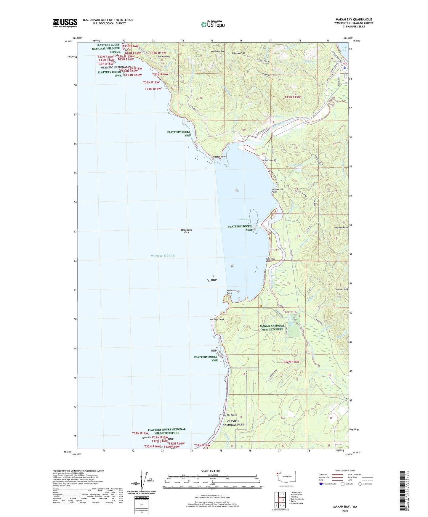
2023 topographic map quadrangle Makah Bay in the state of Washington. Scale: 1:24000. Based on the newly updated USGS 7.5' US Topo map series, this map is in the following counties: Clallam. The map contains contour data, water features, and other items you are used to seeing on USGS maps, but also has updated roads and other features. This is the next generation of topographic maps. Printed on high-quality waterproof paper with UV fade-resistant inks.
Quads adjacent to this one:
North: Cape Flattery
Northeast: Waadah Island
East: Neah Bay
Southeast: Umbrella Creek
South: Ozette
Southwest: Bodelteh Islands
This map covers the same area as the classic USGS quad with code o48124c6.
Contains the following named places: Anderson Point, Archawat, Archawat Creek, Archawat Peak, Bahobohosh Point, Bahokus Peak, Bear Creek, Cheeka Creek, Cheeka Peak, Colby Creek, Grimes Creek, Hobuck Beach, Hobuck Lake, Holden Creek, Kabusie Creek, Makah Air Force Station, Makah Bay, Makah Indian Reservation, Makah National Fish Hatchery, Makah National Salmon Hatchery, Makah Tribal Ambulance, Makah Tribal Fire Department, Neah Bay Ambulance Service, Neah Bay Assembly of God Church, Ocean Creek, Petroleum Creek, Portage Head, Shi-Shi Beach, Spike Rock, Strawberry Rock, Tsoo-Yess, Tsoo-Yess Beach, Tsoo-Yess River, Tyler Creek, Village Creek, Waatch, Waatch Creek, Waatch Peak, Waatch Point, Waatch River, ZIP Code: 98357