MyTopo
Coal Creek Washington US Topo Map
Couldn't load pickup availability
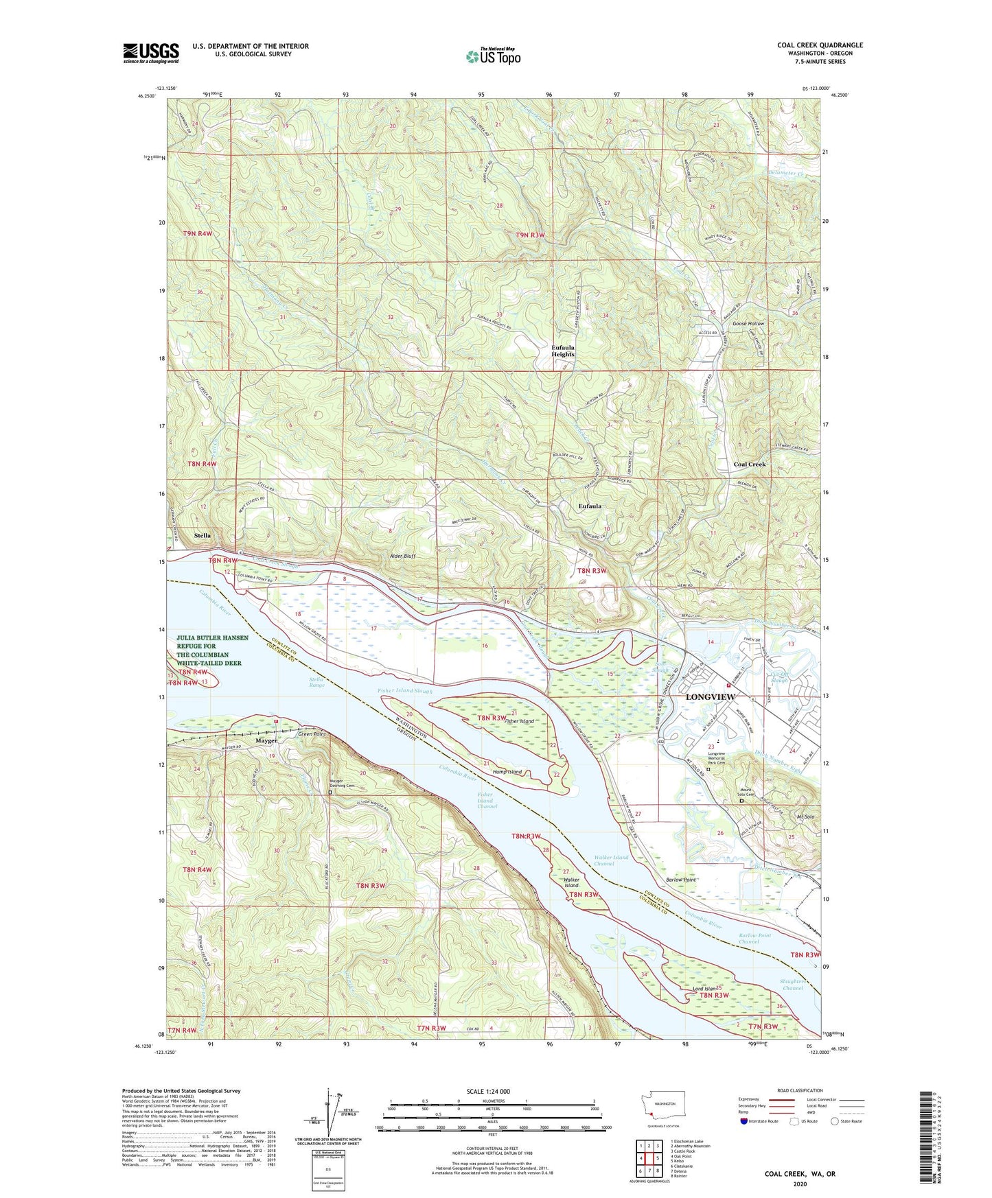
2020 topographic map quadrangle Coal Creek in the states of Washington, Oregon. Scale: 1:24000. Based on the newly updated USGS 7.5' US Topo map series, this map is in the following counties: Cowlitz, Columbia. The map contains contour data, water features, and other items you are used to seeing on USGS maps, but also has updated roads and other features. This is the next generation of topographic maps. Printed on high-quality waterproof paper with UV fade-resistant inks.
Quads adjacent to this one:
West: Oak Point
Northwest: Elochoman Lake
North: Abernathy Mountain
Northeast: Castle Rock
East: Kelso
Southeast: Rainier
South: Delena
Southwest: Clatskanie
Contains the following named places: Alder Bluff, Barlow Point, Barlow Point Channel, Beaver Landing Post Office, Brock Creek, Clatskanie Rural Fire Mayger Station, Cleaveland Landing, Coal Creek, Coal Creek Slough, Cowlitz 2 Fire and Rescue Station 22 Bakers Corner, Cut-Off Slough, Ditch Number Eight, Ditch Number Six, Ditch Number Ten, Downing, Downing Station, East Fork Coal Creek, Elliott Landing, Eufaula, Eufaula Heights, Fall Creek, Fisher Island, Fisher Island Channel, Fisher Island Slough, Fluhrers Spur, Flume Creek, Germany Creek, Goose Hollow, Green Creek, Green Point, Harmony Creek, Hump Island, Kingdom Hall of Jehovahs Witnesses, La Du Post Light, Longview Church of Christ, Longview Laestadian Lutheran Church, Longview Memorial Park Cemetery, Lord Island, Mayger, Mayger Downing Cemetery, Mayger Post Office, Mount Solo Cemetery, Pyramid, Rinearson Slough, Roy Morse Park, Solo Slough, Stella, Stella Range, Tryon, Tryon Post Office, Walker Island, Walker Island Channel, Walker Island Post Light, Willow Grove, ZIP Code: 98632