MyTopo
Colfax North Washington US Topo Map
Couldn't load pickup availability
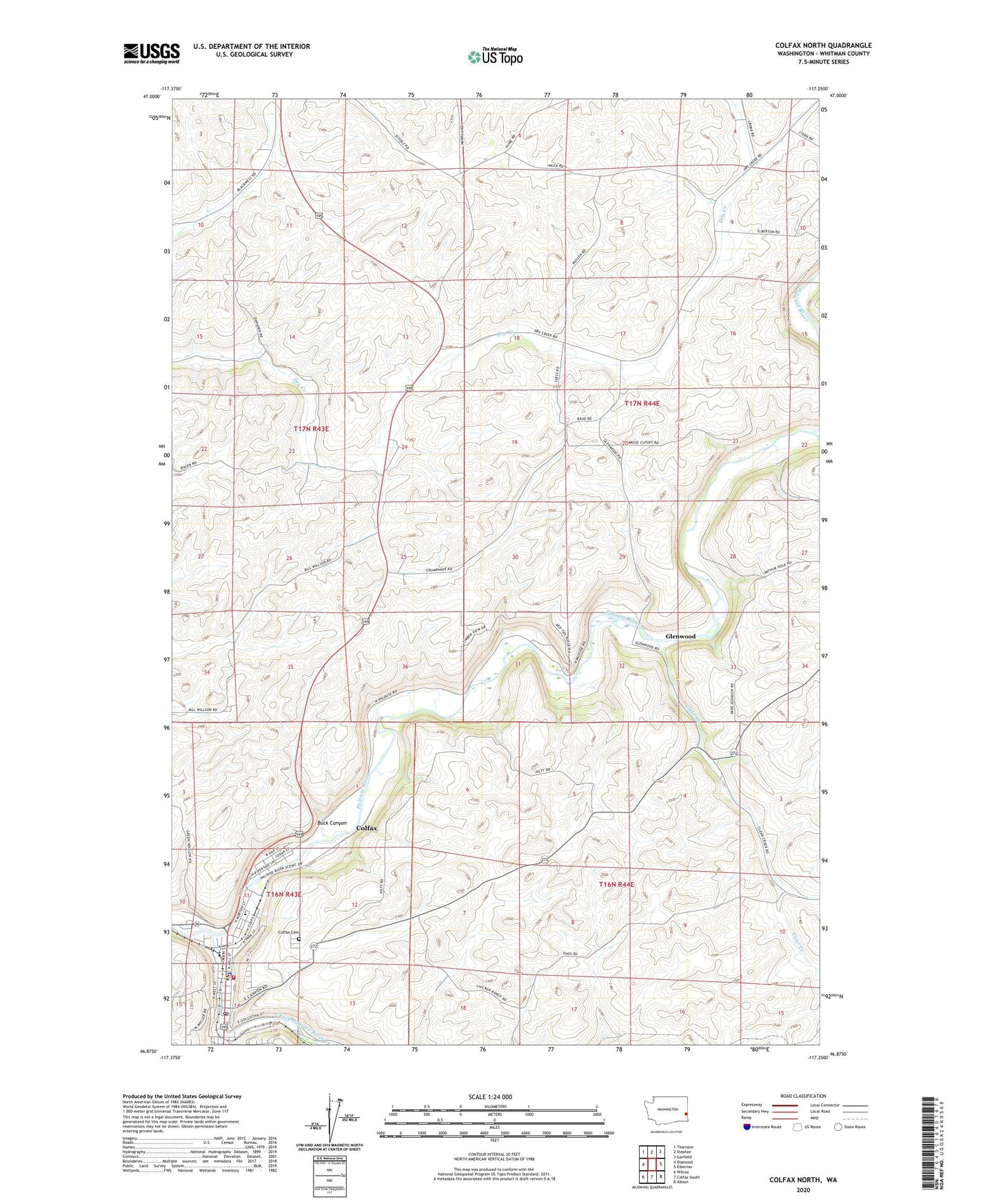
2023 topographic map quadrangle Colfax North in the state of Washington. Scale: 1:24000. Based on the newly updated USGS 7.5' US Topo map series, this map is in the following counties: Whitman. The map contains contour data, water features, and other items you are used to seeing on USGS maps, but also has updated roads and other features. This is the next generation of topographic maps. Printed on high-quality waterproof paper with UV fade-resistant inks.
Quads adjacent to this one:
West: Diamond
Northwest: Thornton
North: Steptoe
Northeast: Garfield
East: Elberton
Southeast: Albion
South: Colfax South
Southwest: Wilcox
This map covers the same area as the classic USGS quad with code o46117h3.
Contains the following named places: Buck Canyon, City of Colfax, City of Colfax Fire Department, Clear Creek, Colfax, Colfax Cemetery, Colfax Golf and Country Club, Colfax High School, Colfax Little League Park, Colfax Police Department, Colfax Post Office, Colfax-Palouse Division, Eels Park, Glenwood, Leonard M Jennings Elementary School, Schmuck Park, South Fork Palouse River, Spring Flat Creek, Whitman County Courthouse, Whitman County Sheriff's Office