MyTopo
Conway Washington US Topo Map
Couldn't load pickup availability
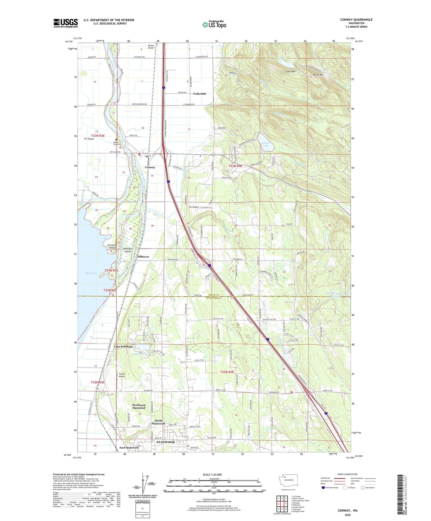
2020 topographic map quadrangle Conway in the state of Washington. Scale: 1:24000. Based on the newly updated USGS 7.5' US Topo map series, this map is in the following counties: Skagit, Snohomish. The map contains contour data, water features, and other items you are used to seeing on USGS maps, but also has updated roads and other features. This is the next generation of topographic maps. Printed on high-quality waterproof paper with UV fade-resistant inks.
Quads adjacent to this one:
West: Utsalady
Northwest: La Conner
North: Mount Vernon
Northeast: Sedro-Woolley South
East: McMurray
Southeast: Arlington West
South: Stanwood
Southwest: Juniper Beach
Contains the following named places: Aqua Farm, Barker Airport, Boom Slough, Brandstedt Slough, Bulson Creek, Cedardale, Cedarhome, Cedarhome Baptist Church, Cedarhome Christian School, Cedarhome Seventh Day Adventist Church, Conway, Conway Census Designated Place, Conway Division, Conway Pit, Conway Post Office, Conway School, Courting Frogs Nursery, Devils Mountain, Erickson Island, Fir - Conway Lutheran Church, Fir Station, Fisher Creek, Folkertsma Dairy, Freeborn Church, Freedom Creek, Haflinger Haven Farm, Happy Little Farm, Harvey Arabian Farms, Hidden Meadow Ranch, Hill Ditch, Isohis Slough, JC's Airport, Johnson Creek, Lake Ketchum, Lake Ketchum Census Designated Place, Milltown, Milltown Island, Morning Glory Farms, North County Fire / Emergency Medical Services Station 96 Freeborn, North Stanwood, North Stanwood Census Designated Place, Northwest Stanwood Census Designated Place, Old River, River Bend Dairy, Sandy Creek, Scott Mountain, Sixteen Lake, Skagit City Cemetery, Skagit County Fire District 3 Conway, Smith Morrison Farms, South Fork Skagit River, Steamboat Slough, Sunset Airport, Tazer Valley Farm, Ten Lake, Tom Moore Slough, Victoria Heights Reservoir, Victoria Heights Reservoir Dam, Westheim Farms, ZIP Code: 98238