MyTopo
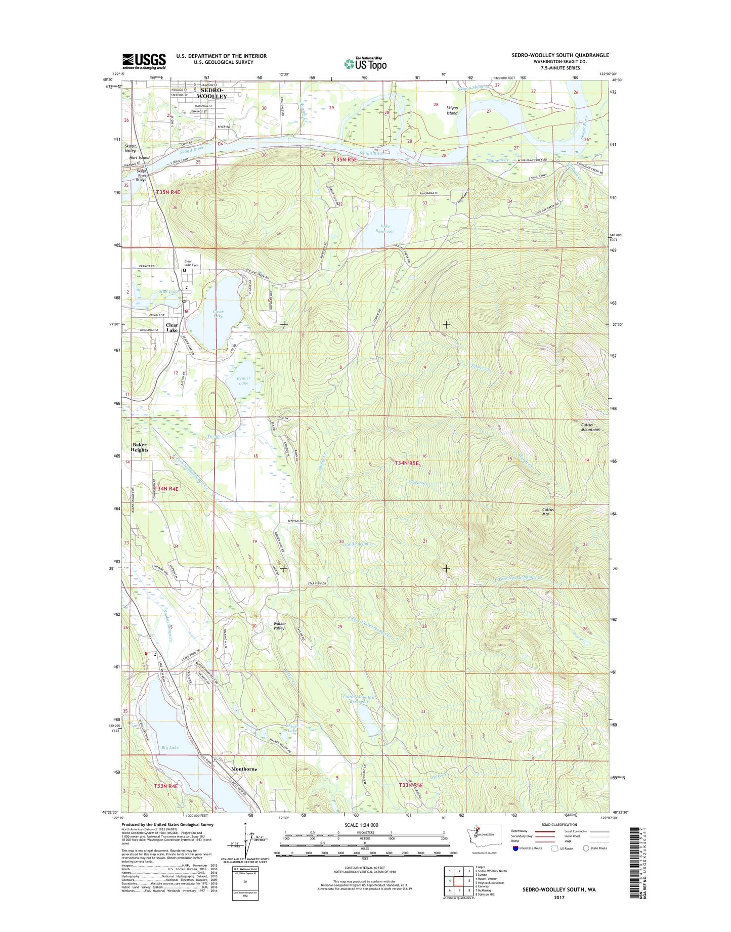
Sedro-Woolley South Washington US Topo Map
Couldn't load pickup availability
Also explore the Sedro-Woolley South Forest Service Topo of this same quad for updated USFS data
2023 topographic map quadrangle Sedro-Woolley South in the state of Washington. Scale: 1:24000. Based on the newly updated USGS 7.5' US Topo map series, this map is in the following counties: Skagit. The map contains contour data, water features, and other items you are used to seeing on USGS maps, but also has updated roads and other features. This is the next generation of topographic maps. Printed on high-quality waterproof paper with UV fade-resistant inks.
Quads adjacent to this one:
West: Mount Vernon
Northwest: Alger
North: Sedro-Woolley North
Northeast: Lyman
East: Haystack Mountain
Southeast: Stimson Hill
South: McMurray
Southwest: Conway
This map covers the same area as the classic USGS quad with code o48122d2.
Contains the following named places: Beaver Lake, Beaver Lake Quarry, Big Lake, Big Lake Census Designated Place, Big Lake Community Church, Big Lake Elementary School, Birchview Memory Care Community, Clear Lake, Clear Lake Cemetery, Clear Lake Census Designated Place, Clear Lake Division, Clear Lake Elementary School, Clearlake Post Office, Cold Spring Creek, Community Covenant Church, Cultus Mountain, Cultus Mountain Reservoir, Cultus Mountain Reservoir Dam A, Cultus Mountain Reservoir Dam B, Cultus Mountain Reservoir Dam C, First Baptist Church, Gilligan Creek, Judy Reservoir, Judy Reservoir Dam A, Judy Reservoir Dam B, Montborne, Mud Lake, Mundt Creek, Pigeon Creek, Riverfront Recreational Vehicle Park, Salmon Creek, Sedro - Woolley Sewage Treatment Plant, Sedro - Woolley South Park and Ride, Shiner Lake, Skagit County Fire District 4 Clear Lake Fire Department, Skagit County Fire District 9 Big Lake Fire Department Station 1, Skagit River Bridge, Skagit Valley, Skagit Water Treatment Plant, Skiyou Island, Skiyou Slough, Turner Creek, Valley View Dairy, Walker Creek, Walker Valley, Walking M Dam, ZIP Code: 98235