MyTopo
Darland Mountain Washington US Topo Map
Couldn't load pickup availability
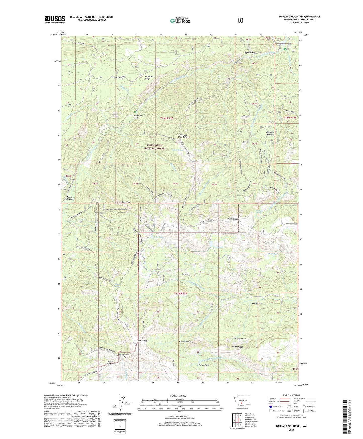
2020 topographic map quadrangle Darland Mountain in the state of Washington. Scale: 1:24000. Based on the newly updated USGS 7.5' US Topo map series, this map is in the following counties: Yakima. The map contains contour data, water features, and other items you are used to seeing on USGS maps, but also has updated roads and other features. This is the next generation of topographic maps. Printed on high-quality waterproof paper with UV fade-resistant inks.
Quads adjacent to this one:
West: Pinegrass Ridge
Northwest: Spiral Butte
North: Rimrock Lake
Northeast: Tieton Basin
East: Foundation Ridge
Southeast: Piscoe Meadow
South: Fairview Ridge
Southwest: Jennies Butte
Contains the following named places: Bakeoven Flats, Blue Lake, Blue Slide, Blue Slide Lookout Tower, Buckhorn Meadows, Camp Creek, Cedar Creek, Clover Flats, Corral Creek, Cougar Flats, Darland Mountain, Dead Hole, Divide Ridge, East Fork Short and Dirty Creek, Fish Creek, Green Lake, Greens Pocket, Grey Creek, Grey Creek Campground, Jayhawk Flats, Little Lake, Minnie Meadows, Narrowneck Gap, Shellneck Creek, Short and Dirty Creek, Short and Dirty Ridge, South Fork Campground, South Fork Tieton River, Spencer Creek, Spruce Creek, Spruce Spring, Strobach Springs, Whites Pocket, Whites Ridge, Withrow Spring