MyTopo
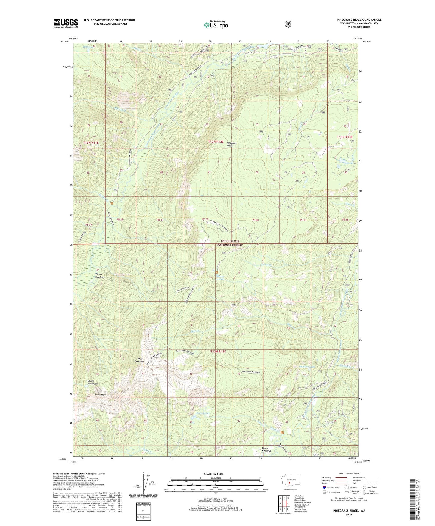
Pinegrass Ridge Washington US Topo Map
Couldn't load pickup availability
Also explore the Pinegrass Ridge Forest Service Topo of this same quad for updated USFS data
2023 topographic map quadrangle Pinegrass Ridge in the state of Washington. Scale: 1:24000. Based on the newly updated USGS 7.5' US Topo map series, this map is in the following counties: Yakima. The map contains contour data, water features, and other items you are used to seeing on USGS maps, but also has updated roads and other features. This is the next generation of topographic maps. Printed on high-quality waterproof paper with UV fade-resistant inks.
Quads adjacent to this one:
West: Old Snowy Mountain
Northwest: White Pass
North: Spiral Butte
Northeast: Rimrock Lake
East: Darland Mountain
Southeast: Fairview Ridge
South: Jennies Butte
Southwest: Walupt Lake
This map covers the same area as the classic USGS quad with code o46121e3.
Contains the following named places: Bear Creek, Bear Creek Mountain, Bear Creek Mountain Trail, Clear Lake Guard Station, Conrad Lake, Conrad Meadows, Devils Horn, Devils Washbasin, Discovery Creek, Hell Creek, Hell Lake, Long Creek, Minnie Meadows Trail, Miriam Creek, North Fork Tieton Trail, North Fork Trailhead, Phantom Lake, Pinegrass Ridge, Scatter Creek, Section 3 Lake, Short Creek, Tieton Meadows, Tieton Meadows Trail