MyTopo
Davenport Washington US Topo Map
Couldn't load pickup availability
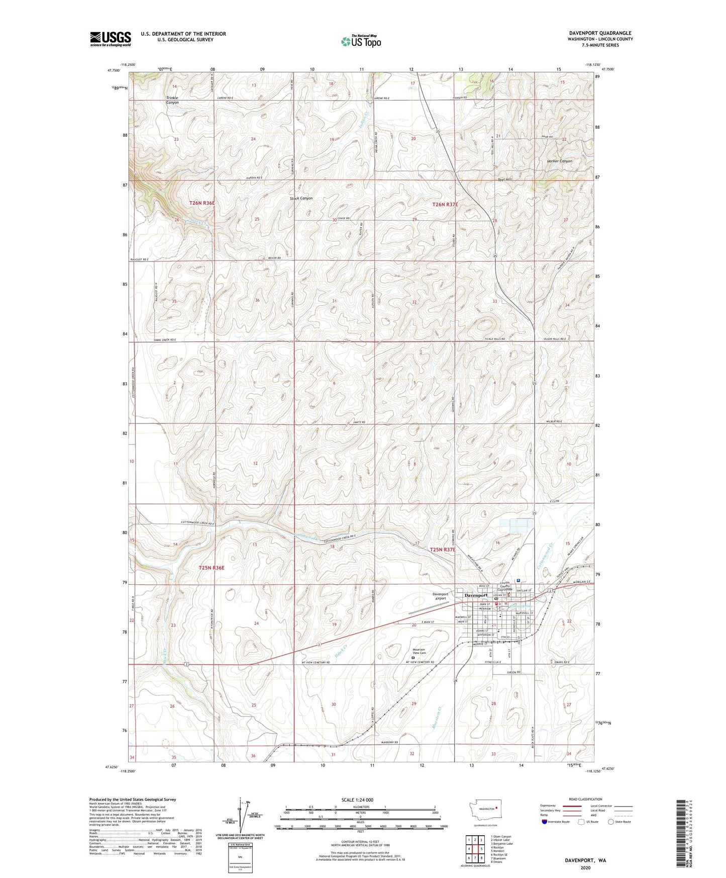
2020 topographic map quadrangle Davenport in the state of Washington. Scale: 1:24000. Based on the newly updated USGS 7.5' US Topo map series, this map is in the following counties: Lincoln. The map contains contour data, water features, and other items you are used to seeing on USGS maps, but also has updated roads and other features. This is the next generation of topographic maps. Printed on high-quality waterproof paper with UV fade-resistant inks.
Quads adjacent to this one:
West: Rocklyn
Northwest: Olsen Canyon
North: Inkster Lake
Northeast: Benjamin Lake
East: Mondovi
Southeast: Omans
South: Bluestem
Southwest: Rocklyn SE
Contains the following named places: City of Davenport, Cotton Spring, Cottonwood Creek, Davenport, Davenport Airport, Davenport Edwall United Methodist Church, Davenport Elementary School, Davenport High School, Davenport Post Office, First Presbyterian Church, Harvest Celebration Church, Immaculate Conception Catholic Church, Lincoln County Courthouse, Lincoln County Fairgrounds, Lincoln County Fire District 5 Davenport, Lincoln County Hospital Heliport, Lincoln County Sheriff's Office, Lincoln Hospital, Lincoln Hospital Ambulance and Northwest Medstar Critical Care Helicopter Transport, Mountain View Cemetery, Teel Hill, The Church of Jesus Christ of Latter Day Saints, Trinity Bible Fellowship Church, Zion Lutheran Church, ZIP Code: 99122