MyTopo
Diamond Washington US Topo Map
Couldn't load pickup availability
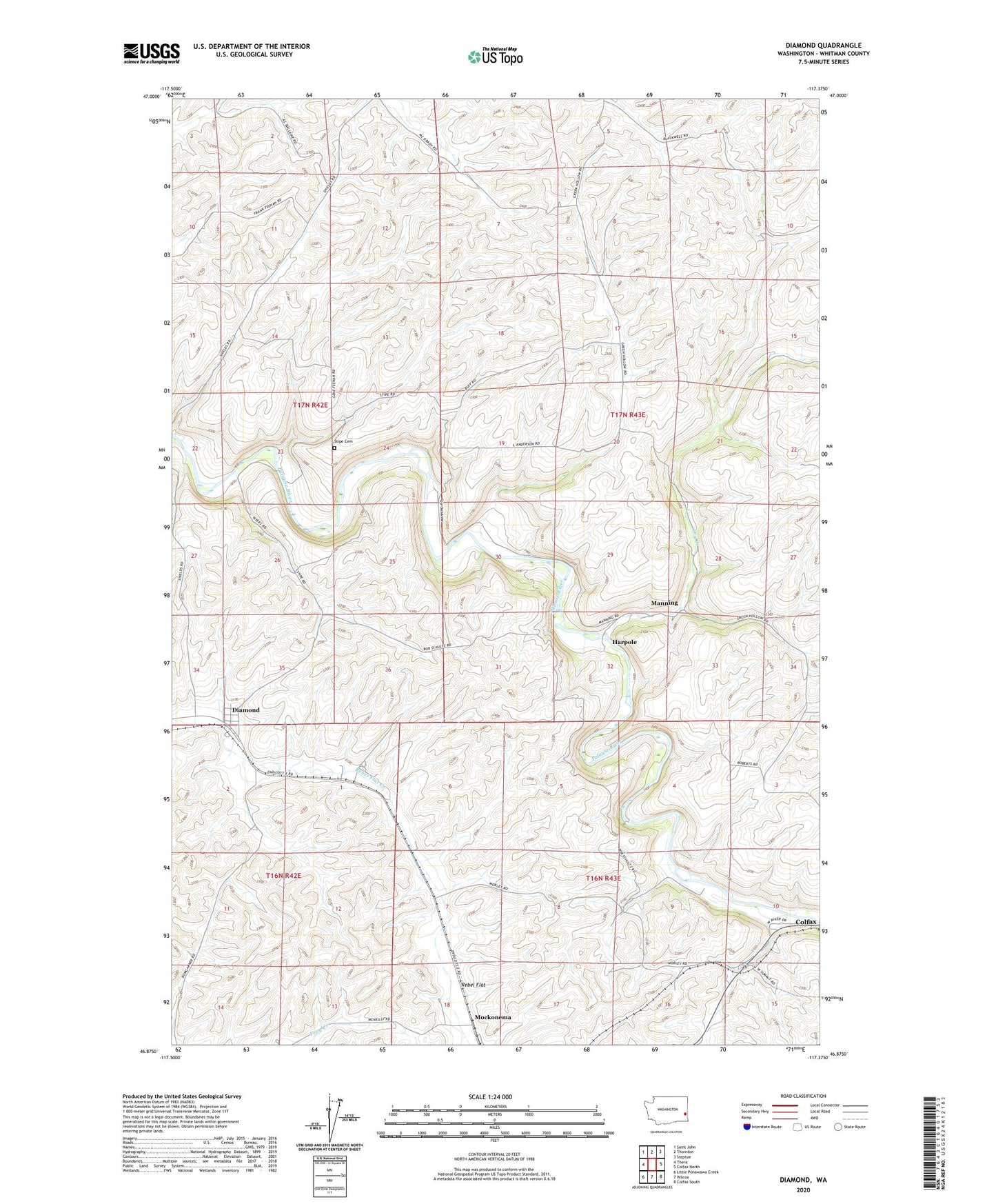
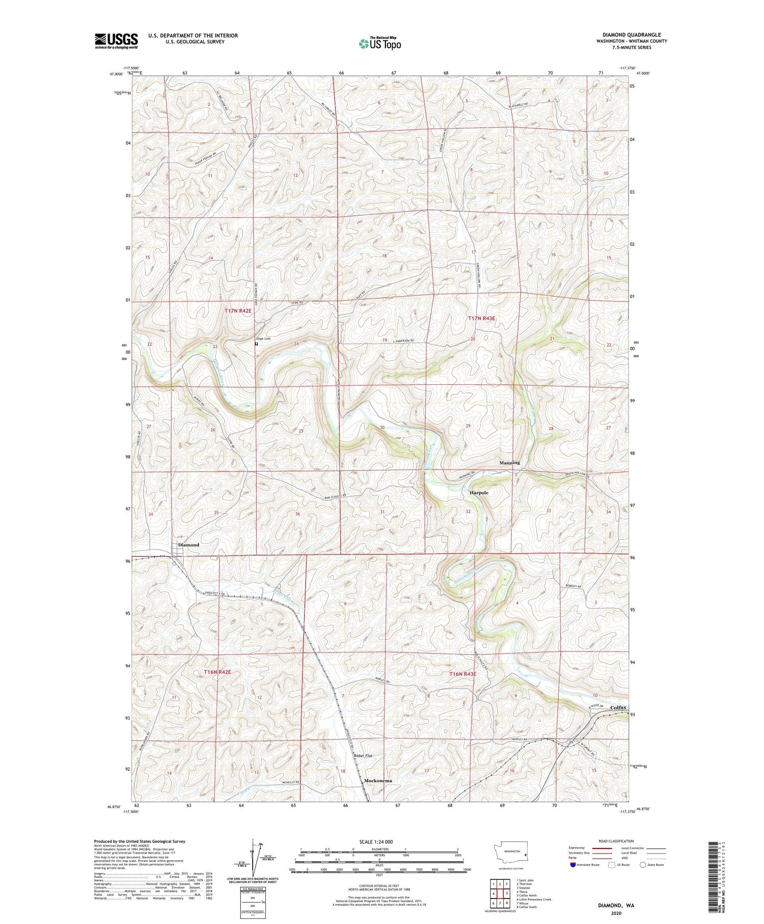
2020 topographic map quadrangle Diamond in the state of Washington. Scale: 1:24000. Based on the newly updated USGS 7.5' US Topo map series, this map is in the following counties: Whitman. The map contains contour data, water features, and other items you are used to seeing on USGS maps, but also has updated roads and other features. This is the next generation of topographic maps. Printed on high-quality waterproof paper with UV fade-resistant inks.
Quads adjacent to this one:
West: Thera
Northwest: Saint John
North: Thornton
Northeast: Steptoe
East: Colfax North
Southeast: Colfax South
South: Wilcox
Southwest: Little Penawawa Creek
Contains the following named places: Blackwell, Diamond, Dry Creek, Harpole, Manning, Mockonema, Rye, Stipe Cemetery, Whitman County Nature Trail