MyTopo
Little Penawawa Creek Washington US Topo Map
Couldn't load pickup availability
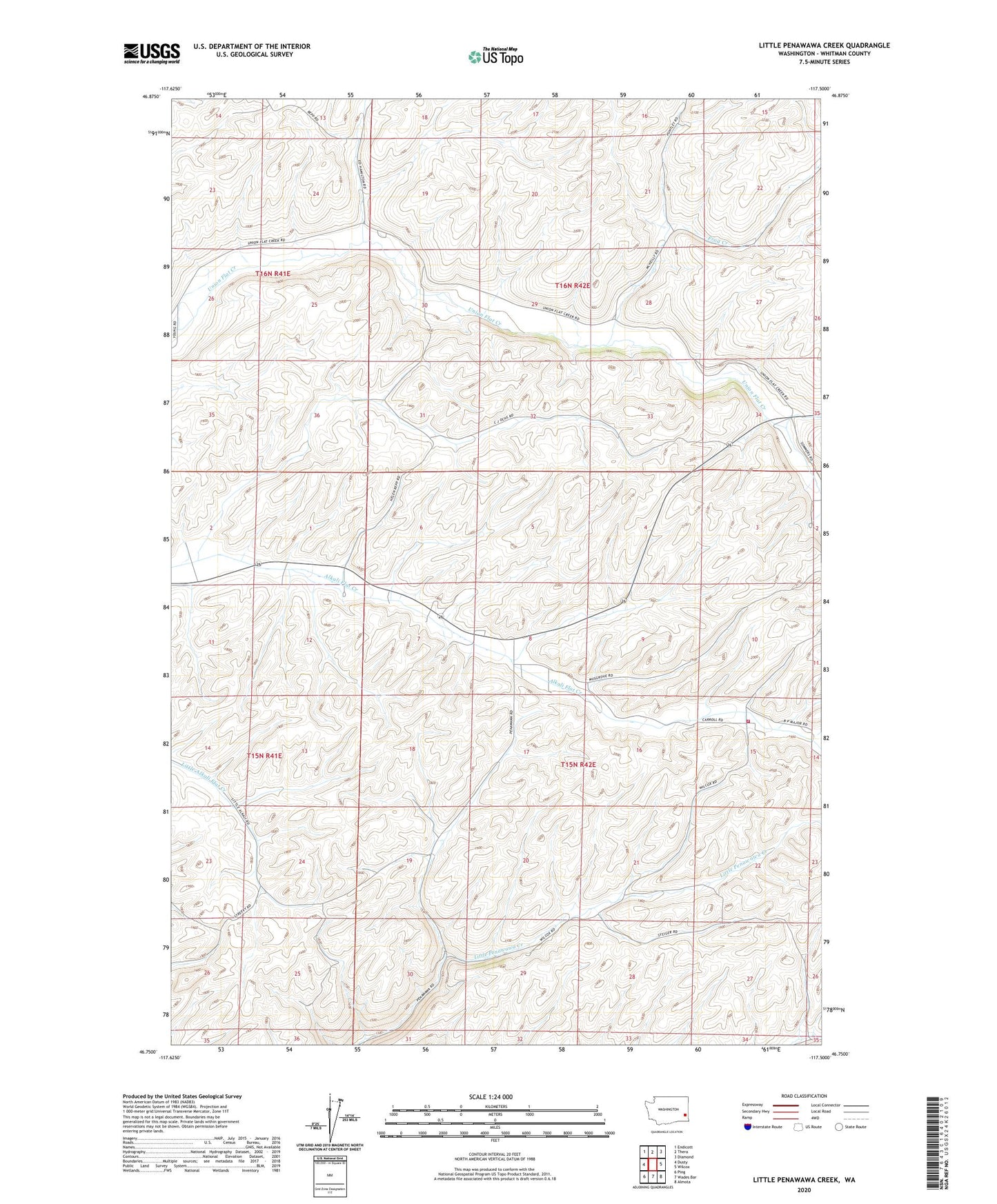
2023 topographic map quadrangle Little Penawawa Creek in the state of Washington. Scale: 1:24000. Based on the newly updated USGS 7.5' US Topo map series, this map is in the following counties: Whitman. The map contains contour data, water features, and other items you are used to seeing on USGS maps, but also has updated roads and other features. This is the next generation of topographic maps. Printed on high-quality waterproof paper with UV fade-resistant inks.
Quads adjacent to this one:
West: Dusty
Northwest: Endicott
North: Thera
Northeast: Diamond
East: Wilcox
Southeast: Almota
South: Wades Bar
Southwest: Ping
This map covers the same area as the classic USGS quad with code o46117g5.
Contains the following named places: Frog Creek, Whitman County Fire District 13, Wilcox Grange