MyTopo
Dodge Washington US Topo Map
Couldn't load pickup availability
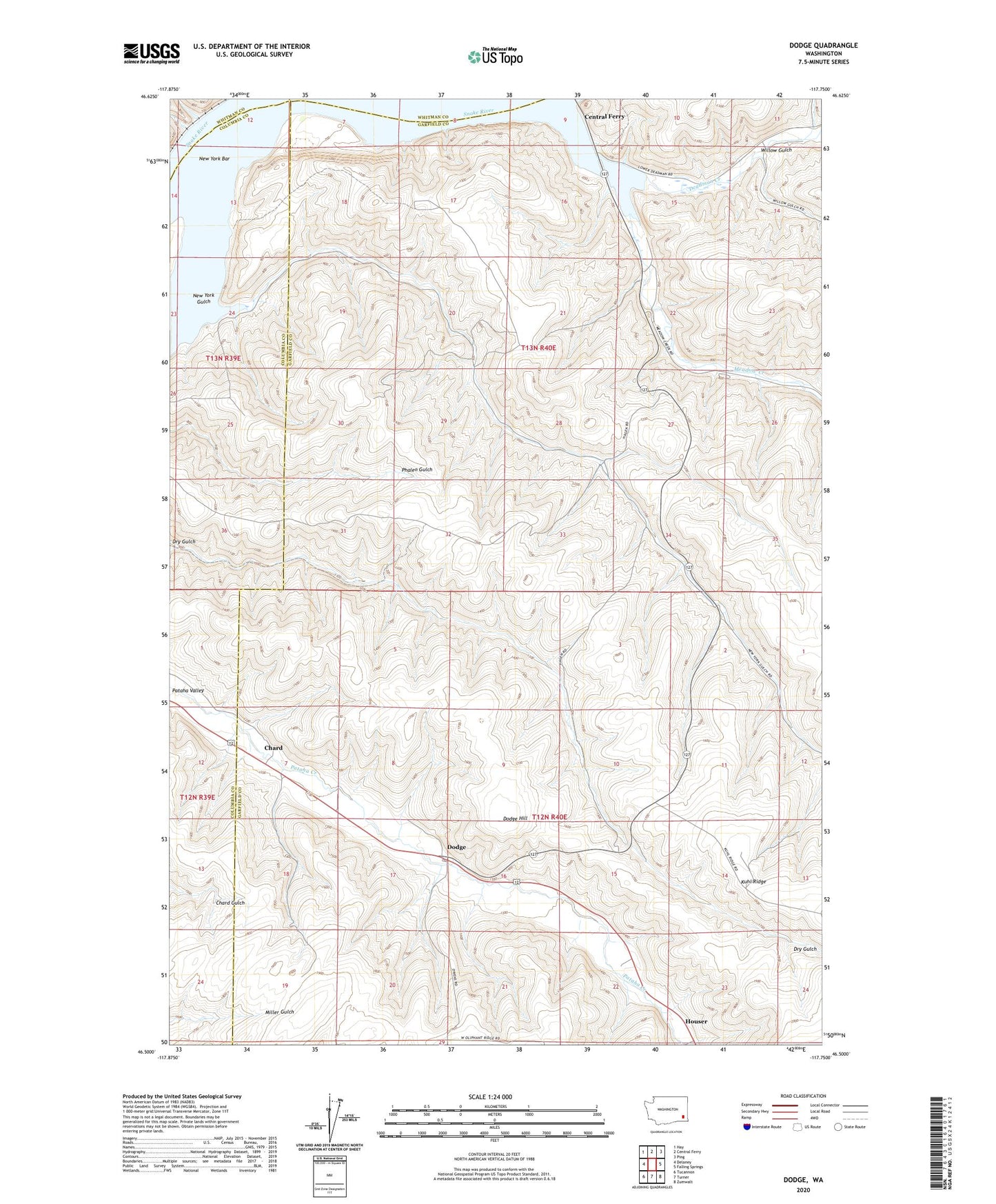
2020 topographic map quadrangle Dodge in the state of Washington. Scale: 1:24000. Based on the newly updated USGS 7.5' US Topo map series, this map is in the following counties: Garfield, Columbia, Whitman. The map contains contour data, water features, and other items you are used to seeing on USGS maps, but also has updated roads and other features. This is the next generation of topographic maps. Printed on high-quality waterproof paper with UV fade-resistant inks.
Quads adjacent to this one:
West: Delaney
Northwest: Hay
North: Central Ferry
Northeast: Ping
East: Falling Springs
Southeast: Zumwalt
South: Turner
Southwest: Tucannon
Contains the following named places: Chard, Deadman Creek, Dodge, Dodge Hill, Houser, Kuhl Ridge, Meadow Creek, New York Bar, New York Gulch, New York Island, Pataha Valley Grange, Port of Garfield, Scott Seed Farm Airport, Willow Gulch