MyTopo
Ping Washington US Topo Map
Couldn't load pickup availability
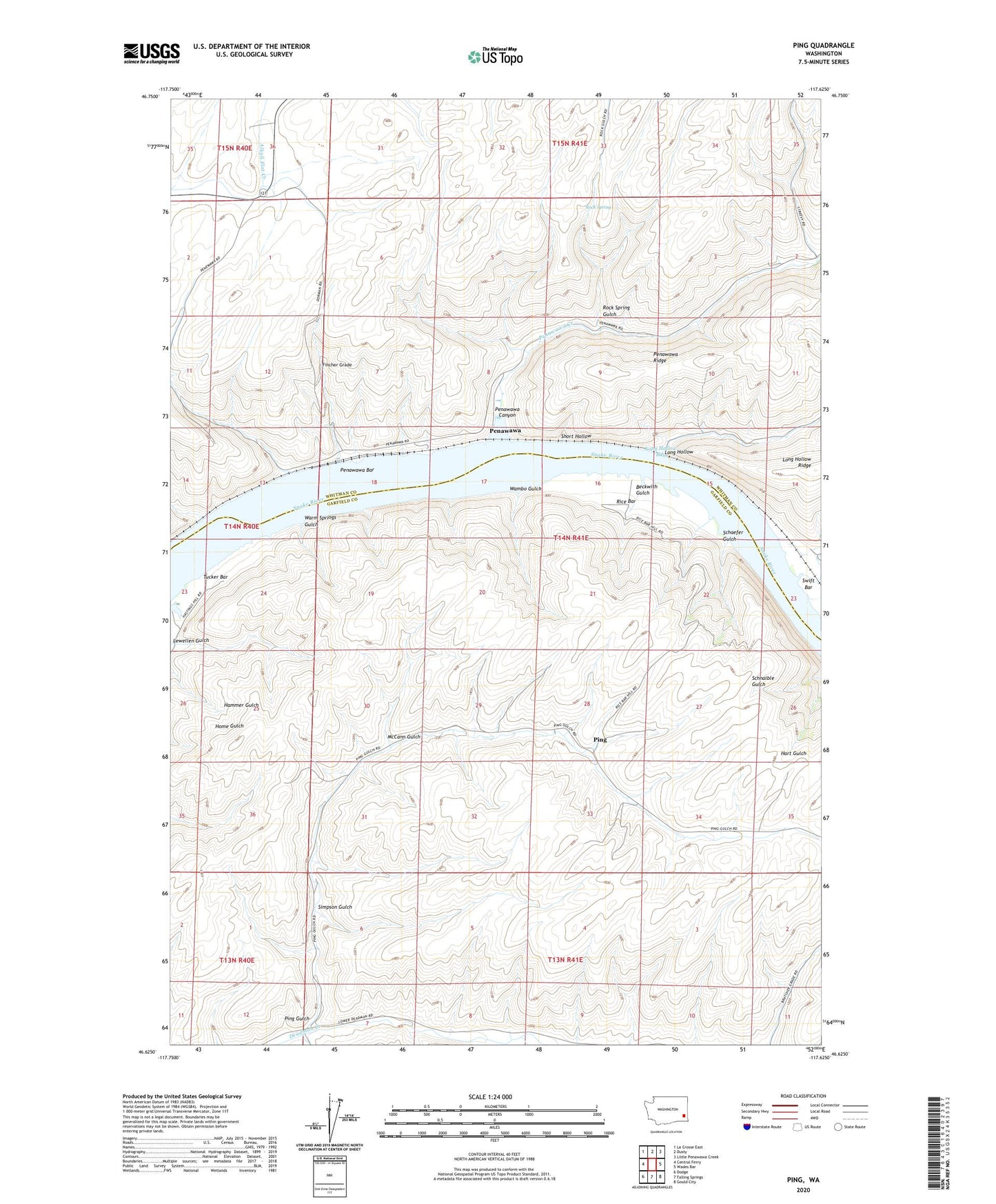
2023 topographic map quadrangle Ping in the state of Washington. Scale: 1:24000. Based on the newly updated USGS 7.5' US Topo map series, this map is in the following counties: Garfield, Whitman. The map contains contour data, water features, and other items you are used to seeing on USGS maps, but also has updated roads and other features. This is the next generation of topographic maps. Printed on high-quality waterproof paper with UV fade-resistant inks.
Quads adjacent to this one:
West: Central Ferry
Northwest: La Crosse East
North: Dusty
Northeast: Little Penawawa Creek
East: Wades Bar
Southeast: Gould City
South: Falling Springs
Southwest: Dodge
This map covers the same area as the classic USGS quad with code o46117f6.
Contains the following named places: Beckwith Gulch, Fincher Grade, Lewellen Gulch, Long Hollow, Long Hollow Bay, Long Hollow Ridge, McCann Gulch, Penawawa, Penawawa Bar, Penawawa Canyon, Penawawa Creek, Penawawa Ridge, Ping, Ping Gulch, Rice Bar, Rock Spring, Rock Spring Gulch, Schaefer Gulch, Short Hollow, Simpson Gulch, Tucker Bar, Wambo Gulch, Warm Springs Gulch, Willow Landing