MyTopo
Delaney Washington US Topo Map
Couldn't load pickup availability
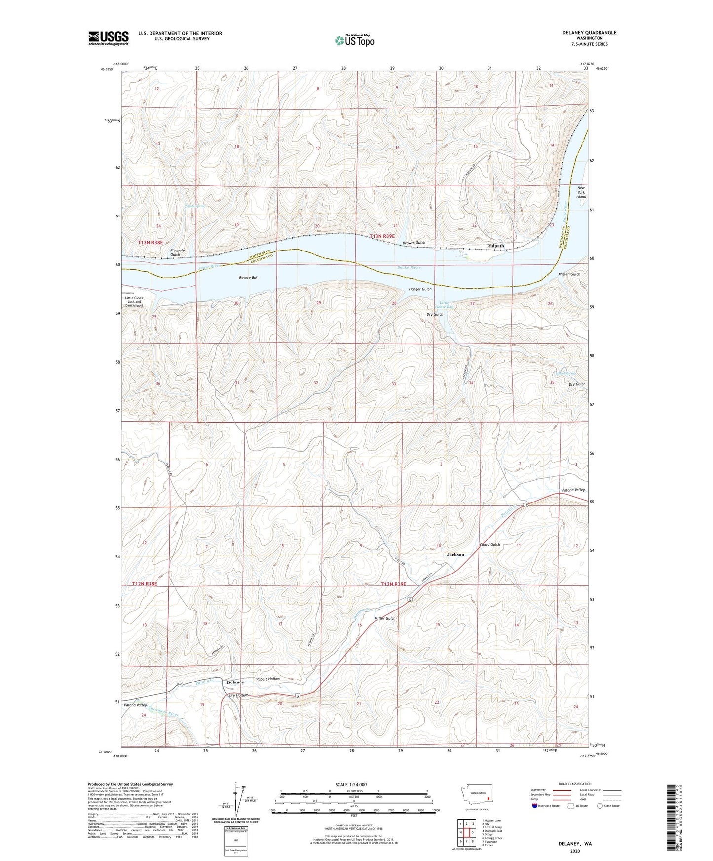
2023 topographic map quadrangle Delaney in the state of Washington. Scale: 1:24000. Based on the newly updated USGS 7.5' US Topo map series, this map is in the following counties: Columbia, Whitman. The map contains contour data, water features, and other items you are used to seeing on USGS maps, but also has updated roads and other features. This is the next generation of topographic maps. Printed on high-quality waterproof paper with UV fade-resistant inks.
Quads adjacent to this one:
West: Starbuck East
Northwest: Hooper Lake
North: Hay
Northeast: Central Ferry
East: Dodge
Southeast: Turner
South: Tucannon
Southwest: Kellogg Creek
This map covers the same area as the classic USGS quad with code o46117e8.
Contains the following named places: Browns Gulch, Chard Gulch, Coyote Spring, Delaney, Dry Gulch, Dry Hollow, Flagpole Gulch, Hanger Gulch, Jackson, Little Goose Bay, Lizard Spring, Miller Gulch, Pataha Creek, Pataha Valley, Phalen Gulch, Rabbit Hollow, Revere Bar, Ridpath, Wild Goose