MyTopo
Douglas Washington US Topo Map
Couldn't load pickup availability
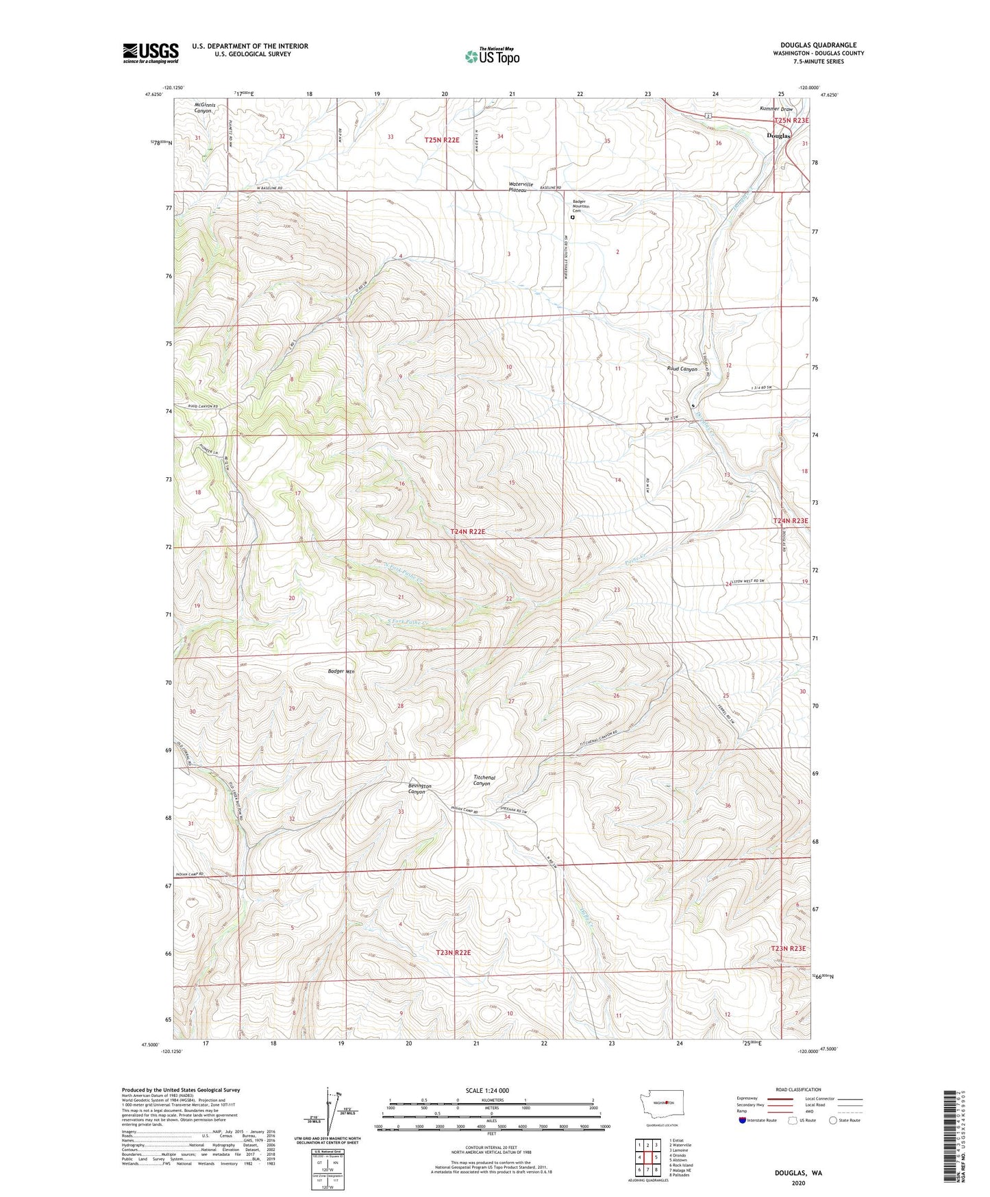
2023 topographic map quadrangle Douglas in the state of Washington. Scale: 1:24000. Based on the newly updated USGS 7.5' US Topo map series, this map is in the following counties: Douglas. The map contains contour data, water features, and other items you are used to seeing on USGS maps, but also has updated roads and other features. This is the next generation of topographic maps. Printed on high-quality waterproof paper with UV fade-resistant inks.
Quads adjacent to this one:
West: Orondo
Northwest: Entiat
North: Waterville
Northeast: Lamoine
East: Alstown
Southeast: Palisades
South: Malaga NE
Southwest: Rock Island
This map covers the same area as the classic USGS quad with code o47120e1.
Contains the following named places: Badger Mountain View Cemetery, Douglas, Kummer Draw, North Fork Paine Creek, Paine Creek, Ruud Canyon, South Fork Paine Creek