MyTopo
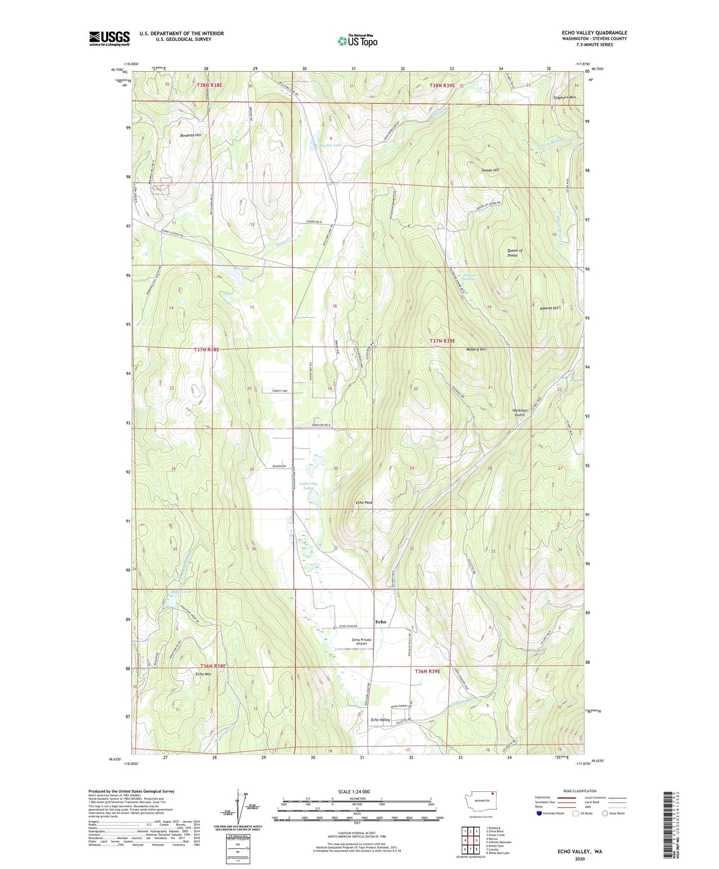
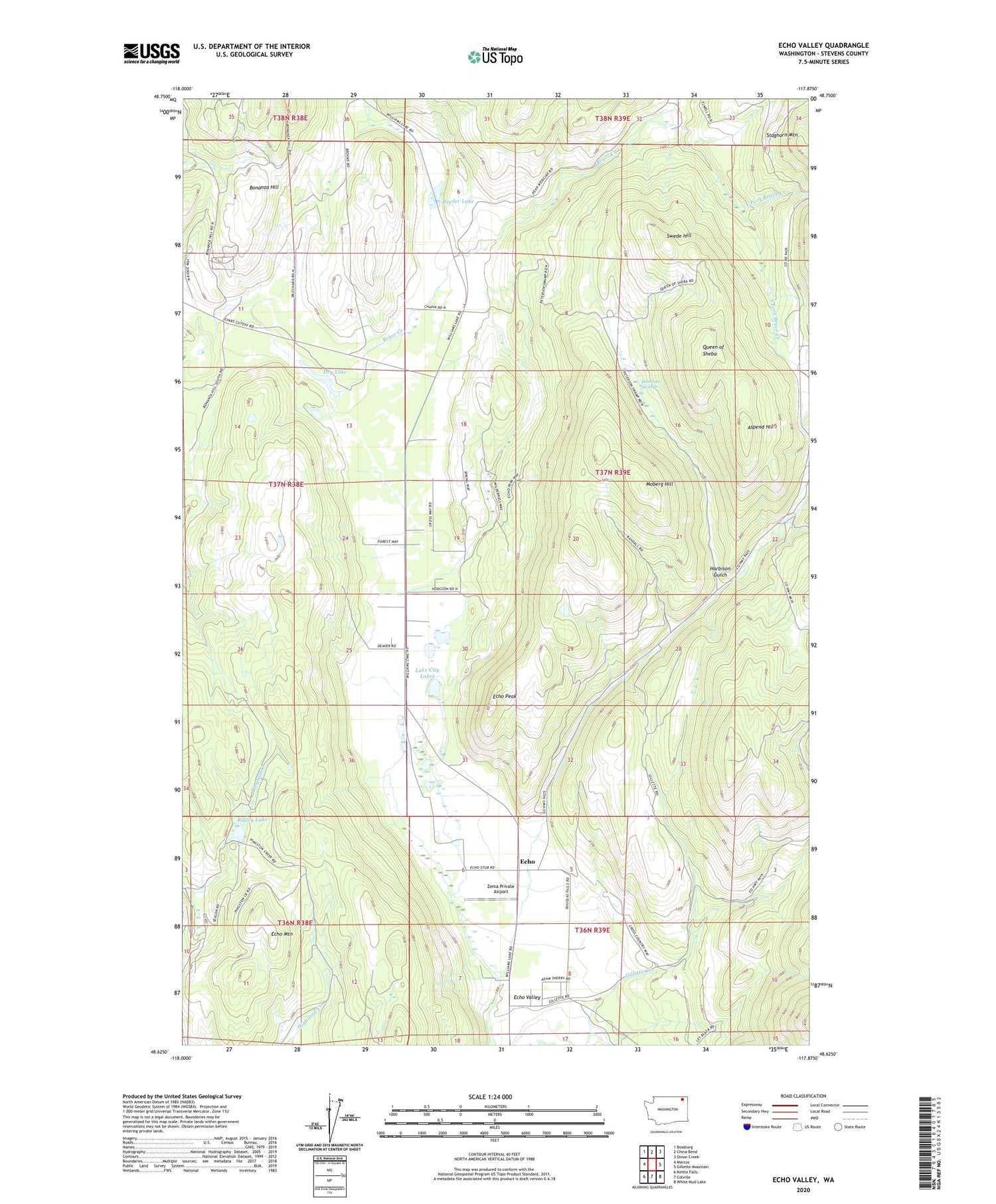
Echo Valley Washington US Topo Map
Couldn't load pickup availability
2020 topographic map quadrangle Echo Valley in the state of Washington. Scale: 1:24000. Based on the newly updated USGS 7.5' US Topo map series, this map is in the following counties: Stevens. The map contains contour data, water features, and other items you are used to seeing on USGS maps, but also has updated roads and other features. This is the next generation of topographic maps. Printed on high-quality waterproof paper with UV fade-resistant inks.
Quads adjacent to this one:
West: Marcus
Northwest: Bossburg
North: China Bend
Northeast: Onion Creek
East: Gillette Mountain
Southeast: White Mud Lake
South: Colville
Southwest: Kettle Falls
Contains the following named places: Aspend Hill, Bonanza Hill, Bonanza Mine, Bruce Creek, Bruce Creek Grange, Bruce Creek School, Dry Lake, East Fork Bruce Creek, Echo, Echo Mountain, Echo Peak, Echo Valley, Eureka Surprise, Gillette Creek, Harbison Gulch, Hill Cliff Mine, Lake City, Lake City Lakes, Leadville Mine, Lucky Stone Mine, Moberg Hill, North Fork Bruce Creek, North Fork Clugston Creek, Old Placer Diggings, Peterson Swamp, Queen of Sheba, Reeder Lake, Rigley Lake, South Fork Bruce Creek, South Fork Clugston Creek, Swede Hill, Zema Private Airport, ZIP Code: 99126