MyTopo
Bossburg Washington US Topo Map
Couldn't load pickup availability
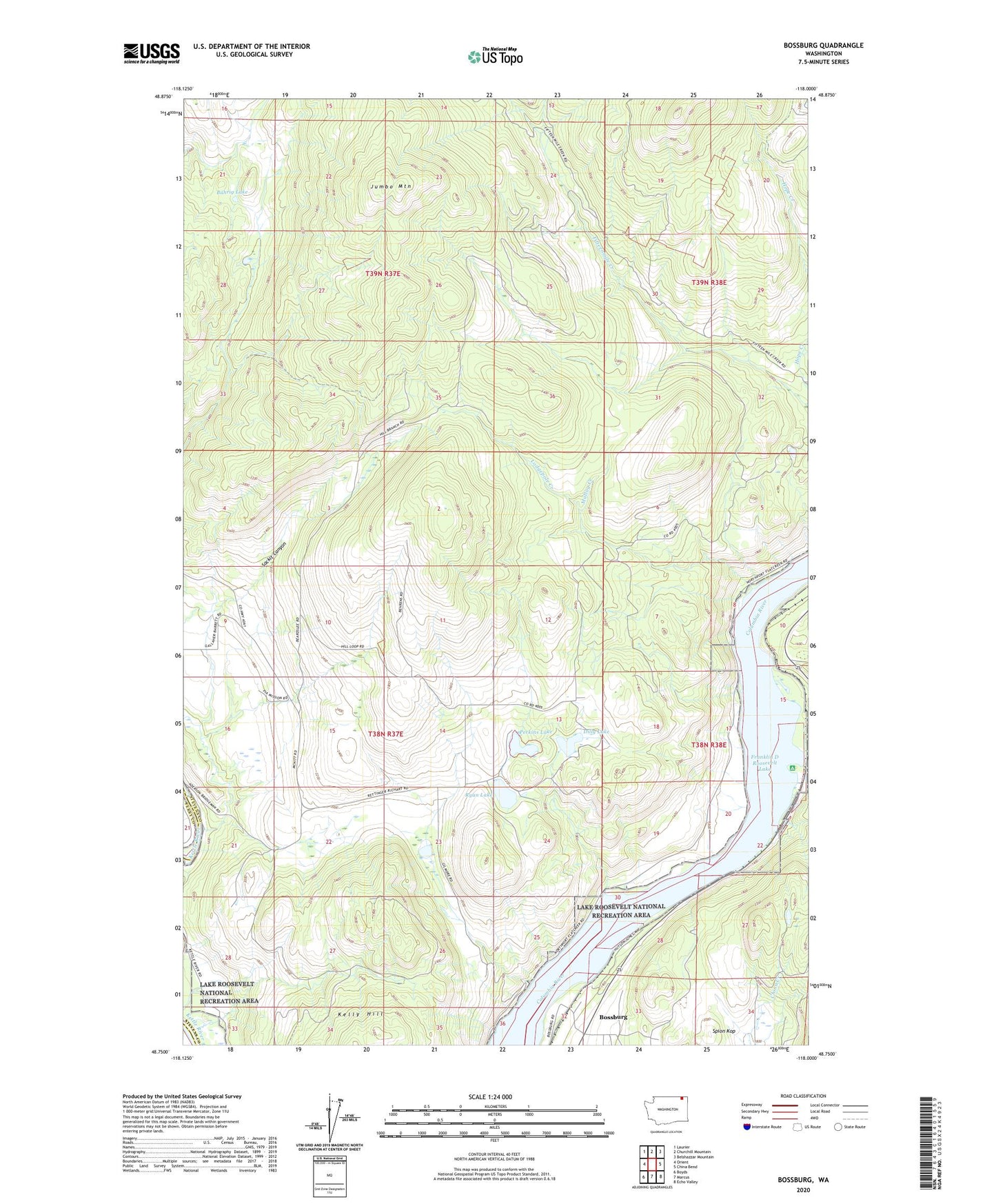
2023 topographic map quadrangle Bossburg in the state of Washington. Scale: 1:24000. Based on the newly updated USGS 7.5' US Topo map series, this map is in the following counties: Stevens, Ferry. The map contains contour data, water features, and other items you are used to seeing on USGS maps, but also has updated roads and other features. This is the next generation of topographic maps. Printed on high-quality waterproof paper with UV fade-resistant inks.
Quads adjacent to this one:
West: Orient
Northwest: Laurier
North: Churchill Mountain
Northeast: Belshazzar Mountain
East: China Bend
Southeast: Echo Valley
South: Marcus
Southwest: Boyds
This map covers the same area as the classic USGS quad with code o48118g1.
Contains the following named places: Bossburg, Buhrig Lake, Dilly Lake, Glasgo Lakes, Jumbo Mountain, Lodgepole Creek, Malloy Creek, North Gorge Campground, Northwest Marble Mine, Perkins Lake, Ryan Lake, Sackit Canyon, Spion Kop, Young America Mine