MyTopo
China Bend Washington US Topo Map
Couldn't load pickup availability
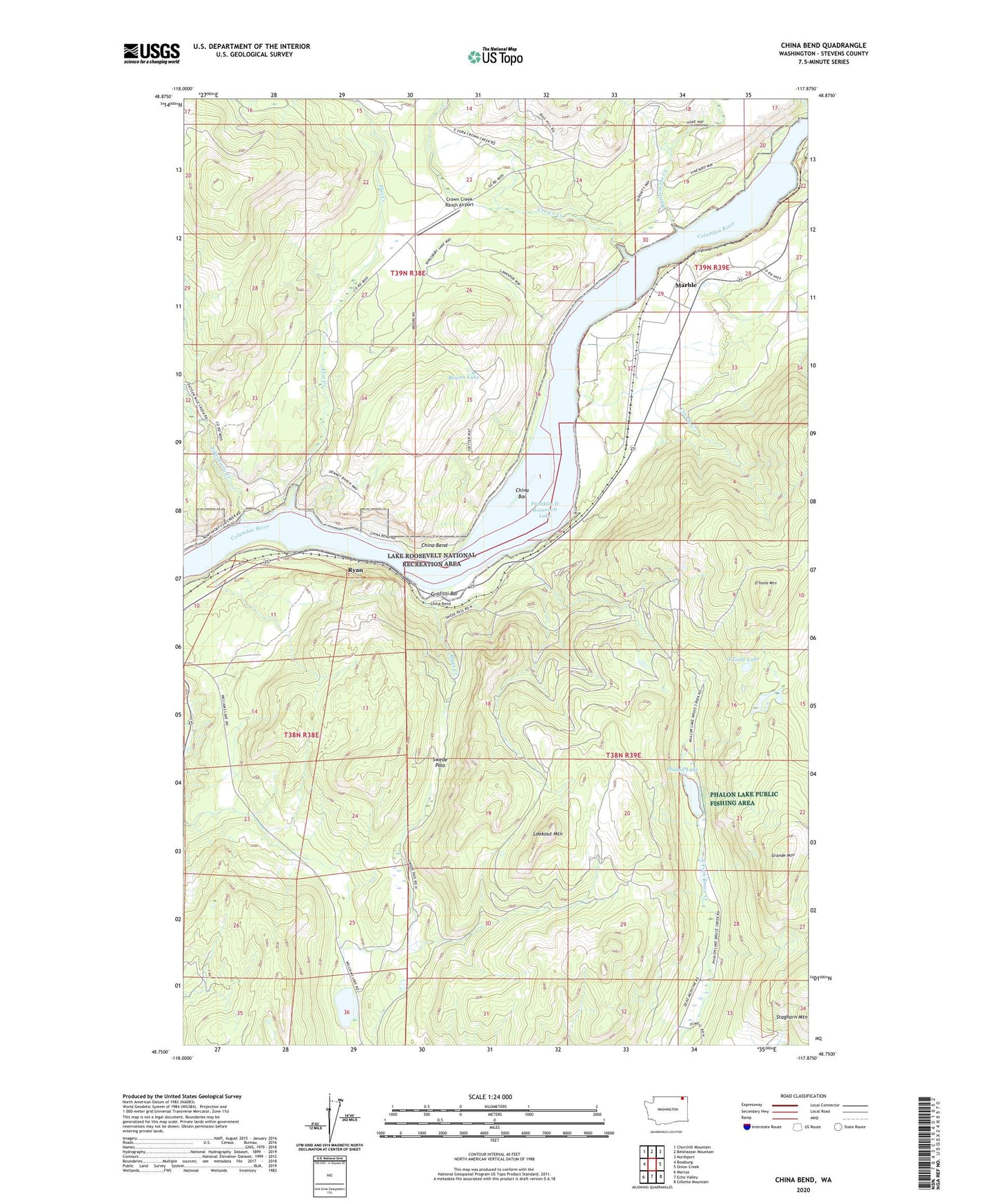
2023 topographic map quadrangle China Bend in the state of Washington. Scale: 1:24000. Based on the newly updated USGS 7.5' US Topo map series, this map is in the following counties: Stevens. The map contains contour data, water features, and other items you are used to seeing on USGS maps, but also has updated roads and other features. This is the next generation of topographic maps. Printed on high-quality waterproof paper with UV fade-resistant inks.
Quads adjacent to this one:
West: Bossburg
Northwest: Churchill Mountain
North: Belshazzar Mountain
Northeast: Northport
East: Onion Creek
Southeast: Gillette Mountain
South: Echo Valley
Southwest: Marcus
This map covers the same area as the classic USGS quad with code o48117g8.
Contains the following named places: Bowen Lake, China Bar, China Bend, Crown Creek, Crown Creek Ranch Airport, Fifteenmile Creek, Flat Creek, Grafitti Bar, Grande Mountain, Hope Creek, Kettle Falls Division, Lookout Mountain, Marble, O'Toole Lake, O'Toole Mountain, Phalon Lake, Phalon Lake Public Fishing Area, Rattlesnake Creek, Ryan, Ryan Creek, Silver Trail Mine, Swede Pass, Williams Lake, Williams Recreation Site, ZIP Code: 99157