MyTopo
Frosty Creek Washington US Topo Map
Couldn't load pickup availability
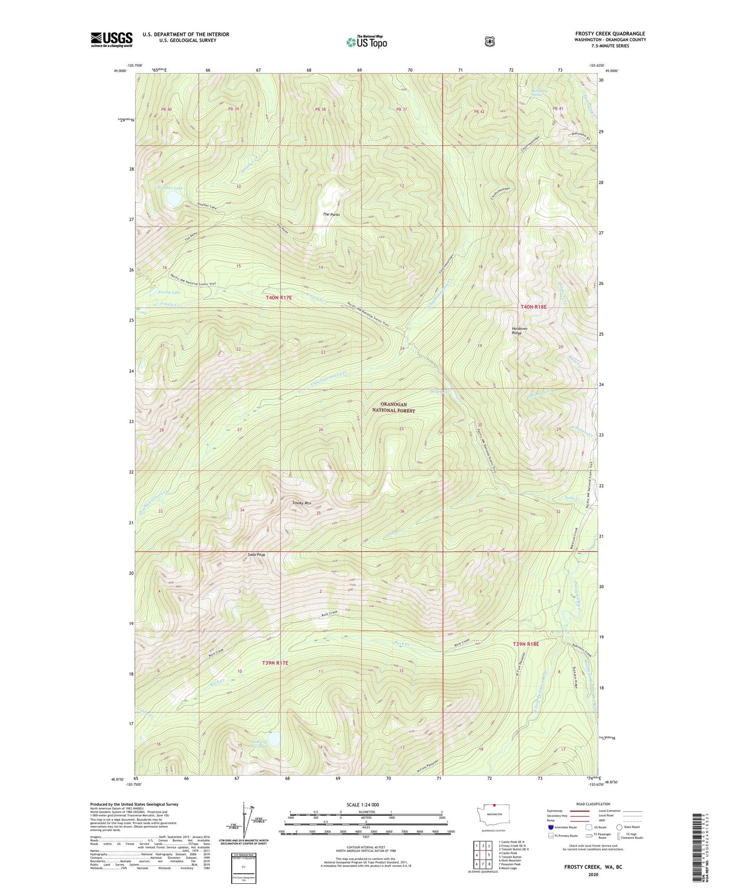
2020 topographic map quadrangle Frosty Creek in the state of Washington. Scale: 1:24000. Based on the newly updated USGS 7.5' US Topo map series, this map is in the following counties: Okanogan. The map contains contour data, water features, and other items you are used to seeing on USGS maps, but also has updated roads and other features. This is the next generation of topographic maps. Printed on high-quality waterproof paper with UV fade-resistant inks.
Quads adjacent to this one:
West: Castle Peak
Northwest: Castle Peak OE N
North: Frosty Creek OE N
Northeast: Tatoosh Buttes OE N
East: Tatoosh Buttes
Southeast: Mount Lago
South: Pasayten Peak
Southwest: Shull Mountain
Contains the following named places: Brown Bear Camp, Chuchuwanteen Cabin, Coney Creek, Dead Lake, Frosty Creek, Frosty Lake, Heather Lake, Holdover Ridge, Lake of the Pines, Lease Creek, Middle Fork Pasayten River, Monument Spring, Pasayten Airstrip Guard Station, Pasayten-US Forest Service Airfield, Rock Creek, Smoky Mountain, Snehumption Creek, Soda Peak, The Parks, Three Forks Cabin, West Fork Pasayten River