MyTopo
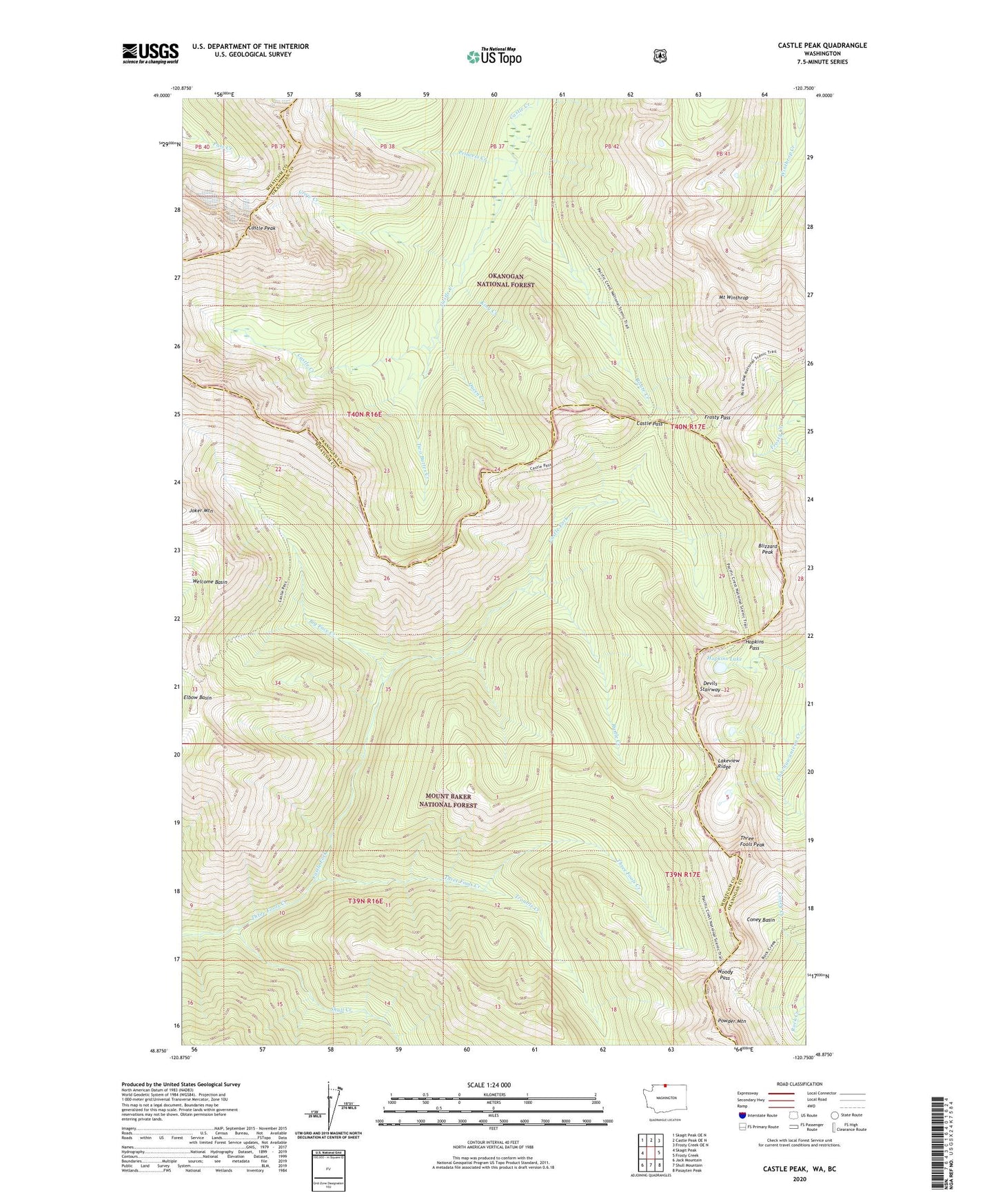
Castle Peak Washington US Topo Map
Couldn't load pickup availability
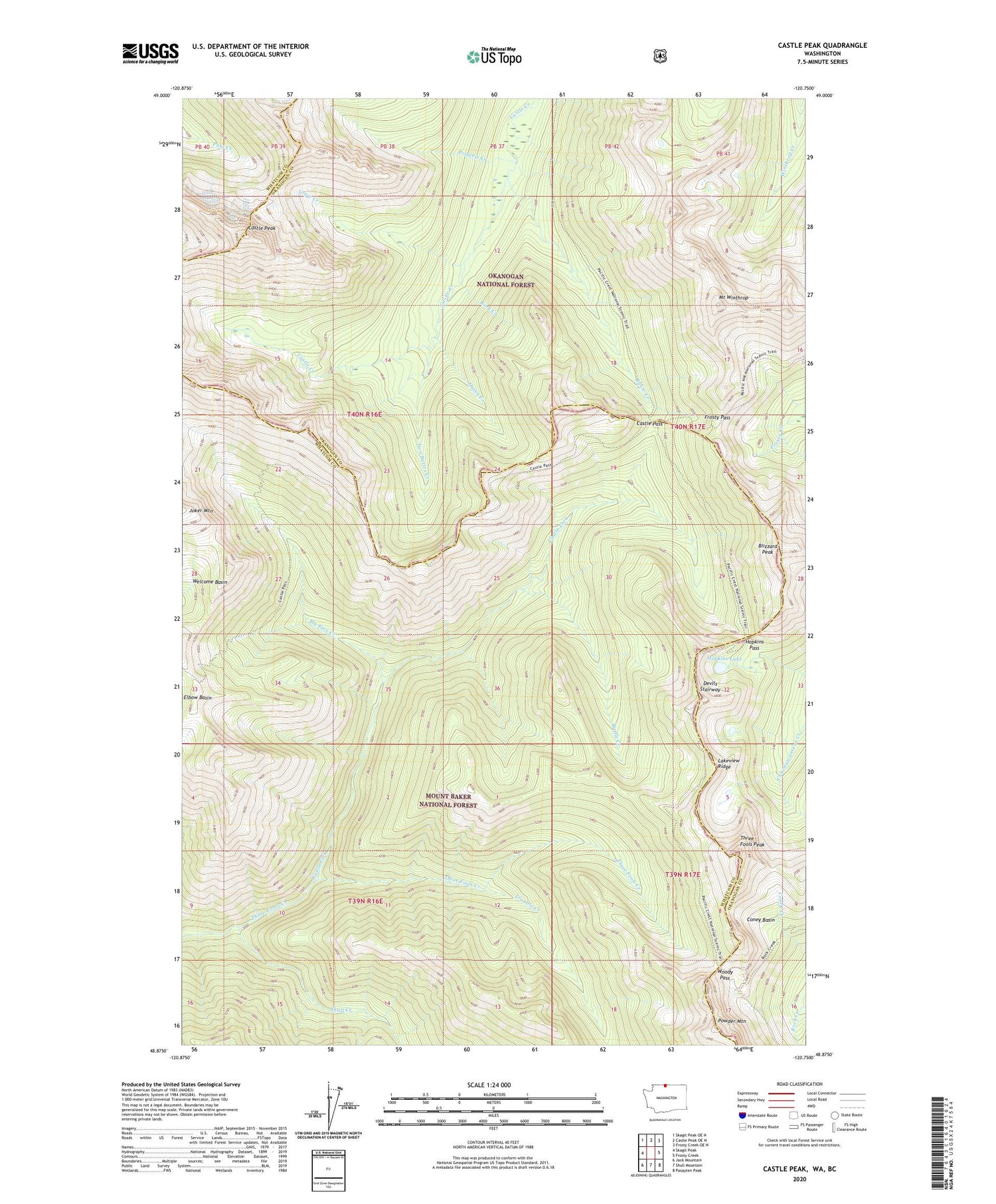
Also explore the Castle Peak Forest Service Topo of this same quad for updated USFS data
2023 topographic map quadrangle Castle Peak in the state of Washington. Scale: 1:24000. Based on the newly updated USGS 7.5' US Topo map series, this map is in the following counties: Whatcom, Okanogan. The map contains contour data, water features, and other items you are used to seeing on USGS maps, but also has updated roads and other features. This is the next generation of topographic maps. Printed on high-quality waterproof paper with UV fade-resistant inks.
Quads adjacent to this one:
West: Skagit Peak
Northwest: Skagit Peak OE N
North: Castle Peak OE N
Northeast: Frosty Creek OE N
East: Frosty Creek
Southeast: Pasayten Peak
South: Shull Mountain
Southwest: Jack Mountain
This map covers the same area as the classic USGS quad with code o48120h7.
Contains the following named places: Big Face Creek, Blizzard Peak, Castle Fork, Castle Pass, Castle Peak, Coney Basin, Crow Creek, Devils Stairway, Frosty Pass, Hopkins Lake, Hopkins Pass, King Creek, Lakeview Ridge, Mount Winthrop, Mountain Home Camp, North Cascade Primitive Area, Pacific Crest National Scenic Trail, Powder Mountain, Princess Creek, Queen Creek, Rock Creek, Route Creek, Rustle Creek, Shull Creek, Three Fools Peak, Trouble Creek, Two Buttes Creek, Woody Pass