MyTopo
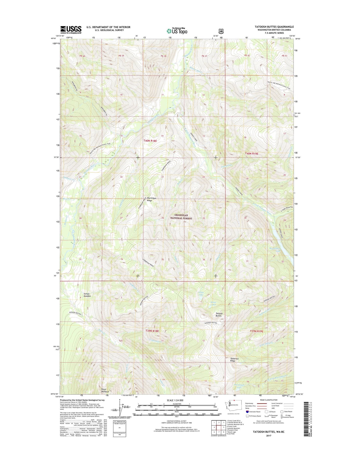
Tatoosh Buttes Washington US Topo Map
Couldn't load pickup availability
Also explore the Tatoosh Buttes Forest Service Topo of this same quad for updated USFS data
2023 topographic map quadrangle Tatoosh Buttes in the state of Washington. Scale: 1:24000. Based on the newly updated USGS 7.5' US Topo map series, this map is in the following counties: Okanogan. The map contains contour data, water features, and other items you are used to seeing on USGS maps, but also has updated roads and other features. This is the next generation of topographic maps. Printed on high-quality waterproof paper with UV fade-resistant inks.
Quads adjacent to this one:
West: Frosty Creek
Northwest: Frosty Creek OE N
North: Tatoosh Buttes OE N
Northeast: Ashnola Mountain OE N
East: Ashnola Mountain
Southeast: Lost Peak
South: Mount Lago
Southwest: Pasayten Peak
This map covers the same area as the classic USGS quad with code o48120h5.
Contains the following named places: Big Hidden Lake, Bunker Hill Creek, Burn Creek, Central Creek, East Fork Pasayten River, Farewell Creek, Getaway Creek, Gunbarrel Camp, Harrison Camp, Harrison Creek, Holdover Creek, Honess Creek, Judy Creek, Lodgepole Creek, Lone Buck Camp, Lunch Creek, Pasayten Cabin, Ptarmigan Lake, Ptarmigan Ridge, Rainy Camp, Soda Creek, Sunset Meadow, Tamarack Creek, Tamarack Ridge, Tatoosh Buttes, Thomson Creek, Trail Creek, White Creek, White Lake, White Lakes