MyTopo
Gable Butte Washington US Topo Map
Couldn't load pickup availability
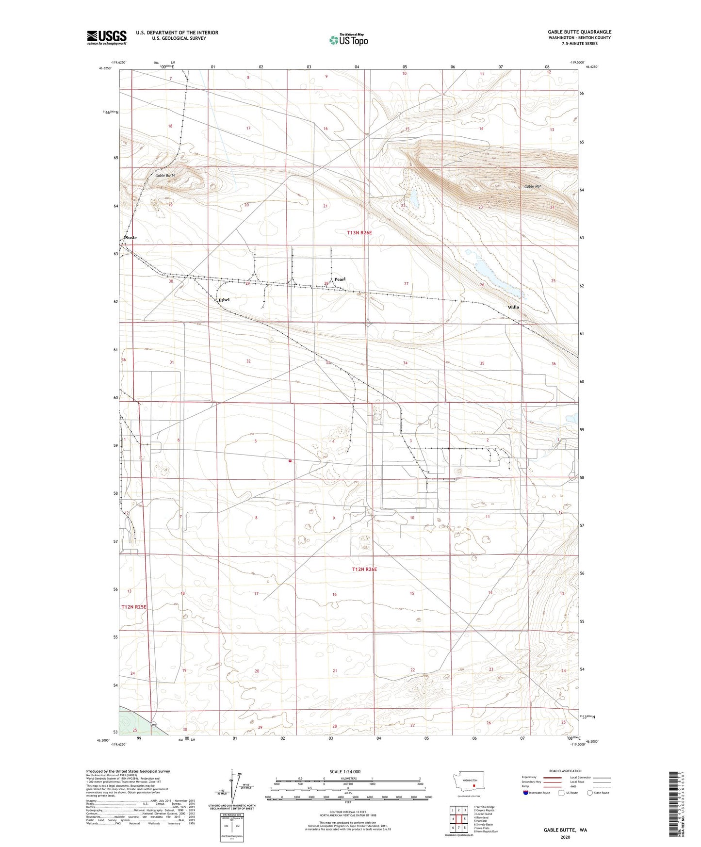
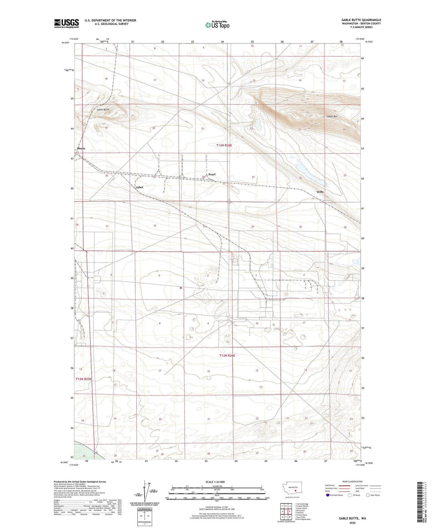
2020 topographic map quadrangle Gable Butte in the state of Washington. Scale: 1:24000. Based on the newly updated USGS 7.5' US Topo map series, this map is in the following counties: Benton. The map contains contour data, water features, and other items you are used to seeing on USGS maps, but also has updated roads and other features. This is the next generation of topographic maps. Printed on high-quality waterproof paper with UV fade-resistant inks.
Quads adjacent to this one:
West: Riverland
Northwest: Vernita Bridge
North: Coyote Rapids
Northeast: Locke Island
East: Hanford
Southeast: Horn Rapids Dam
South: Iowa Flats
Southwest: Snively Basin
Contains the following named places: Department of Engery Hanford Site - Hanford Fire Department Station 92, Ethel, Gable Butte, Gable Mountain, Hanford Site, Hanford Site Division, Pearl, Susie, Willa