MyTopo
Georges Peak Washington US Topo Map
Couldn't load pickup availability
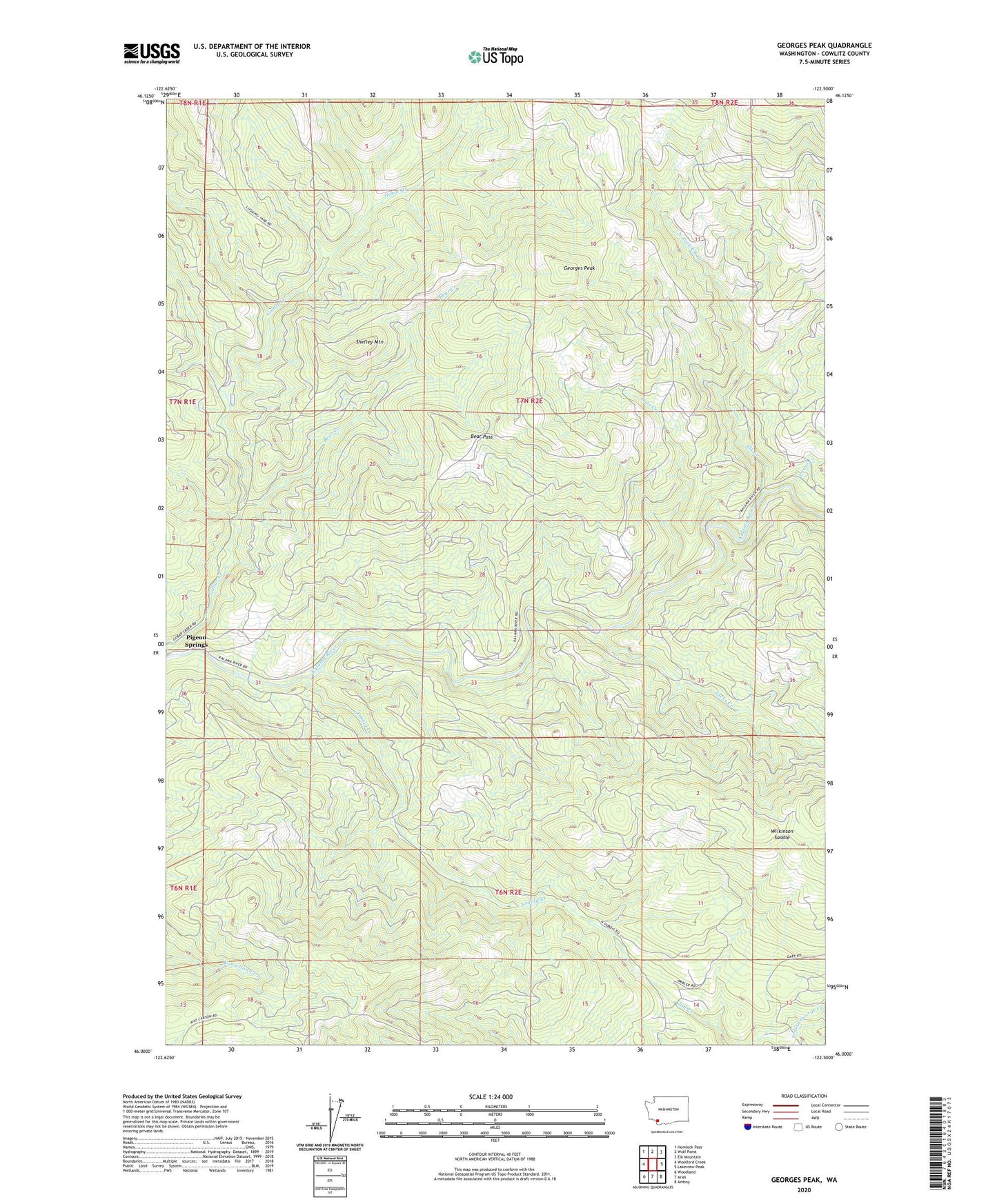
2020 topographic map quadrangle Georges Peak in the state of Washington. Scale: 1:24000. Based on the newly updated USGS 7.5' US Topo map series, this map is in the following counties: Cowlitz. The map contains contour data, water features, and other items you are used to seeing on USGS maps, but also has updated roads and other features. This is the next generation of topographic maps. Printed on high-quality waterproof paper with UV fade-resistant inks.
Quads adjacent to this one:
West: Woolford Creek
Northwest: Hemlock Pass
North: Wolf Point
Northeast: Elk Mountain
East: Lakeview Peak
Southeast: Amboy
South: Ariel
Southwest: Woodland
Contains the following named places: Arnold Creek, Bear Creek, Bear Pass, Camp Kalama, Elk Creek, Georges Peak, Georges Peak Trail, Gobar Creek, Jacks Creek, Lost Creek, Louse Creek, North Fork Elk Creek, Pigeon Springs, Shelley Mountain, Wilkinson Saddle, Woodland Division