MyTopo
Wolf Point Washington US Topo Map
Couldn't load pickup availability
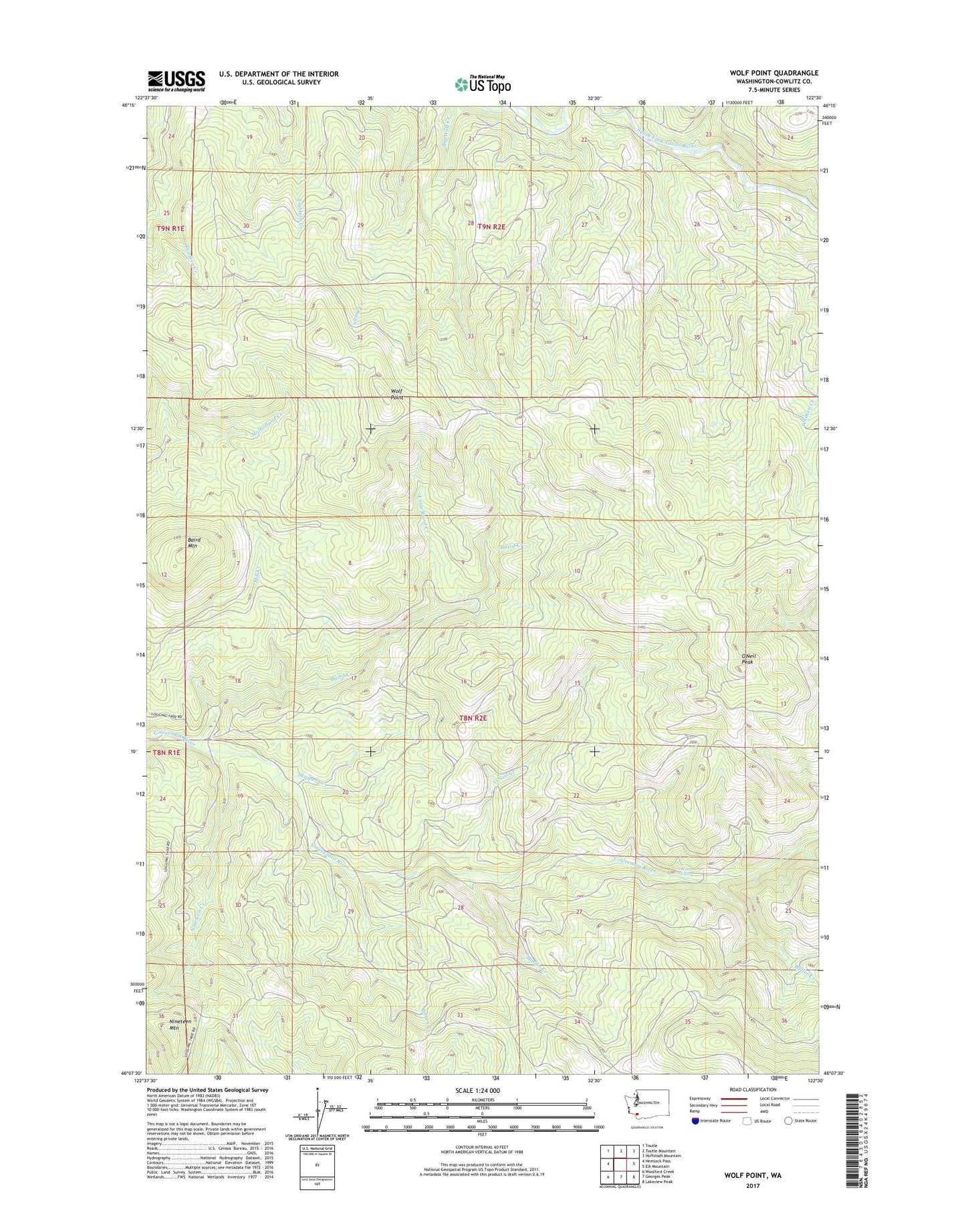
2023 topographic map quadrangle Wolf Point in the state of Washington. Scale: 1:24000. Based on the newly updated USGS 7.5' US Topo map series, this map is in the following counties: Cowlitz. The map contains contour data, water features, and other items you are used to seeing on USGS maps, but also has updated roads and other features. This is the next generation of topographic maps. Printed on high-quality waterproof paper with UV fade-resistant inks.
Quads adjacent to this one:
West: Hemlock Pass
Northwest: Toutle
North: Toutle Mountain
Northeast: Hoffstadt Mountain
East: Elk Mountain
Southeast: Lakeview Peak
South: Georges Peak
Southwest: Woolford Creek
This map covers the same area as the classic USGS quad with code o46122b5.
Contains the following named places: Baird Creek, Baird Mountain, Brown Creek, Butler Creek, Camp Coweeman, Coweeman Ranger Station, Hill Creek, Little Baird Creek, Martin Creek, Nineteen Creek, Nineteen Mountain, O'Neil Creek, O'Neil Peak, Skipper Creek, Washboard Falls, Wolf Point