MyTopo
Amboy Washington US Topo Map
Couldn't load pickup availability
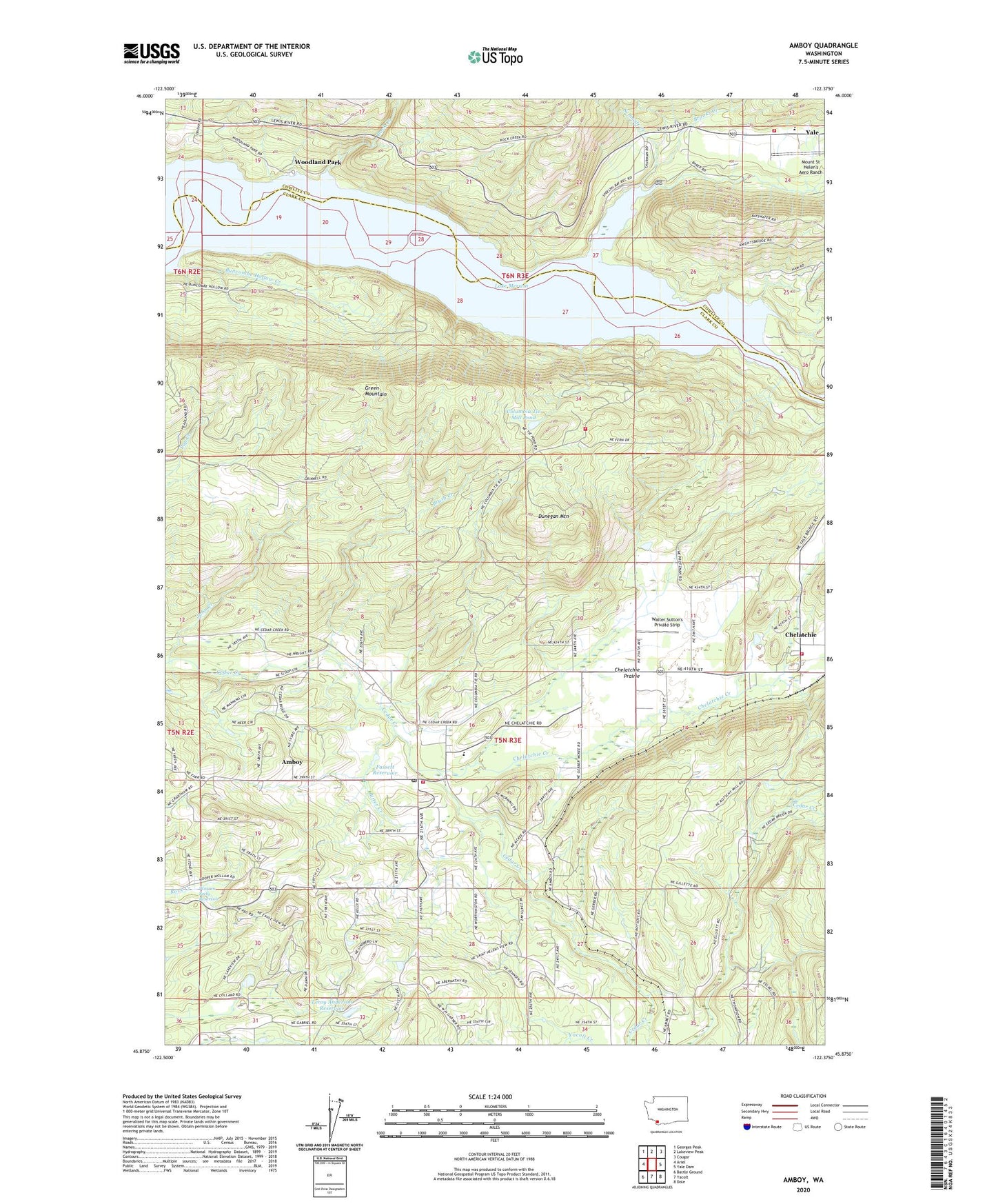
2023 topographic map quadrangle Amboy in the state of Washington. Scale: 1:24000. Based on the newly updated USGS 7.5' US Topo map series, this map is in the following counties: Clark, Cowlitz. The map contains contour data, water features, and other items you are used to seeing on USGS maps, but also has updated roads and other features. This is the next generation of topographic maps. Printed on high-quality waterproof paper with UV fade-resistant inks.
Quads adjacent to this one:
West: Ariel
Northwest: Georges Peak
North: Lakeview Peak
Northeast: Cougar
East: Yale Dam
Southeast: Dole
South: Yacolt
Southwest: Battle Ground
This map covers the same area as the classic USGS quad with code o45122h4.
Contains the following named places: Amboy, Amboy Census Designated Place, Amboy Middle School, Amboy Park, Amboy Post Office, Bitter Creek, Brooks Creek, Brush Creek, Buncombe Hollow Creek, Chelatchie, Chelatchie Creek, Chelatchie Prairie, Clark County Fire District 10 Station 1, Clark County Fire District 10 Station 106, Clark County Fire District 10 Station 2, Columbia Tie Mill Pond, Cowlitz - Skamania Fire District 7 Station 71, Dunegan Mountain, Fassett Reservoir, Fassett Reservoir Dam, Green Mountain, John Creek, Lake Merwin, Leroy Anderson Dam, Leroy Anderson Reservoir, Maple Pit, Mount Saint Helens National Volcanic Monument Headquarters, Mount St Helen's Aero Ranch, Rock Creek, Saint Helens Ranger Station, Schmidt Creek, Seely Dam, Speelyai Creek, Speelyai Picnic Area, Walter Sutton's Private Strip, Warren Seely Reservoir, Woodland Park, Yale, Yale Elementary School