MyTopo
Golgotha Butte Washington US Topo Map
Couldn't load pickup availability
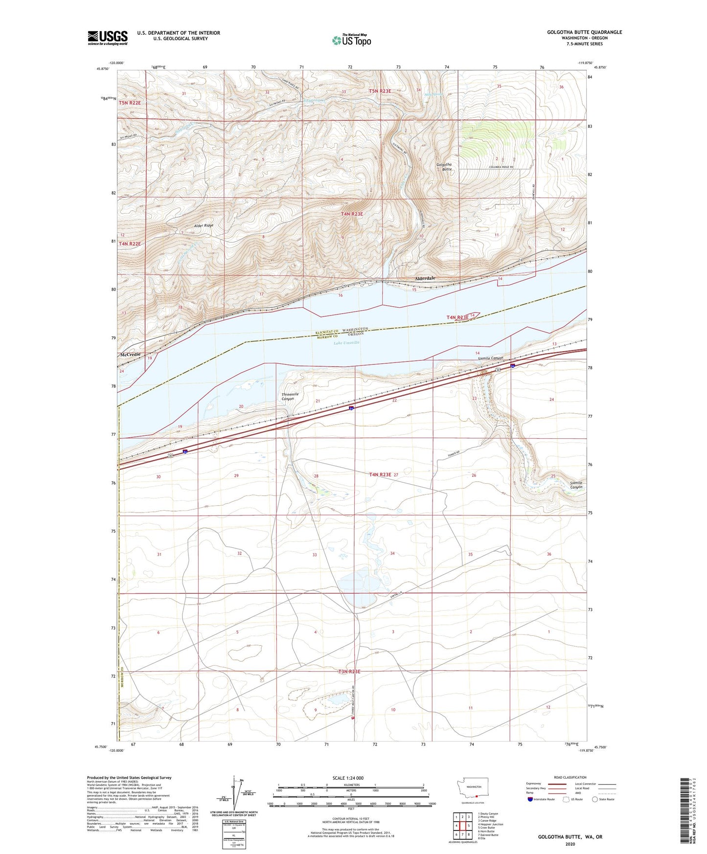
2020 topographic map quadrangle Golgotha Butte in the states of Oregon, Washington. Scale: 1:24000. Based on the newly updated USGS 7.5' US Topo map series, this map is in the following counties: Klickitat, Morrow, Gilliam. The map contains contour data, water features, and other items you are used to seeing on USGS maps, but also has updated roads and other features. This is the next generation of topographic maps. Printed on high-quality waterproof paper with UV fade-resistant inks.
Quads adjacent to this one:
West: Heppner Junction
Northwest: Douty Canyon
North: Phinny Hill
Northeast: Canoe Ridge
East: Crow Butte
Southeast: Ella
South: Dalreed Butte
Southwest: Horn Butte
Contains the following named places: Alder Creek, Alder Ridge, Alderdale, Alderdale Treaty Fishing Access Site, Boardman Rural Fire Protection District Station 3, Boulder, Cottonwood Creek, Golgotha Butte, Lake Umatilla, McCredie, Quesna County Park, Quesnal Park Boat Ramp, Sally Spring, Simtag Farms Airstrip, Sixmile Canyon, Sixprong Creek, Threemile Canyon, Threemile Canyon Treaty Fishing Access Site, ZIP Code: 97818