MyTopo
Phinny Hill Washington US Topo Map
Couldn't load pickup availability
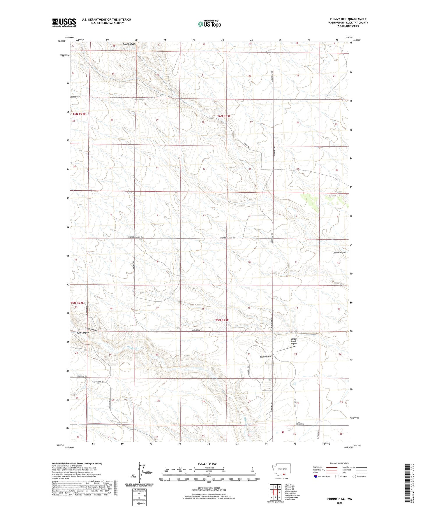
2023 topographic map quadrangle Phinny Hill in the state of Washington. Scale: 1:24000. Based on the newly updated USGS 7.5' US Topo map series, this map is in the following counties: Klickitat. The map contains contour data, water features, and other items you are used to seeing on USGS maps, but also has updated roads and other features. This is the next generation of topographic maps. Printed on high-quality waterproof paper with UV fade-resistant inks.
Quads adjacent to this one:
West: Douty Canyon
Northwest: Tule Prong
North: Prosser SW
Northeast: Prosser SE
East: Canoe Ridge
Southeast: Crow Butte
South: Golgotha Butte
Southwest: Heppner Junction
This map covers the same area as the classic USGS quad with code o45119h8.
Contains the following named places: Klickitat County Fire District 10, Mercer Ranch Airport, Phinny Hill, Tule Canyon