MyTopo
Harrah Washington US Topo Map
Couldn't load pickup availability
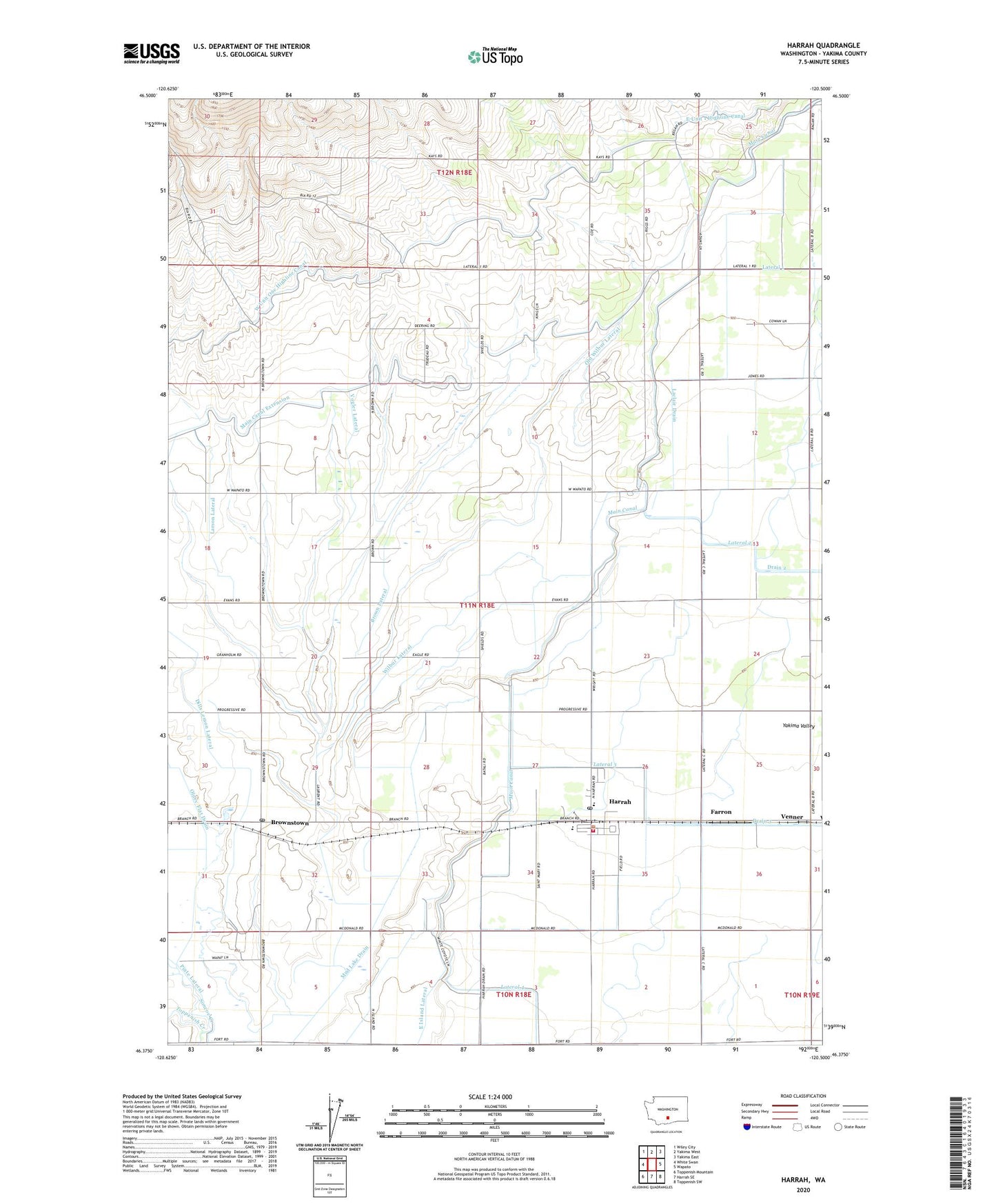
2020 topographic map quadrangle Harrah in the state of Washington. Scale: 1:24000. Based on the newly updated USGS 7.5' US Topo map series, this map is in the following counties: Yakima. The map contains contour data, water features, and other items you are used to seeing on USGS maps, but also has updated roads and other features. This is the next generation of topographic maps. Printed on high-quality waterproof paper with UV fade-resistant inks.
Quads adjacent to this one:
West: White Swan
Northwest: Wiley City
North: Yakima West
Northeast: Yakima East
East: Wapato
Southeast: Toppenish SW
South: Harrah SE
Southwest: Toppenish Mountain
Contains the following named places: Brown Lateral, Brownstown, Brownstown Post Office, Dills Lemon Lateral, East Island Lateral, Farron, Harrah, Harrah Community Christian School, Harrah Elementary School, Harrah Feedlot, Harrah Post Office, Labbee Field, Laclair Drain, Larson Lateral, Lateral 1, Main Canal, Mud Lake Drain, Old Wilbur Lateral, Olney Flat Drain, Piute Lateral, Reservation Memorial Park, Simcoe Creek, Town of Harrah, Venner, Vogler Lateral, Wilbur Lateral, Yakima County Fire District 5 Station 2 Brownstown, Yakima County Fire District 5 Station 3 Harrah, ZIP Code: 98951