MyTopo
Yakima East Washington US Topo Map
Couldn't load pickup availability
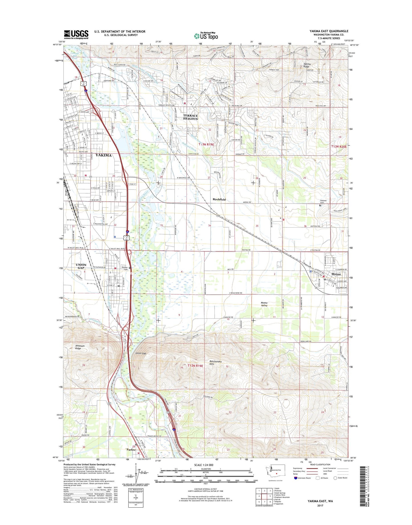
2023 topographic map quadrangle Yakima East in the state of Washington. Scale: 1:24000. Based on the newly updated USGS 7.5' US Topo map series, this map is in the following counties: Yakima. The map contains contour data, water features, and other items you are used to seeing on USGS maps, but also has updated roads and other features. This is the next generation of topographic maps. Printed on high-quality waterproof paper with UV fade-resistant inks.
Quads adjacent to this one:
West: Yakima West
Northwest: Selah
North: Pomona
Northeast: Selah Springs
East: Elephant Mountain
Southeast: Toppenish
South: Wapato
Southwest: Harrah
This map covers the same area as the classic USGS quad with code o46120e4.
Contains the following named places: Adams Elementary School, Ahtanum Creek, American Medical Response, Bethel Church, Birchfield, Broadmead Shopping Center, Cahalan Park, Cascade Mill Pond, Cascade Mill Pond Dam, Central Washington Fairgrounds, Childs School, City of Moxee, City of Union Gap, Country Shopping Center, East Valley Central Middle School, East Valley High School, First Reformed Church, Fullbright Park, Holland Cemetery, Holy Rosary School, Hubbard Ditch, Jefferson School, KBBO-AM (Yakima), KHYT-FM (Toppenish), KIHS-FM (Yakima), KIT-AM (Yakima), Kiwanis Park, KMWX-AM (Yakima), KRSE-FM (Yakima), KUTI-AM (Selah), KXDD-FM (Yakima), KZTA-AM (Yakima), Madison School, Martin Luther King Jr Elementary School, Mill Pond, Mount Hope Church, Moxee Canal, Moxee City, Moxee Elementary School, Moxee Police Department, Moxee Post Office, Moxee Valley, Parker, Parker Census Designated Place, Parker Post Office, Parker Station, Pioneer Cemetery, Roza Canal, Saint Michaels Church, Selah Moxee Irrigation Canal, Terrace Heights, Terrace Heights Census Designated Place, Terrace Heights Elementary School, Union Gap, Union Gap Fire Department, Union Gap Police Department, Union Gap Post Office, Valley Mall, Wapato Dam, Washington Middle School, Washington Park, Wide Hollow Creek, Yakima County Fire District 4 East Valley Fire Department Station 40, Yakima County Fire District 4 East Valley Fire Department Station 41, Yakima County Fire District 4 East Valley Fire Department Station 42, Yakima County Fire District 5 Station 5 Parker, Yakima County Sheriff's Office, Yakima Fire Department Station 95, Yakima Sportsmen State Park, Yakima Town and Country Club