MyTopo
Wapato Washington US Topo Map
Couldn't load pickup availability
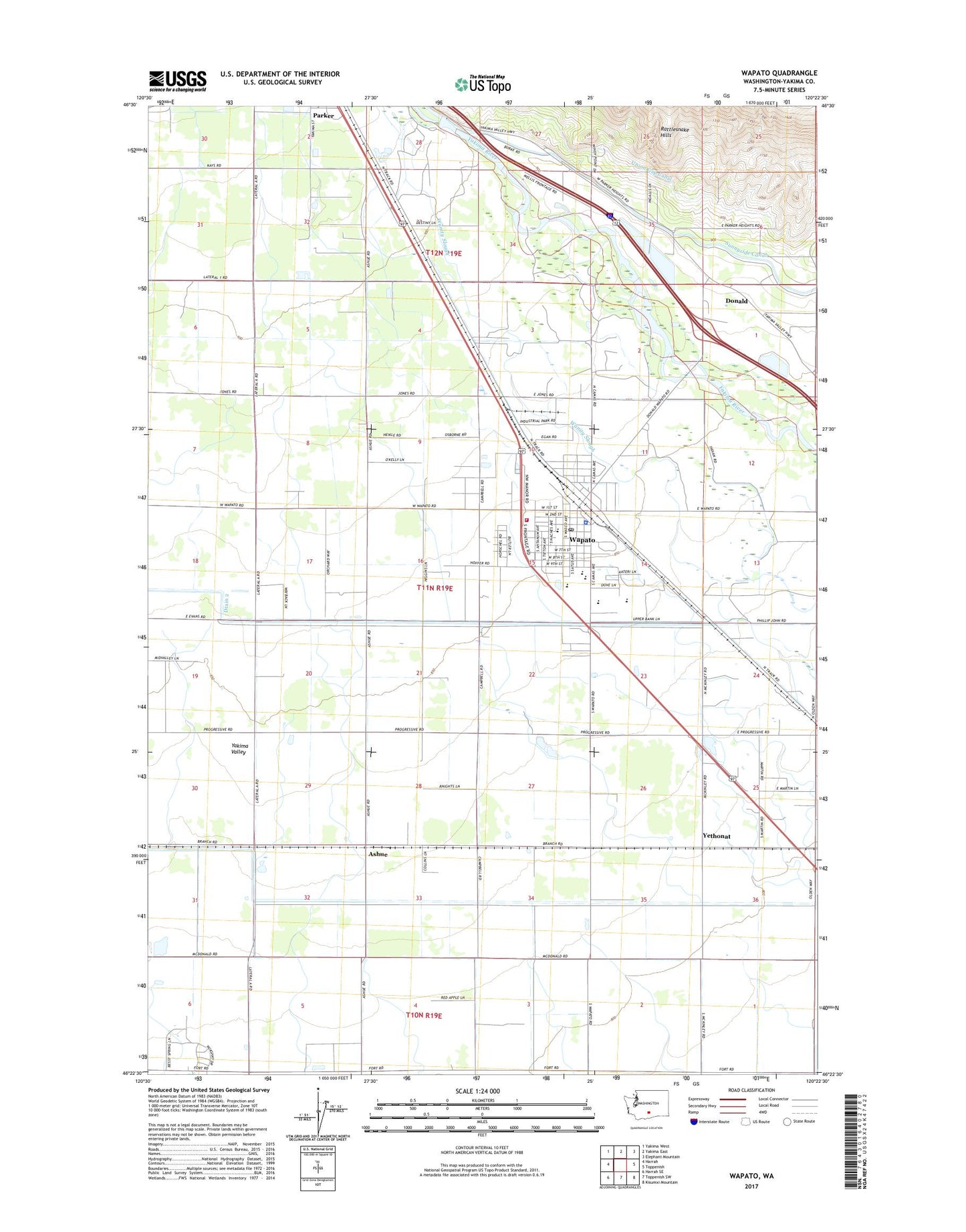
2023 topographic map quadrangle Wapato in the state of Washington. Scale: 1:24000. Based on the newly updated USGS 7.5' US Topo map series, this map is in the following counties: Yakima. The map contains contour data, water features, and other items you are used to seeing on USGS maps, but also has updated roads and other features. This is the next generation of topographic maps. Printed on high-quality waterproof paper with UV fade-resistant inks.
Quads adjacent to this one:
West: Harrah
Northwest: Yakima West
North: Yakima East
Northeast: Elephant Mountain
East: Toppenish
South: Toppenish SW
Southwest: Harrah SE
This map covers the same area as the classic USGS quad with code o46120d4.
Contains the following named places: Ashue, Central Valley Junior Academy, City of Wapato, Donald, Donald Census Designated Place, Drain 2, Drain 3, Lateral 2, Lateral 3, Parker Heights Grange, Parker Heights School, Parker School, Satus Elementary School, Sunnyside Dam, Toppenish-Wapato Division, Union Gap Canal, Utahco, Wapato, Wapato High School, Wapato Intermediate School, Wapato Middle School, Wapato Police Department, Wapato Post Office, Yakima County Fire District 5 Station 6 Wapato, Yethonat, ZIP Code: 98939