MyTopo
Hoodsport Washington US Topo Map
Couldn't load pickup availability
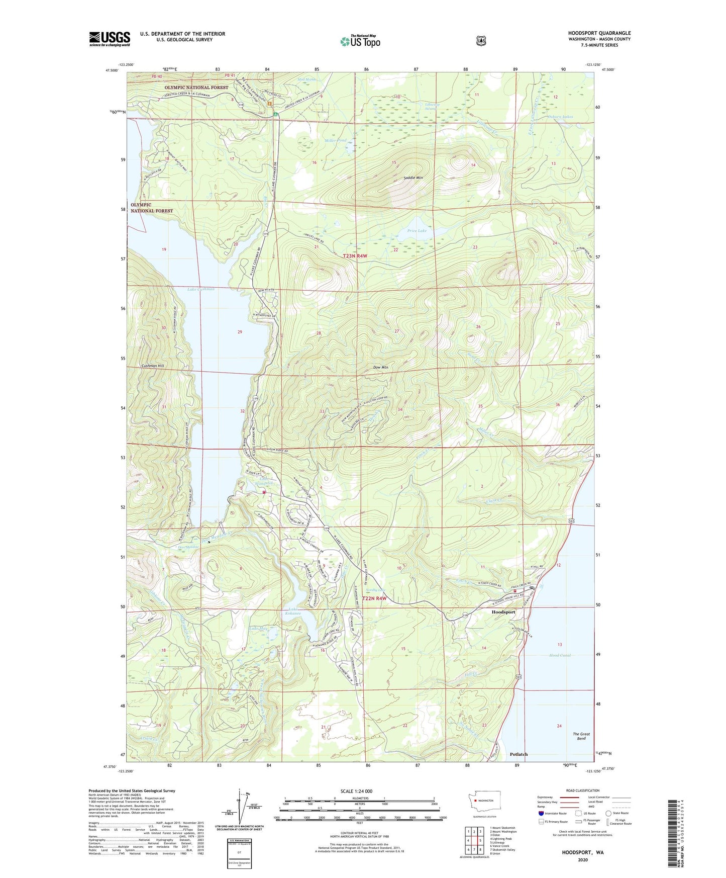
2020 topographic map quadrangle Hoodsport in the state of Washington. Scale: 1:24000. Based on the newly updated USGS 7.5' US Topo map series, this map is in the following counties: Mason. The map contains contour data, water features, and other items you are used to seeing on USGS maps, but also has updated roads and other features. This is the next generation of topographic maps. Printed on high-quality waterproof paper with UV fade-resistant inks.
Quads adjacent to this one:
West: Lightning Peak
Northwest: Mount Skokomish
North: Mount Washington
Northeast: Eldon
East: Lilliwaup
Southeast: Union
South: Skokomish Valley
Southwest: Vance Creek
Contains the following named places: Big Creek, Big Creek Campground, Clark Creek, Cushman Dam, Cushman Hill, Deer Meadow, Deer Meadow Creek, Dow Creek, Dow Mountain, Dow Mountain Lookout, East Fork Lilliwaup Creek, Finch Creek, Gibbons Creek, Hill Creek, Hood Canal Community Church, Hood Canal Ranger Station, Hood Canal Salmon Hatchery, Hoodsport, Hoodsport Census Designated Place, Hoodsport Hatchery, Hoodsport Post Office, Hoodsport Timberland Library, Hoodsport Trail State Park, Lake Cushman State Park, Lake Cushman State Park Campground, Lake Kokanee, Lake May, Lake Standstill, Lilliwaup Swamp, Lower Cushman Dam, Mason County Fire District 1, Mason County Fire District 18, Miller Pond, Mint Marsh, No Name Creek, Nordby Lake, Osborn Lakes, Potlatch, Price Lake, Saddle Mountain, Saint Germains Church