MyTopo
Lilliwaup Washington US Topo Map
Couldn't load pickup availability
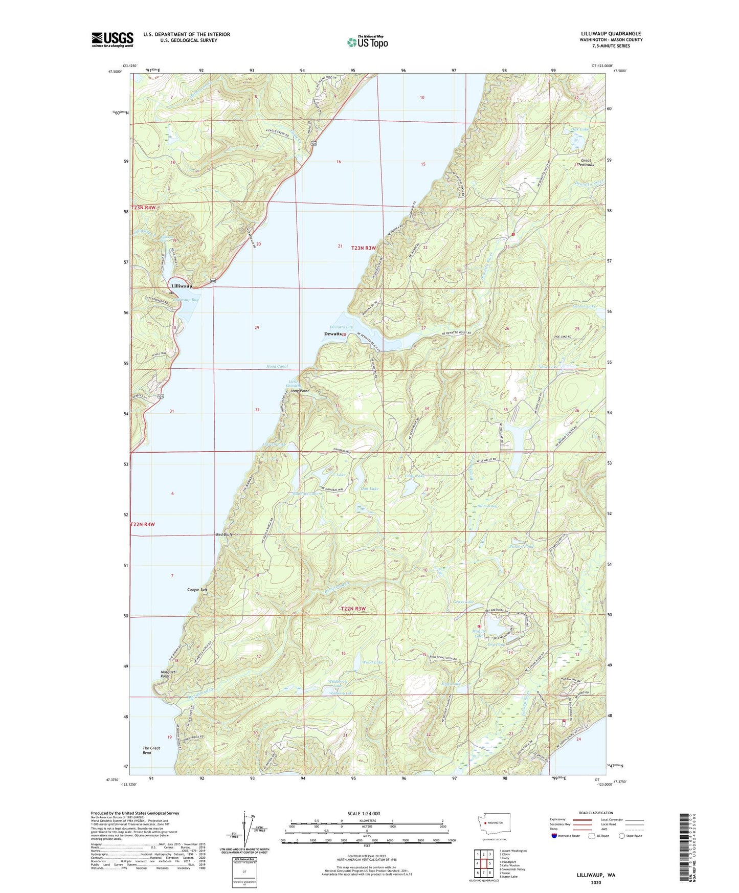
2023 topographic map quadrangle Lilliwaup in the state of Washington. Scale: 1:24000. Based on the newly updated USGS 7.5' US Topo map series, this map is in the following counties: Mason. The map contains contour data, water features, and other items you are used to seeing on USGS maps, but also has updated roads and other features. This is the next generation of topographic maps. Printed on high-quality waterproof paper with UV fade-resistant inks.
Quads adjacent to this one:
West: Hoodsport
Northwest: Mount Washington
North: Eldon
Northeast: Holly
East: Lake Wooten
Southeast: Mason Lake
South: Union
Southwest: Skokomish Valley
This map covers the same area as the classic USGS quad with code o47123d1.
Contains the following named places: Aldrich Lake, Cady Lake, Cougar Spit, Dewatto, Dewatto Bay, Dewatto River, Don Lake, Dry Pond, Eagle Creek, Grass Lake, Jiggs Lake, Larson Lake, Lilliwaup, Lilliwaup Bay, Lilliwaup Creek, Lilliwaup Falls, Lilliwaup Post Office, Little Dewatto, Lone Duck Pond, Long Point, Maggie Lake, Mason County Fire District 2, Melbourne Creek, Melbourne Lake Dam, Miller Creek, Musqueti Point, North Mason Regional Fire Authority Station 28, North Mason Regional Fire Authority Station 82, North Mason Regional Fire Authority Station 83, Oak Lake, Pickers Pond, Red Bluff, Rendsland Creek, Rest - A - While Marina, Rest - A - While Mobile Home Park, Rest - A - While Recreational Vehicle Park, Robbins Lake, Shoe Lake, Sund Creek, Tahuya School, Tee Lake, The Peat Bog, U Lake, Wildberry Lake, Wood Lake, ZIP Code: 98588