MyTopo
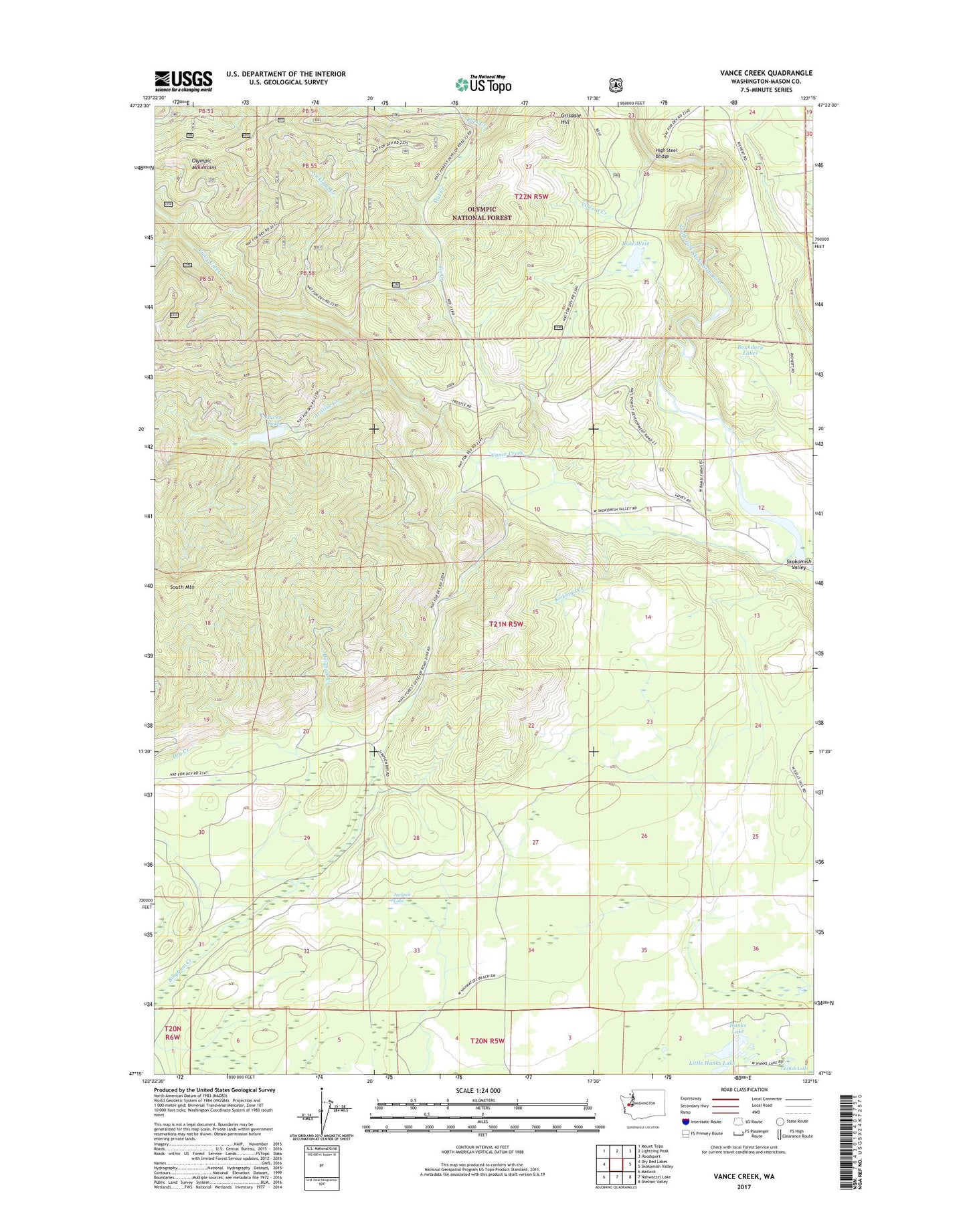
Vance Creek Washington US Topo Map
Couldn't load pickup availability
Also explore the Vance Creek Forest Service Topo of this same quad for updated USFS data
2023 topographic map quadrangle Vance Creek in the state of Washington. Scale: 1:24000. Based on the newly updated USGS 7.5' US Topo map series, this map is in the following counties: Mason. The map contains contour data, water features, and other items you are used to seeing on USGS maps, but also has updated roads and other features. This is the next generation of topographic maps. Printed on high-quality waterproof paper with UV fade-resistant inks.
Quads adjacent to this one:
West: Dry Bed Lakes
Northwest: Mount Tebo
North: Lightning Peak
Northeast: Hoodsport
East: Skokomish Valley
Southeast: Shelton Valley
South: Nahwatzel Lake
Southwest: Matlock
This map covers the same area as the classic USGS quad with code o47123c3.
Contains the following named places: Aristine Creek, Bingham Creek Reload, Boundary Lakes, Camp 3, Camp Govey, Fir Creek, Fir Creek Guard Station, Fir Creek Reload, Fir Creek Work Center, Flat Creek, Grisdale Hill, Grisdale Hill Lookout, Hanks Lake, Haven Lake, High Steel Bridge, Jackpot Lake, Jackpot Siding, Kirkland Creek, Lake West, Little Hanks Lake, Nicklund Creek, Simpson Lookout, South Mountain, Vance Creek, Vincent Creek, West Lake Dam, Windy Siding