MyTopo
Keller Washington US Topo Map
Couldn't load pickup availability
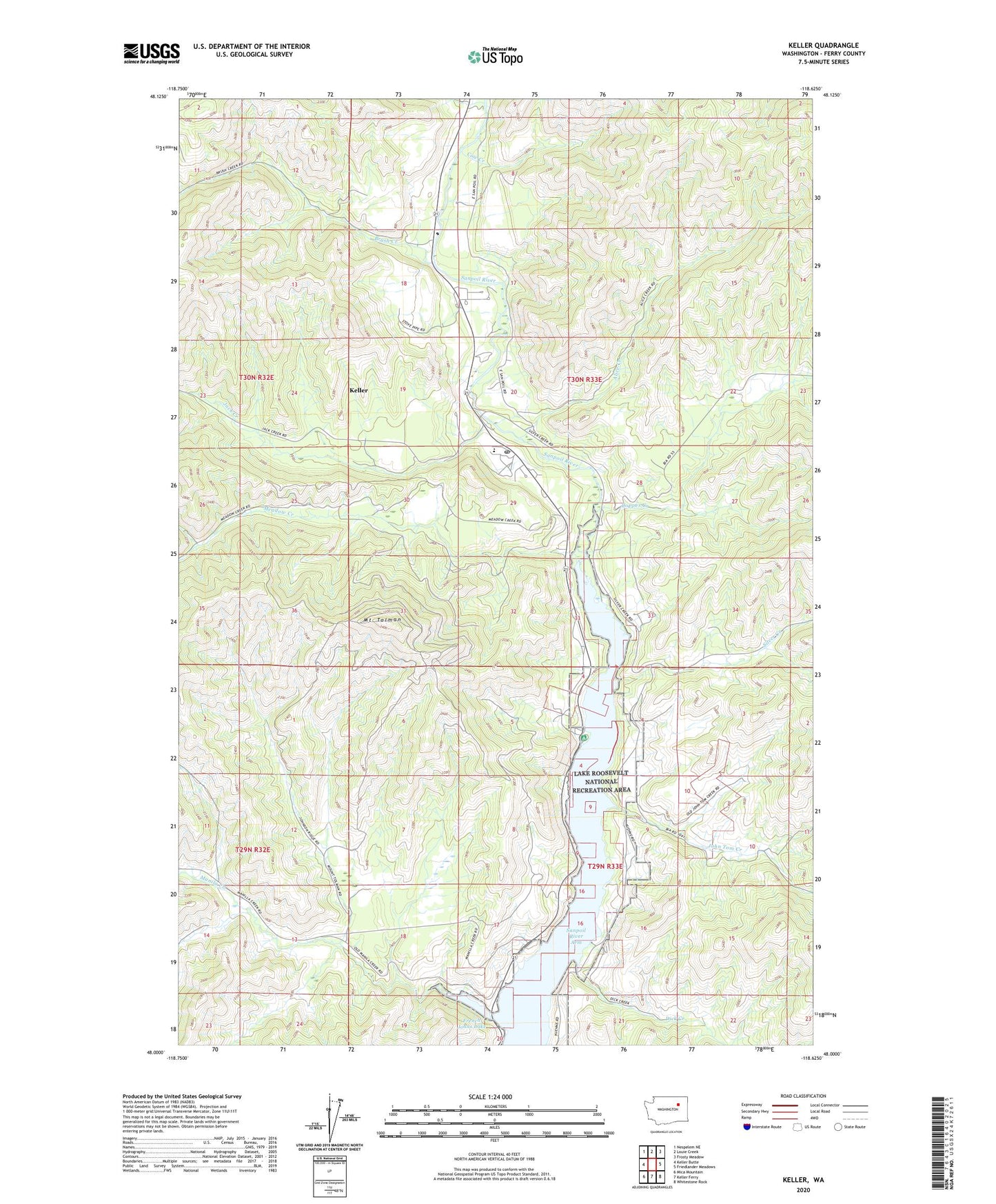
2020 topographic map quadrangle Keller in the state of Washington. Scale: 1:24000. Based on the newly updated USGS 7.5' US Topo map series, this map is in the following counties: Ferry. The map contains contour data, water features, and other items you are used to seeing on USGS maps, but also has updated roads and other features. This is the next generation of topographic maps. Printed on high-quality waterproof paper with UV fade-resistant inks.
Quads adjacent to this one:
West: Keller Butte
Northwest: Nespelem NE
North: Louie Creek
Northeast: Frosty Meadow
East: Friedlander Meadows
Southeast: Whitestone Rock
South: Keller Ferry
Southwest: Mica Mountain
Contains the following named places: Alice Creek, Brush Creek, Colville Tribal Emergency Medical Services, Consolidated Mines, Copper Creek, Cow Creek, Dick Creek, Empire Creek, French Johns Lake, Jack Creek, John Tom Creek, Keller, Keller Census Designated Place, Keller Elementary School, Keller Post Office, Manila Creek, Meadow Creek, Meadow Creek Mine, Mount Tolman, Silver Creek, ZIP Code: 99140