MyTopo
Whitestone Rock Washington US Topo Map
Couldn't load pickup availability
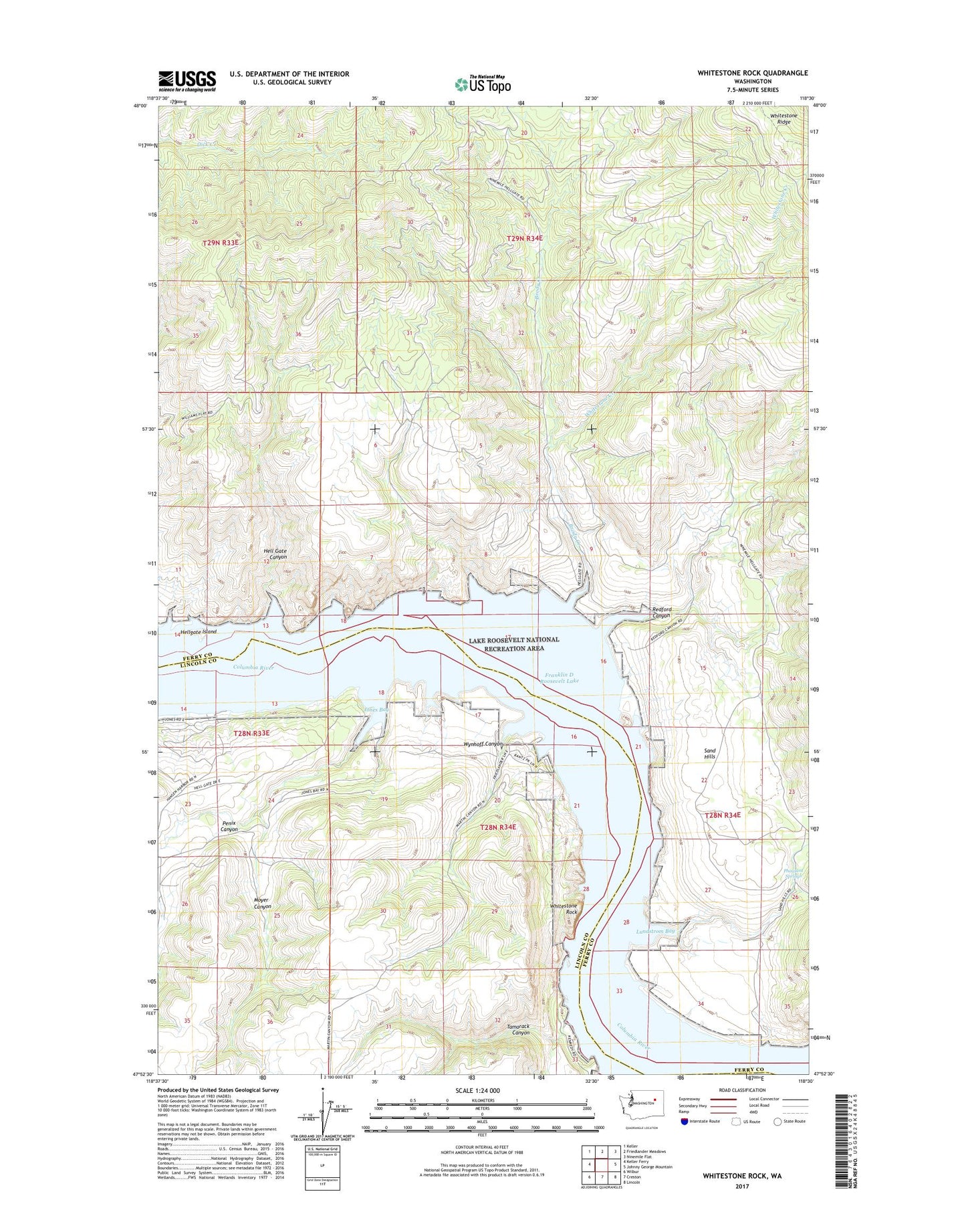
2023 topographic map quadrangle Whitestone Rock in the state of Washington. Scale: 1:24000. Based on the newly updated USGS 7.5' US Topo map series, this map is in the following counties: Ferry, Lincoln. The map contains contour data, water features, and other items you are used to seeing on USGS maps, but also has updated roads and other features. This is the next generation of topographic maps. Printed on high-quality waterproof paper with UV fade-resistant inks.
Quads adjacent to this one:
West: Keller Ferry
Northwest: Keller
North: Friedlander Meadows
Northeast: Ninemile Flat
East: Johnny George Mountain
Southeast: Lincoln
South: Creston
Southwest: Wilbur
This map covers the same area as the classic USGS quad with code o47118h5.
Contains the following named places: Brody Creek, Hell Gate Canyon, Hellgate Island, Jones Bay, Lundstrom Bay, Moyer Canyon, Penix Canyon, Pheasant Springs, Redford Canyon, Sand Hills, Tamarack Canyon, Whitestone Creek, Whitestone Rock, Wynhoff Canyon