MyTopo
Louie Creek Washington US Topo Map
Couldn't load pickup availability
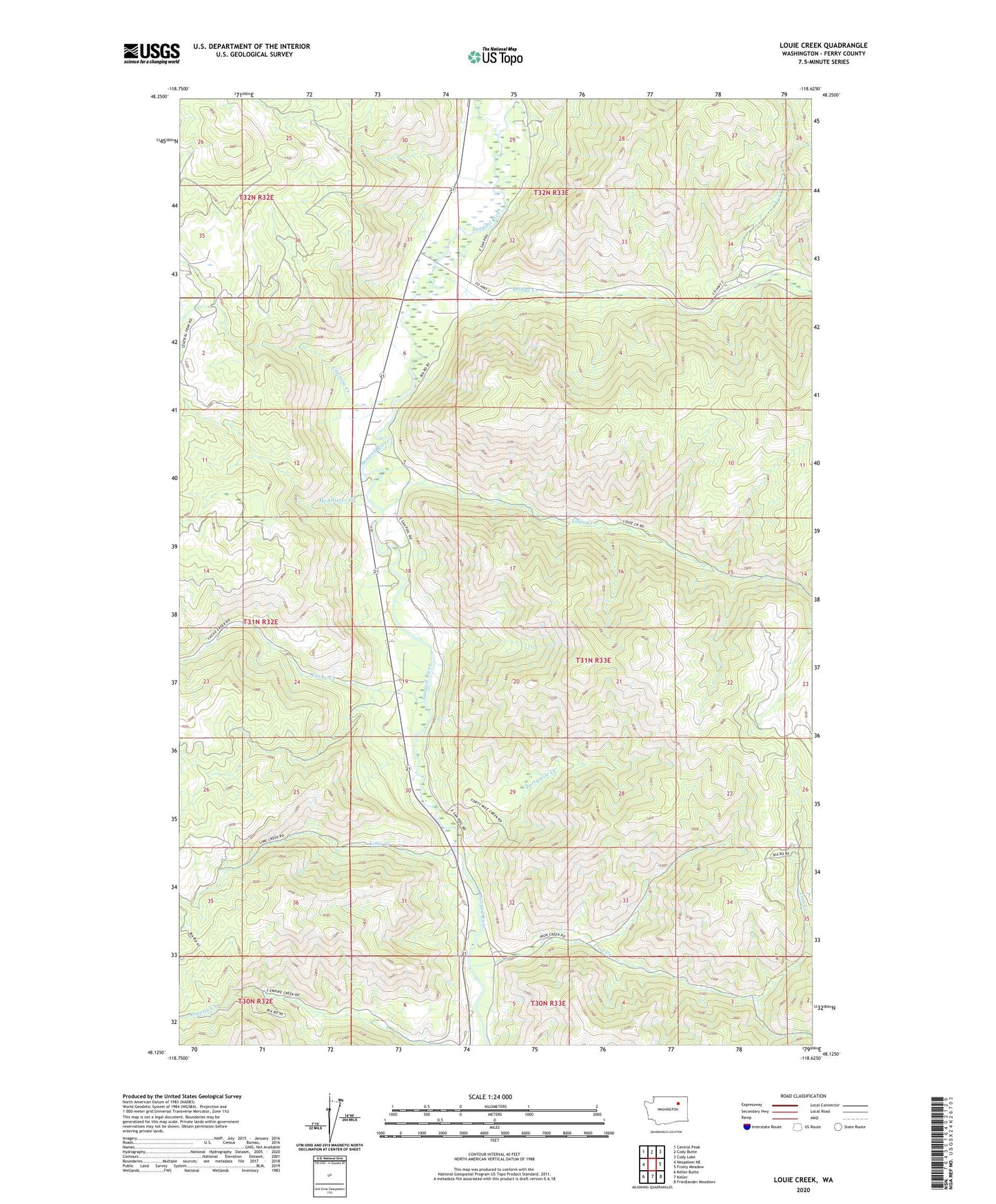
2023 topographic map quadrangle Louie Creek in the state of Washington. Scale: 1:24000. Based on the newly updated USGS 7.5' US Topo map series, this map is in the following counties: Ferry. The map contains contour data, water features, and other items you are used to seeing on USGS maps, but also has updated roads and other features. This is the next generation of topographic maps. Printed on high-quality waterproof paper with UV fade-resistant inks.
Quads adjacent to this one:
West: Nespelem NE
Northwest: Central Peak
North: Cody Butte
Northeast: Cody Lake
East: Frosty Meadow
Southeast: Friedlander Meadows
South: Keller
Southwest: Keller Butte
This map covers the same area as the classic USGS quad with code o48118b6.
Contains the following named places: Bridge Creek, Cache Creek, Capoose Creek, Fortymile Creek, Iron Creek, Keno Mine, Lime Creek, Louie Creek, McAllister Creek, Shamrock Mine