MyTopo
Kimta Peak Washington US Topo Map
Couldn't load pickup availability
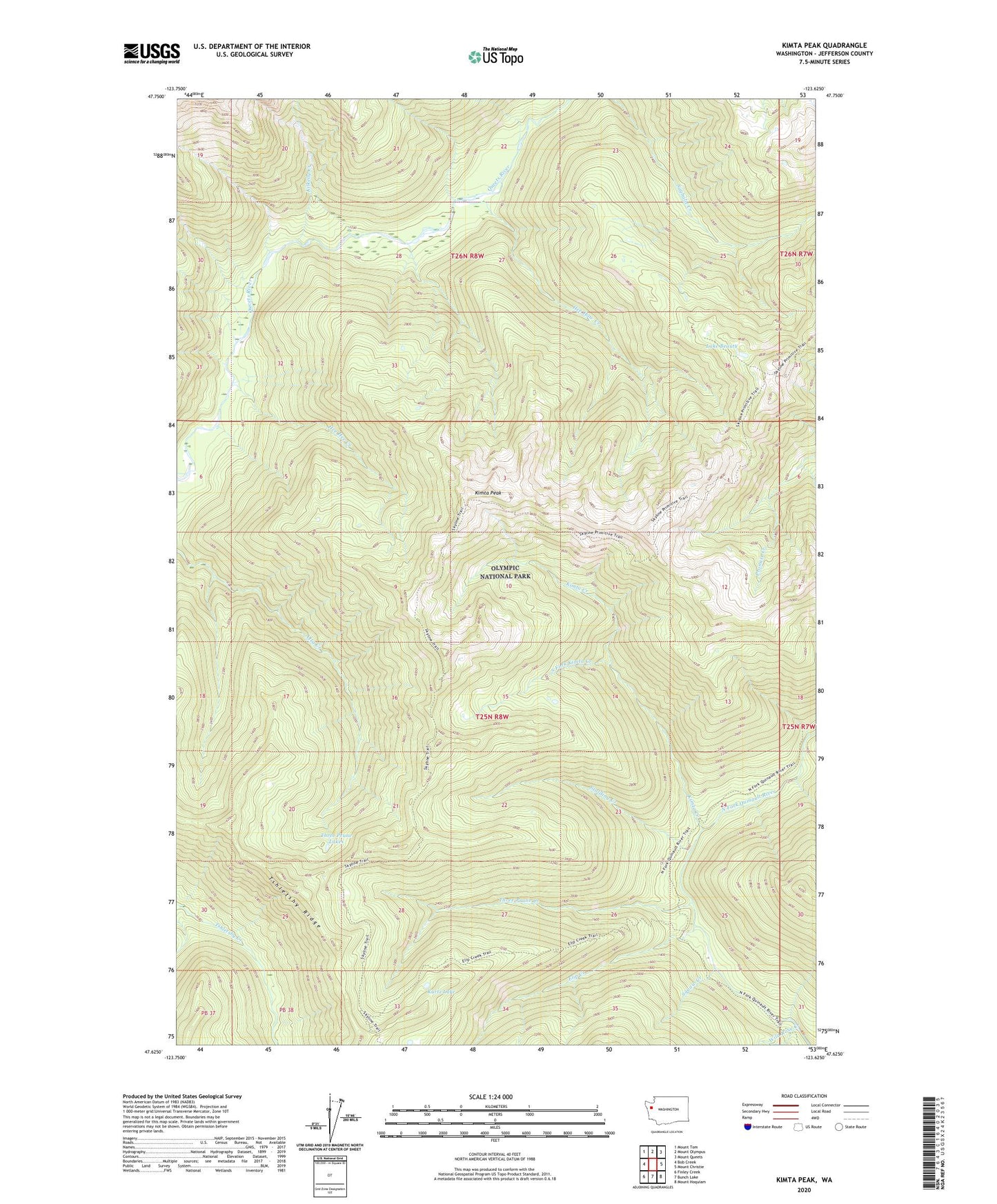
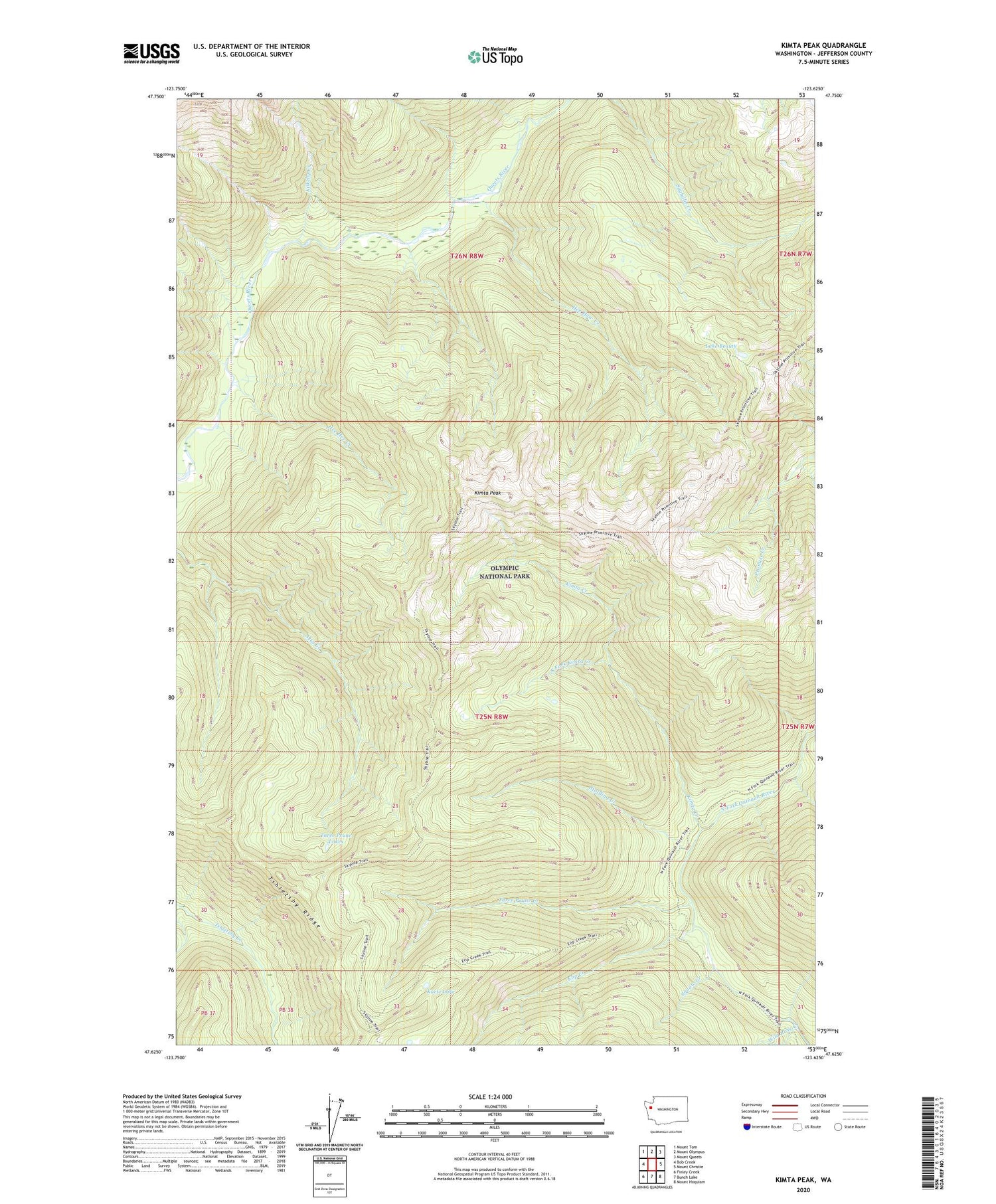
2020 topographic map quadrangle Kimta Peak in the state of Washington. Scale: 1:24000. Based on the newly updated USGS 7.5' US Topo map series, this map is in the following counties: Jefferson. The map contains contour data, water features, and other items you are used to seeing on USGS maps, but also has updated roads and other features. This is the next generation of topographic maps. Printed on high-quality waterproof paper with UV fade-resistant inks.
Quads adjacent to this one:
West: Bob Creek
Northwest: Mount Tom
North: Mount Olympus
Northeast: Mount Queets
East: Mount Christie
Southeast: Mount Hoquiam
South: Bunch Lake
Southwest: Finley Creek
Contains the following named places: Elip Creek, Francis Creek Campsite, Halfway House Campsite, Hee Haw Creek, Hee Hee Creek, Kilkelly Creek, Kimta Creek, Kimta Lake, Kimta Peak, Kurtz Lake, Lake Beauty, Paull Creek, Skyline Trail, South Fork Kimta Creek, Squaw Creek, Stalding Creek, Three Prune Creek, Three Prune Lakes, Three Prune Shelter, Trapper Shelter, Tshletshy Ridge, Wild Rose Creek