MyTopo
Lake Pleasant Washington US Topo Map
Couldn't load pickup availability
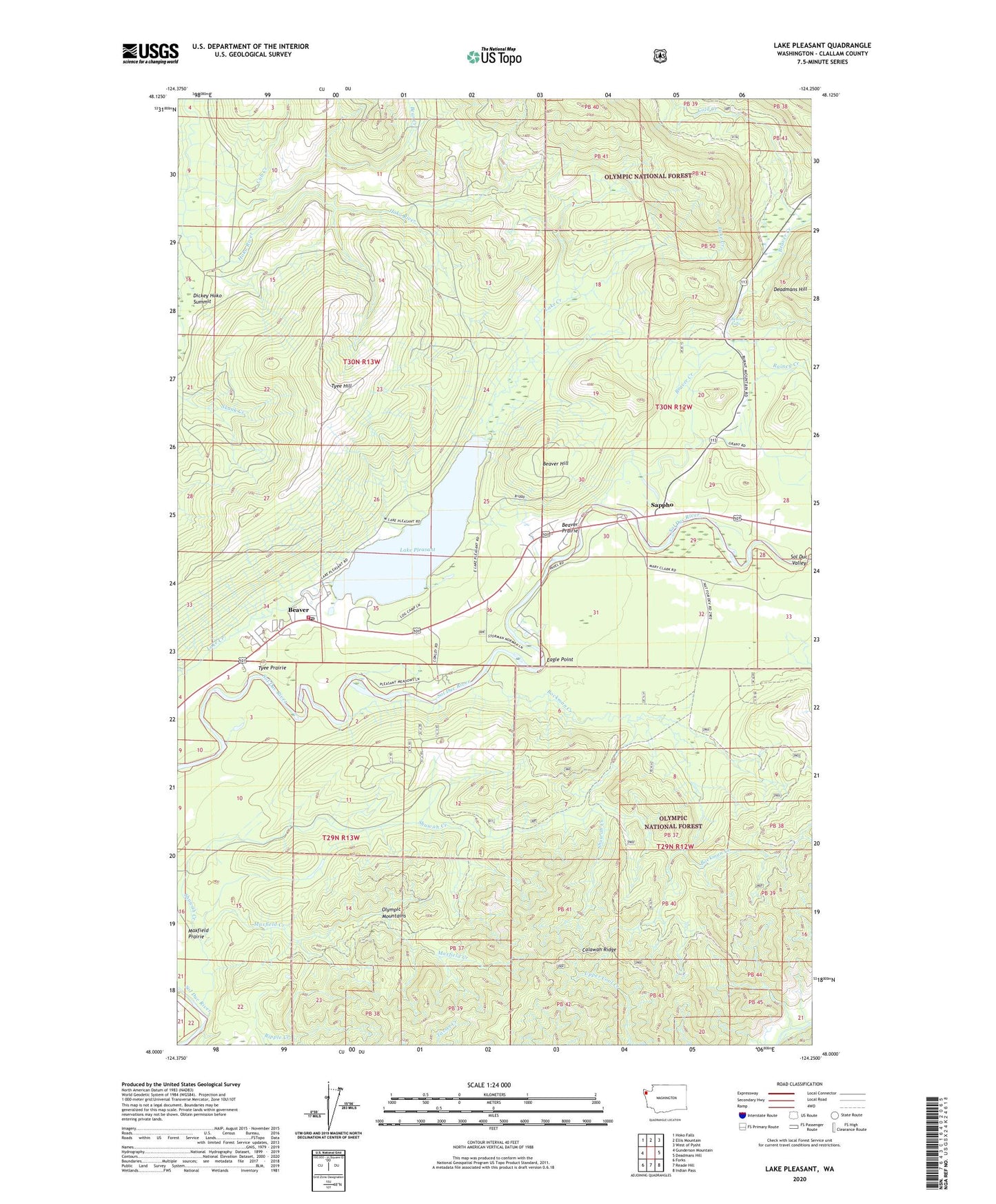
2020 topographic map quadrangle Lake Pleasant in the state of Washington. Scale: 1:24000. Based on the newly updated USGS 7.5' US Topo map series, this map is in the following counties: Clallam. The map contains contour data, water features, and other items you are used to seeing on USGS maps, but also has updated roads and other features. This is the next generation of topographic maps. Printed on high-quality waterproof paper with UV fade-resistant inks.
Quads adjacent to this one:
West: Gunderson Mountain
Northwest: Hoko Falls
North: Ellis Mountain
Northeast: West of Pysht
East: Deadmans Hill
Southeast: Indian Pass
South: Reade Hill
Southwest: Forks
Contains the following named places: Bear Creek, Beaver, Beaver Creek, Beaver Falls, Beaver Fire Department, Beaver Hill, Beaver Post Office, Beaver Prairie, Beaver Sand and Gravel Quarry, Beaver School, Bockman Creek, Calawah Ridge, Cold Creek, Cub Creek, Eagle Point, Forks Division, Lake Pleasant, Lake Pleasant Boat Launch Ramp, Lake Pleasant Mobile Home, Lake Pleasant Recreation Area, Lake Pleasant Recreational Vehicle Park, Loop Tavern Quarry, Mary Clark Quarry, Maxfield Creek, Rainey Creek, Sappho, Sappho Quarry, Shuwah Creek, Soleduck Salmon Hatchery, Tumbling Rapids Recreation Area, Tyee Hill, Tyee Prairie