MyTopo
Indian Pass Washington US Topo Map
Couldn't load pickup availability
Also explore the Indian Pass Forest Service Topo of this same quad for updated USFS data
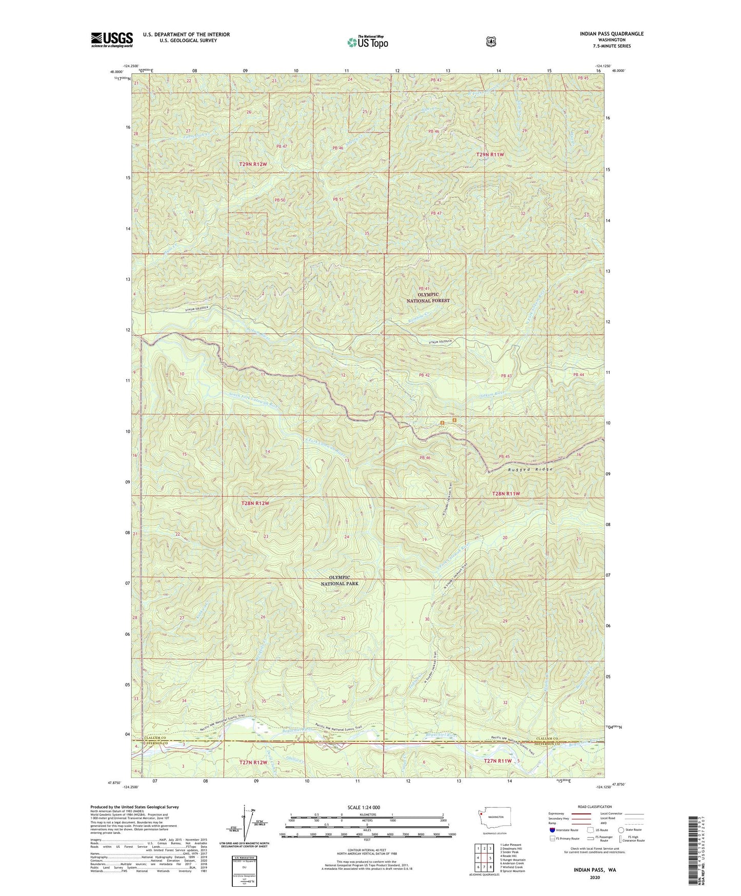
2023 topographic map quadrangle Indian Pass in the state of Washington. Scale: 1:24000. Based on the newly updated USGS 7.5' US Topo map series, this map is in the following counties: Clallam, Jefferson. The map contains contour data, water features, and other items you are used to seeing on USGS maps, but also has updated roads and other features. This is the next generation of topographic maps. Printed on high-quality waterproof paper with UV fade-resistant inks.
Quads adjacent to this one:
West: Reade Hill
Northwest: Lake Pleasant
North: Deadmans Hill
Northeast: Snider Peak
East: Hunger Mountain
Southeast: Spruce Mountain
South: Winfield Creek
Southwest: Anderson Creek
This map covers the same area as the classic USGS quad with code o47124h2.
Contains the following named places: Bogachiel, Bogachiel Shelter, Boulevard Creek, Calawah Shelter, Cultus Creek, Devil Club Creek, Hades Creek, Hyas Lookout, Indian Creek, Kahkwa Creek, Kloshe Creek, Mosquito Creek, North Fork Sitkum River, Olallie Creek, Pass Trail, Rainbow Creek, Rugged Ridge Trail, Shanty Creek, Sitkum River, Sitkum Shelter, Slide Creek