MyTopo
Deadmans Hill Washington US Topo Map
Couldn't load pickup availability
Also explore the Deadmans Hill Forest Service Topo of this same quad for updated USFS data
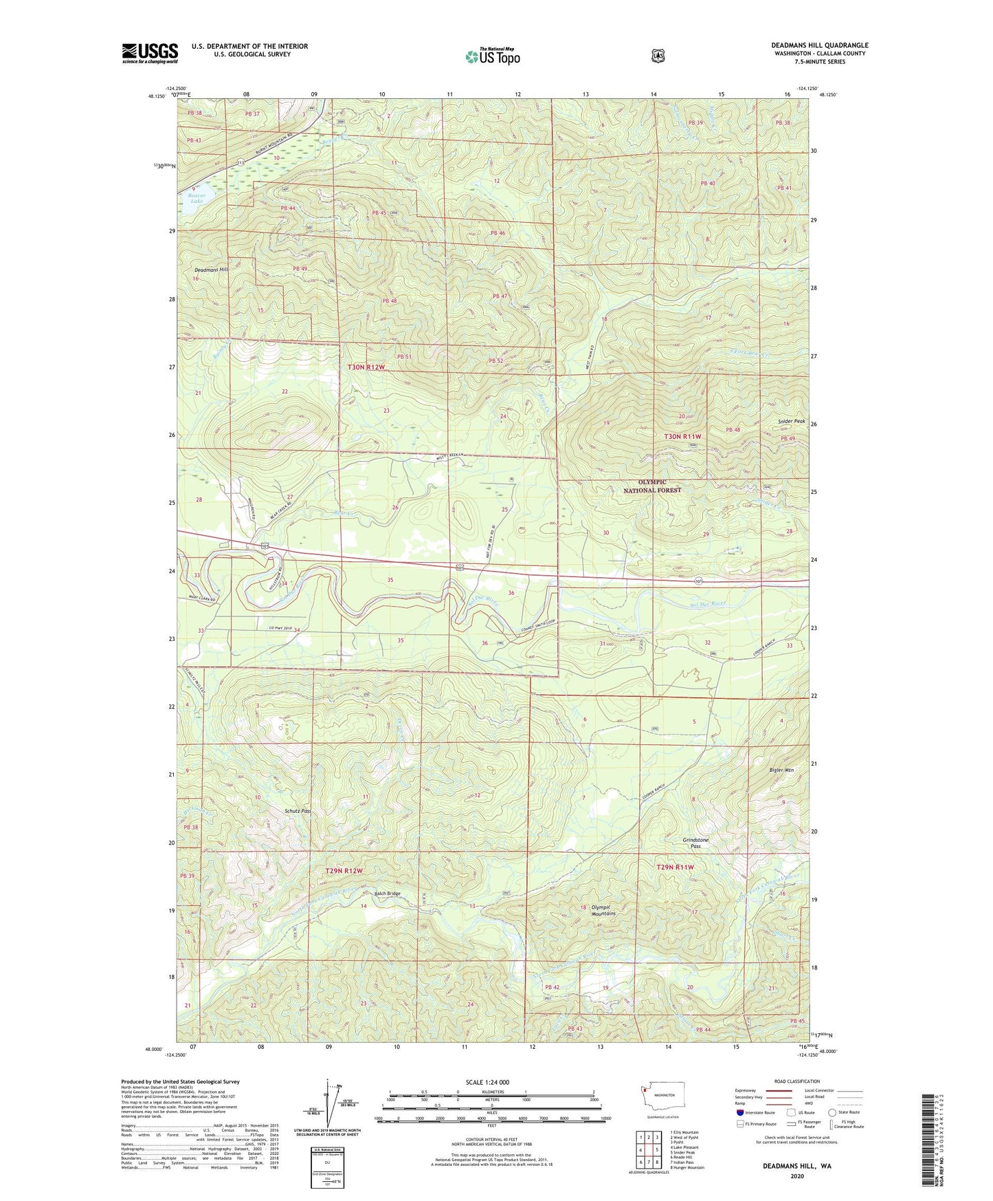
2023 topographic map quadrangle Deadmans Hill in the state of Washington. Scale: 1:24000. Based on the newly updated USGS 7.5' US Topo map series, this map is in the following counties: Clallam. The map contains contour data, water features, and other items you are used to seeing on USGS maps, but also has updated roads and other features. This is the next generation of topographic maps. Printed on high-quality waterproof paper with UV fade-resistant inks.
Quads adjacent to this one:
West: Lake Pleasant
Northwest: Ellis Mountain
North: West of Pysht
Northeast: Pysht
East: Snider Peak
Southeast: Hunger Mountain
South: Indian Pass
Southwest: Reade Hill
This map covers the same area as the classic USGS quad with code o48124a2.
Contains the following named places: Albion Creek, Balch Bridge, Bear Creek, Bear Creek Campground, Bear Springs Rearing Pond, Beaver Lake, Deadmans Hill, Devils Creek, Evergreen Lookout, Floe Quarry, Grindstone Pass, Schutz Pass, Short Creek, South Fork Bear Creek, Trail Creek, West Fork Albion Creek, Wye Creek