
MyTopo
Lake Quinault East Washington US Topo Map
Couldn't load pickup availability
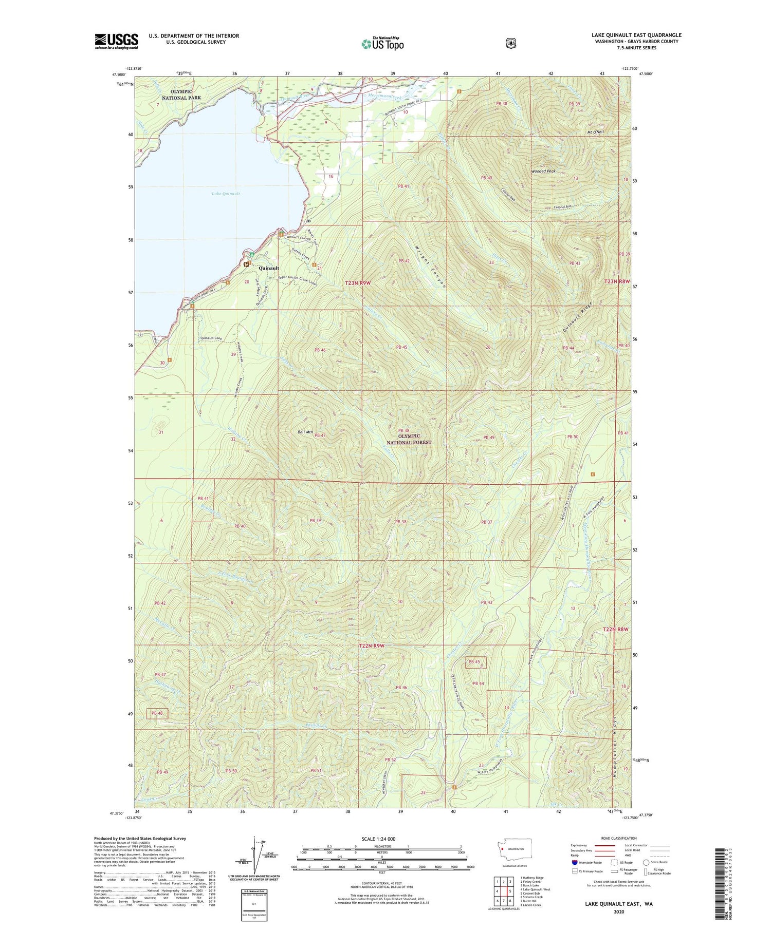
2020 topographic map quadrangle Lake Quinault East in the state of Washington. Scale: 1:24000. Based on the newly updated USGS 7.5' US Topo map series, this map is in the following counties: Grays Harbor. The map contains contour data, water features, and other items you are used to seeing on USGS maps, but also has updated roads and other features. This is the next generation of topographic maps. Printed on high-quality waterproof paper with UV fade-resistant inks.
Quads adjacent to this one:
West: Lake Quinault West
Northwest: Matheny Ridge
North: Finley Creek
Northeast: Bunch Lake
East: Colonel Bob
Southeast: Larsen Creek
South: Burnt Hill
Southwest: Stevens Creek
Contains the following named places: Bell Mountain, Canoe Creek, Chester Creek, Falls Creek, Falls Creek Forest Camp, Falls Creek Work Center, Finley Creek, Gatton Creek, Gatton Creek Campground, Haas Creek, Indian Affairs Forestry Station, July Creek, July Creek Campground, Lake Quinault, Lake Quinault Historical Society and Museum, McCormick Creek, Merriman Creek, Mount O'Neil, Mulkey Shelter, Norwood, Pacific Ranger District - Quinault Office, Phillips Creek, Quinault, Quinault Post Office, Quinault Ranger District, Quinault Recreation Area, Quinault Research Natural Area, Rampage Creek, Slide Creek, Willaby Creek, Willaby Creek Forest Camp, Wooded Peak, Wright Canyon, Ziegler Creek, ZIP Code: 98575


