MyTopo
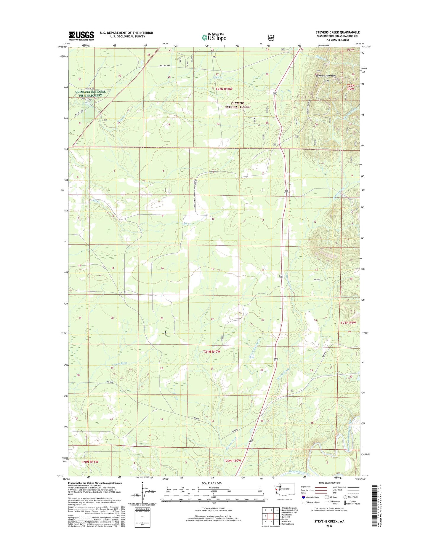
Stevens Creek Washington US Topo Map
Couldn't load pickup availability
Also explore the Stevens Creek Forest Service Topo of this same quad for updated USFS data
2023 topographic map quadrangle Stevens Creek in the state of Washington. Scale: 1:24000. Based on the newly updated USGS 7.5' US Topo map series, this map is in the following counties: Grays Harbor. The map contains contour data, water features, and other items you are used to seeing on USGS maps, but also has updated roads and other features. This is the next generation of topographic maps. Printed on high-quality waterproof paper with UV fade-resistant inks.
Quads adjacent to this one:
West: Macafee Hill
Northwest: Thimble Mountain
North: Lake Quinault West
Northeast: Lake Quinault East
East: Burnt Hill
Southeast: Railroad Camp
South: Humptulips
Southwest: Carlisle
This map covers the same area as the classic USGS quad with code o47123c8.
Contains the following named places: Hathaway Creek, Promised Land Recreation Area, Quinault National Fish Hatchery, Skunk Creek, US Fish and Wildlife Service Quinault National Fish Hatchery, West Fork Stevens Creek, ZIP Code: 98552