MyTopo
Lake Quinault West Washington US Topo Map
Couldn't load pickup availability
Also explore the Lake Quinault West Forest Service Topo of this same quad for updated USFS data
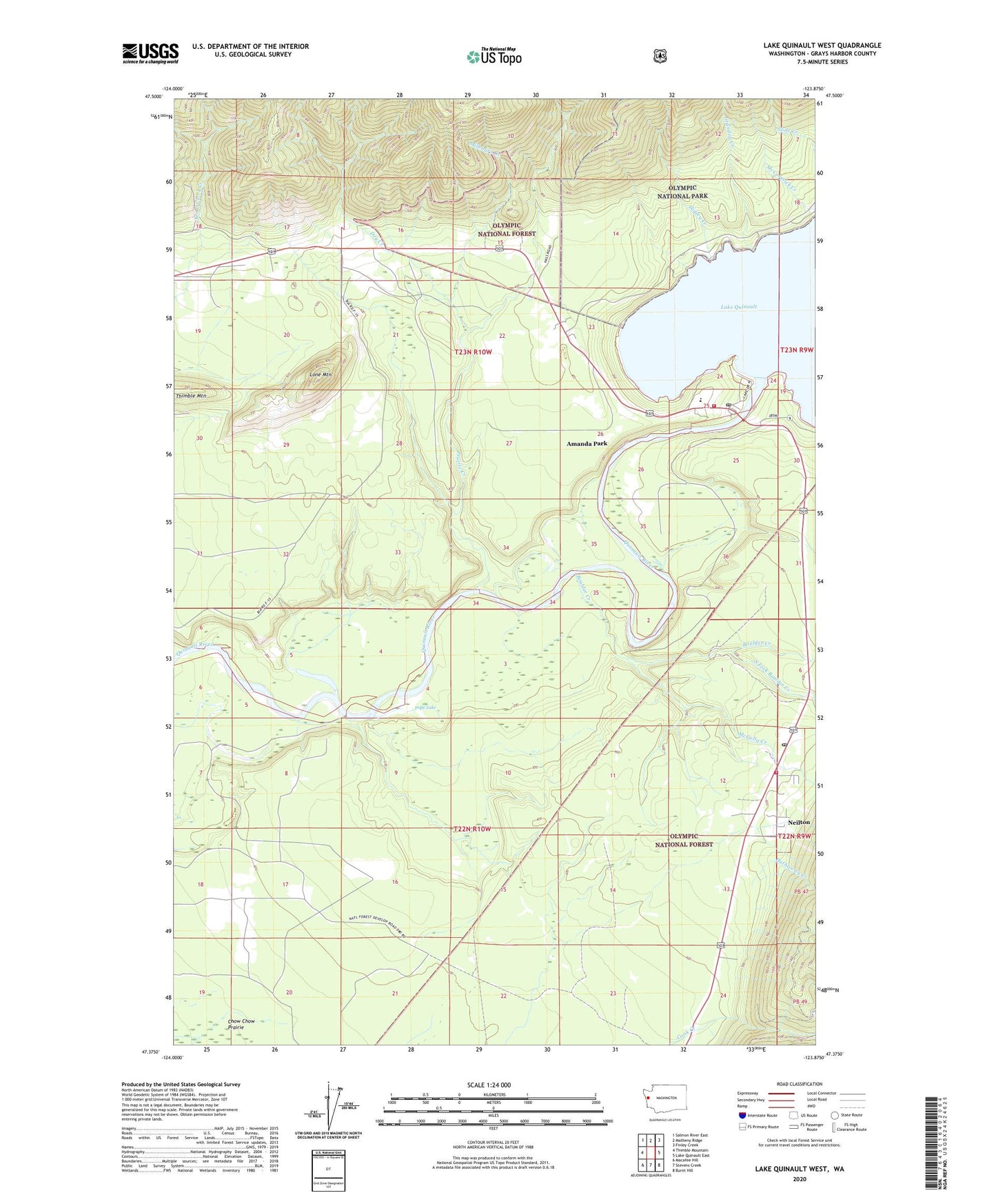
2023 topographic map quadrangle Lake Quinault West in the state of Washington. Scale: 1:24000. Based on the newly updated USGS 7.5' US Topo map series, this map is in the following counties: Grays Harbor. The map contains contour data, water features, and other items you are used to seeing on USGS maps, but also has updated roads and other features. This is the next generation of topographic maps. Printed on high-quality waterproof paper with UV fade-resistant inks.
Quads adjacent to this one:
West: Thimble Mountain
Northwest: Salmon River East
North: Matheny Ridge
Northeast: Finley Creek
East: Lake Quinault East
Southeast: Burnt Hill
South: Stevens Creek
Southwest: Macafee Hill
This map covers the same area as the classic USGS quad with code o47123d8.
Contains the following named places: Amanda Park, Amanda Park Census Designated Place, Amanda Park Post Office, Amanda Park Regional Library, Boulder Creek, Dry Creek, Grandey Creek, Grays Harbor Fire District 4 Lake Quinault Volunteer Fire Department, Grays Harbor Fire District 4 Lake Quinault Volunteer Fire Department Neilton, Higley Creek, Higley Trail, Lake Quinault Elementary School, Lake Quinault High - Junior High School, Lake Quinault High School, Lone Mountain, McCalla Creek, Milbourn Creek, Neilton, Neilton Census Designated Place, Neilton Post Office, Our Lady - Olympics Catholic Church, Pope Lake, Prairie Creek, Quinault Lake School District 97 Office, Quinault Valley Chapel, South Fork Boulder Creek, ZIP Code: 98526