MyTopo
Lind Washington US Topo Map
Couldn't load pickup availability
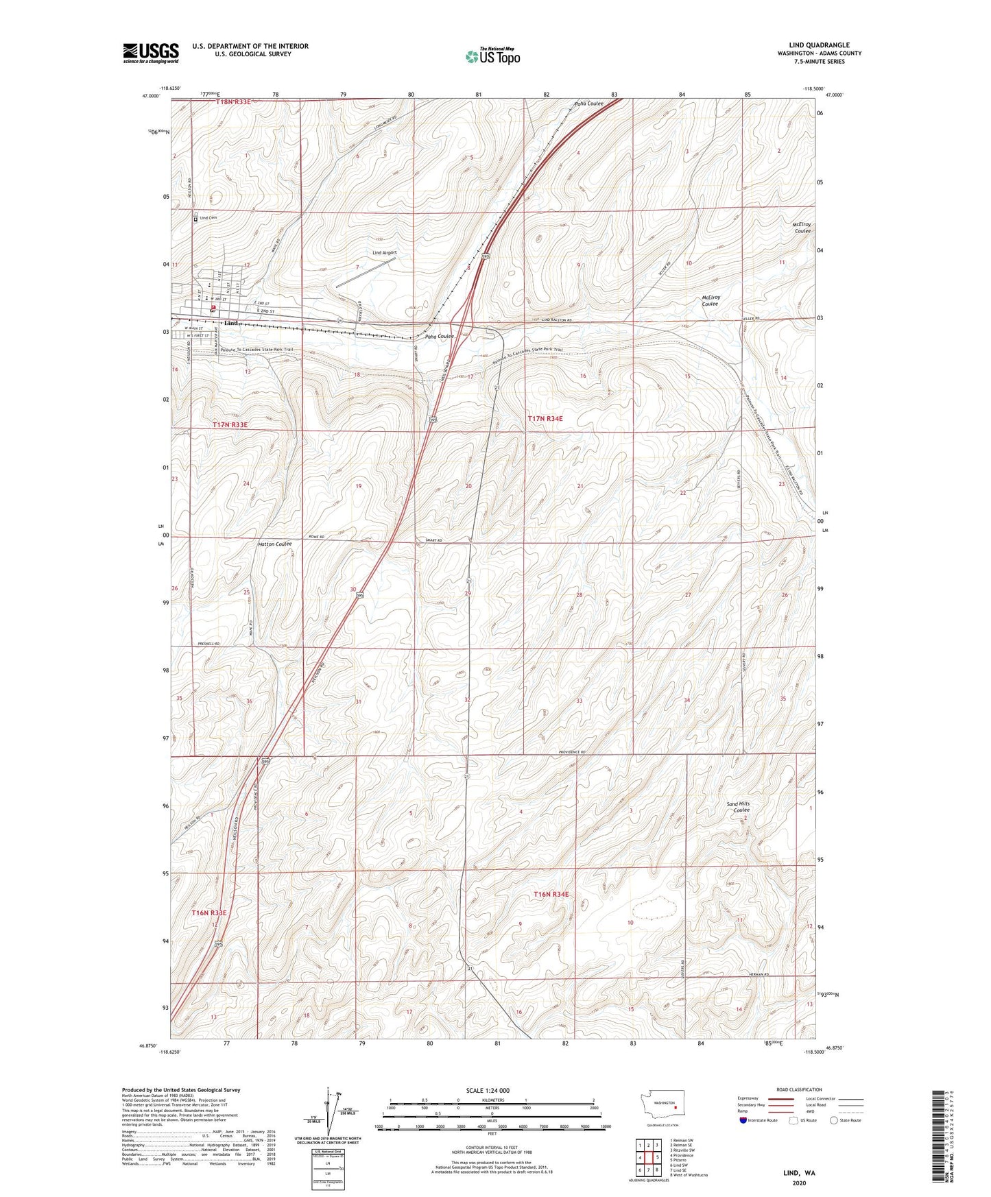
2023 topographic map quadrangle Lind in the state of Washington. Scale: 1:24000. Based on the newly updated USGS 7.5' US Topo map series, this map is in the following counties: Adams. The map contains contour data, water features, and other items you are used to seeing on USGS maps, but also has updated roads and other features. This is the next generation of topographic maps. Printed on high-quality waterproof paper with UV fade-resistant inks.
Quads adjacent to this one:
West: Providence
Northwest: Reiman SW
North: Reiman SE
Northeast: Ritzville SW
East: Pizarro
Southeast: West of Washtucna
South: Lind SE
Southwest: Lind SW
This map covers the same area as the classic USGS quad with code o46118h5.
Contains the following named places: Adams County, Adams County Fire Protection District 2, East Lind, Lind, Lind Airport, Lind Cemetery, Lind Elementary School, Lind Junior - Senior High School, Lind Post Office, Lind Town Fire Department, Lind-Washtucna Division, McElroy Coulee, Paha Coulee, Town of Lind, Vassar