MyTopo
Malden Washington US Topo Map
Couldn't load pickup availability
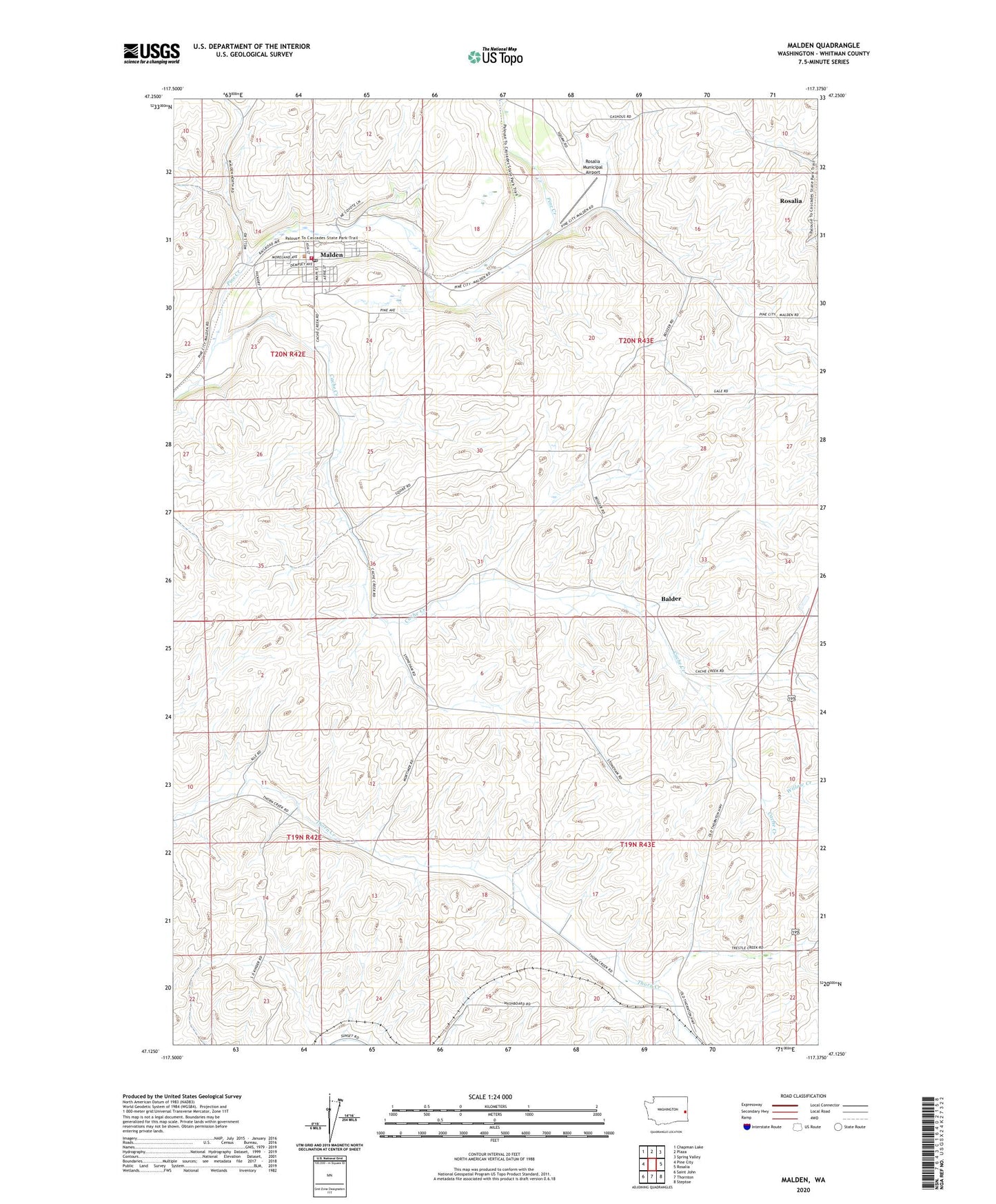
2023 topographic map quadrangle Malden in the state of Washington. Scale: 1:24000. Based on the newly updated USGS 7.5' US Topo map series, this map is in the following counties: Whitman. The map contains contour data, water features, and other items you are used to seeing on USGS maps, but also has updated roads and other features. This is the next generation of topographic maps. Printed on high-quality waterproof paper with UV fade-resistant inks.
Quads adjacent to this one:
West: Pine City
Northwest: Chapman Lake
North: Plaza
Northeast: Spring Valley
East: Rosalia
Southeast: Steptoe
South: Thornton
Southwest: Saint John
This map covers the same area as the classic USGS quad with code o47117b4.
Contains the following named places: Balder, Cache Creek, Malden, Malden Post Office, Malden Volunteer Fire Department and Emergency Medical Services, Rosalia Division, Rosalia Municipal Airport, Stoneham, Town of Malden, Town of Rosalia, Willow Creek, ZIP Codes: 99149, 99170