MyTopo
Malone Washington US Topo Map
Couldn't load pickup availability
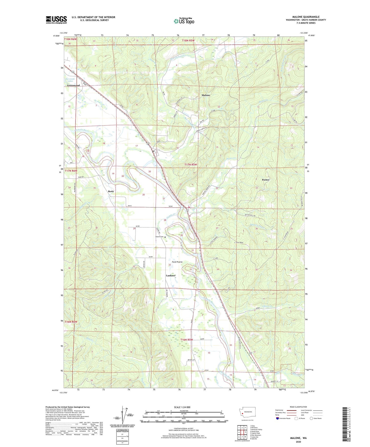
2020 topographic map quadrangle Malone in the state of Washington. Scale: 1:24000. Based on the newly updated USGS 7.5' US Topo map series, this map is in the following counties: Grays Harbor. The map contains contour data, water features, and other items you are used to seeing on USGS maps, but also has updated roads and other features. This is the next generation of topographic maps. Printed on high-quality waterproof paper with UV fade-resistant inks.
Quads adjacent to this one:
West: South Elma
Northwest: Elma
North: McCleary
Northeast: Kamilche Valley
East: Capitol Peak
Southeast: Oakville
South: Cedarville
Southwest: Blue Mountain
Contains the following named places: Cedar Creek, Eaton Creek, Ford Prairie, Gaddis Creek, Gibson Creek, Grays Harbor Fire District 5 Station 52 Porter, Greenwood, Greenwood Mobile Home Park, Jamaica Day Creek, Lankner, Little Spur Truck Trail, Malone, Malone Assembly of God Church, Malone Census Designated Place, Malone Village Post Office, Malone-Porter Census Designated Place, Malone-Porter Division, Mox Chehalis Creek, Porter, Porter Census Designated Place, Porter Creek, Rock Creek, Rony, Sand Creek, Sharon Cemetery, Sharon Grange, Shelton Creek, West Fork Porter Creek, ZIP Code: 98559